Hempstead in Lynbrook in Nassau County, New York — The American Northeast (Mid-Atlantic)
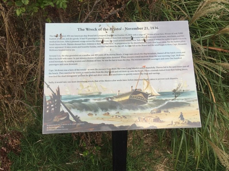
The Wreck of the Bristol - November 21, 1836
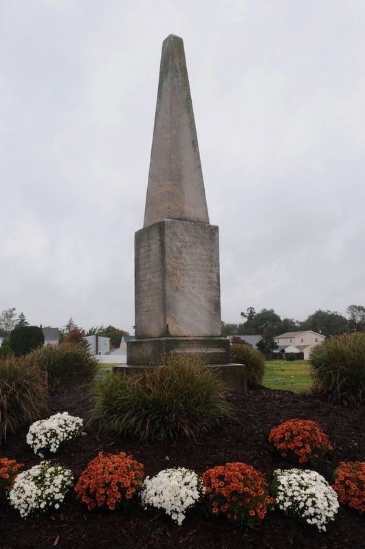
Bristol and Mexico Monument, MARINERS BURYING GROUND
Inscription.
The thee-masted, 450-ton American ship Bristol left Liverpool, England on October 15, 1836 with a cargo of 250 tons of iron bars, 50 tons of coal, 2,000
bushels of wheat, and dry goods. It had 95 passengers aboard, most of them Irish immigrants Included among them were tradesmen, merchants, and two
medical doctors. After a pleasant voyage across the Atlantic Ocean, the vessel arrived outside New York Habor where it waited for a pilot to guide it in to its
South Street berth. Parents dressed their children in their Sunday best, ”in preparation for the disembarkation just a few hours away. But the harbor pilots
never appeared. It was a warm and beautiful Sunday, and they had taken the day off. As night fell on the Bristol and the wind began to blow, Capt. Alexander
McKown headed out to sea.
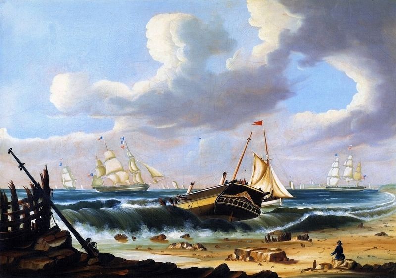
Around 1 AM, the ship grounded on a sandbar just 400 yards off Rockaway Beach. A huge wave struck the ship broadside, blasted off the hatch covers and filled the hold with water. In just minutes dozens of passengers were drowned. When rescuers rowed out from shore the next morning, Capt. McKown acted heroically by sending women and children off first. He was the last to leave the ship. The rescuers saved 44 passengers and crew. One hundred passengers and crew drowned.
Capt. McKown was a hero of the wreck - as were the rescuers from shore. But some Long Islanders acted shamefully. Thieves hid in the sand dunes just off the beach. They watched for waves to wash bodies from the ship's hold and roll them up onto the beach. These criminals rushed from their hiding places, searched the dead immigrants' pockets for gold and silver coins, and used knives to quickly remove any rings and earrings.
Sadly, it would take one more devastating wreck, that of the Mexico a few weeks later, before steps were finally taken to prevent such disasters.
Erected 2015 by Ancient Order of Hibernians of Nassau County, Historical Society of East Rockaway Beach and Lynbrook.
Topics. This historical marker is listed in these topic lists: Cemeteries & Burial Sites • Disasters • Immigration • Waterways & Vessels. A significant historical date for this entry is October 15, 1836.
Location. 40° 39.568′ N, 73° 39.517′ W. Marker is in Lynbrook, New York, in Nassau County. It is in Hempstead. Marker is on Merrick Road near Ocean Avenue. 1793 Sand Hole Cemetery, located in Near Rockaway (Long Island), Town of Hempstead, Formemrly Queens County NY, is now Nassau County formed on January 1st of 1899. It included all of Hempstead. The entire cemetery land is part of the Town of Hempstead. surrounded by the

Photographed By Andrew Ruppenstein, October 1, 2019
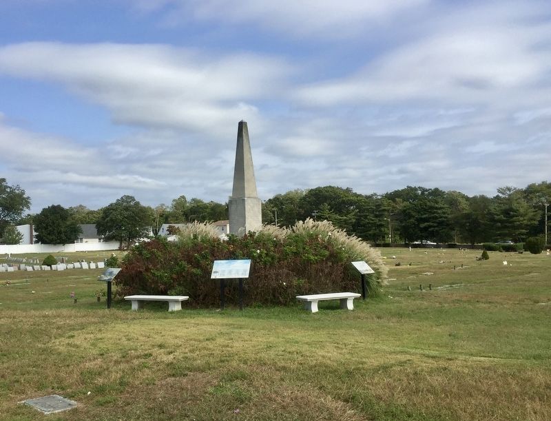
2. The Wreck of the Bristol - November 21, 1836 Marker - wide view
The Bristol marker (this one) is the one on the left, while a marker for the the Mexico shipwreck it that on the right, and in between is a marker for both shipwrecks, as well as the monument behind it.
Other nearby markers. At least 8 other markers are within walking distance of this marker. The Wreck of the Mexico - January 2, 1837 (here, next to this marker); The Sand Hole Church (about 500 feet away, measured in a direct line); Rockville Cemetery and Bristol and Mexico Monument (about 500 feet away); The Church of the Ascension (approx. 0.6 miles away); Anvil (approx. 0.6 miles away); The Suburban Oasis Built by a Thirsty City (approx. 0.7 miles away); St. Agnes World War II Memorial (approx. 0.7 miles away); Saint Agnes (approx. 0.7 miles away). Touch for a list and map of all markers in Lynbrook.
More about this marker. The marker is located more or less in the middle of Rockville Cemetery and is easy to find because it is right by the Bristol and Mexico Monument, the tallest monument in the cemetery.
Also see . . .
1. Remembering the shipwreck victims at Rockville Cemetery (LI Herald, October 28, 2015). (Submitted on December 10, 2019.)
2. Rockville Cemetery and Bristol and Mexico Monument - National Park Service. Download National
Register of Historic Places documentation (Submitted on March 27, 2024, by Anton Schwarzmueller of Wilson, New York.)
Additional keywords. The Wreck of the Bristol - November 21, 1836 The Wreck of the Mexico Long Island Shipwrecks, formation of the Coast Guard, Life Saving Service | The Wreck of the Bristol - November 21, 1836
Credits. This page was last revised on March 27, 2024. It was originally submitted on December 10, 2019, by Andrew Ruppenstein of Lamorinda, California. This page has been viewed 907 times since then and 181 times this year. Last updated on March 20, 2024, by John O'brien of Floral Park, New York. Photos: 1, 2, 3. submitted on December 10, 2019, by Andrew Ruppenstein of Lamorinda, California. 4. submitted on March 20, 2024, by John O'brien of Floral Park, New York. • Bill Pfingsten was the editor who published this page.


