Near Catonsville in Baltimore County, Maryland — The American Northeast (Mid-Atlantic)
Banneker's Cabin
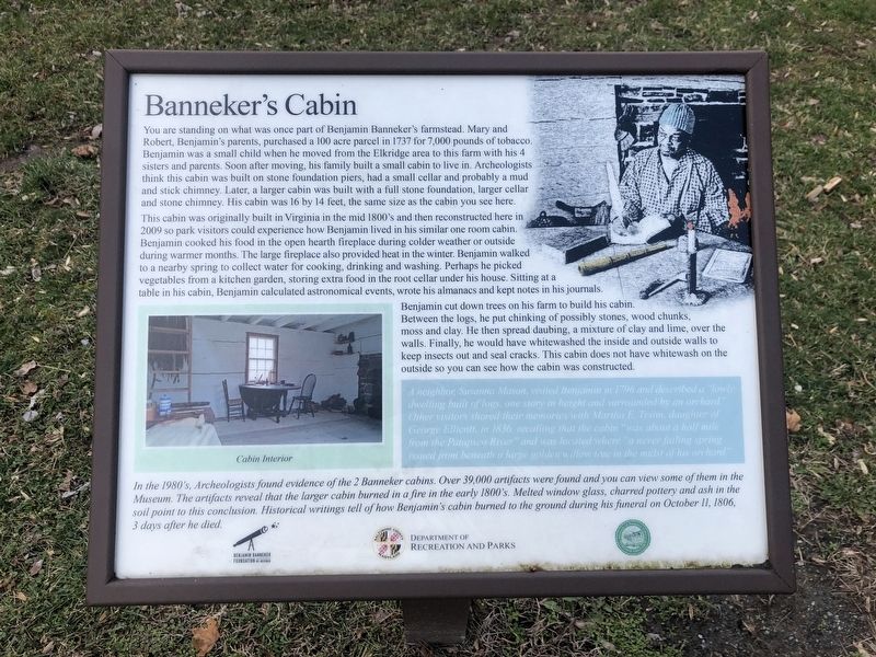
You are standing on what was once part of Benjamin Banneker's farmstead. Mary and Robert, Benjamin's parents, purchased a 100 acre parcel in 1737 for 7,000 pounds of tobacco. Benjamin was a small child when he moved from the Elkridge area to this farm with his 4 sisters and parents. Soon after moving, his family built a small cabin to live in. Archaeologists think this cabin was built on stone foundation piers, had a small cellar and probably a mud and stick chimney. Later, a larger cabin was built with a full stone foundation, larger cellar and stone chimney. His cabin was 16 by 14 feet, the same size as the cabin you see here.
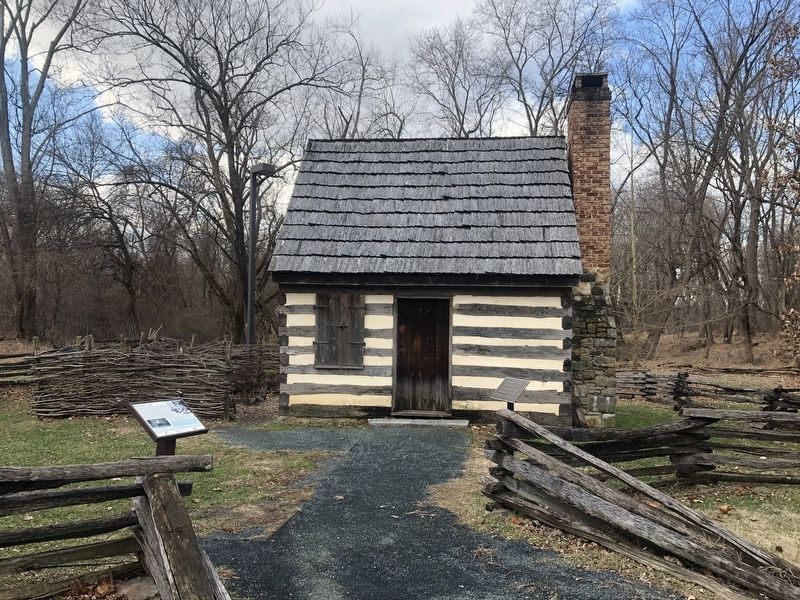
This cabin was originally built in Virginia in the mid 1800's and then reconstructed here in 2009 so park visitors could experience how Benjamin lived in his similar one room cabin. Benjamin cooked his food in the open hearth fireplace during colder weather or outside during warmer months. The large fireplace also provided heat in the winter. Benjamin walked to a nearby spring to collect water for cooking, drinking and washing. Perhaps he picked vegetables from a kitchen garden, storing extra food in the root cellar under his house. Sitting at a table in his cabin, Benjamin calculated astronomical events, wrote his almanacs and kept notes in his journals.
Benjamin cut down trees on his farm to build his cabin. Between the logs, he put chinking of possibly stones, wood chunks, moss and clay. He then spread daubing, a mixture of clay and lime, over the walls. Finally, he would have whitewashed the inside and outside walls to keep insects out and seal cracks. This cabin does not have whitewash on the outside so you can see how the cabin was constructed.
A neighbor, Susanna Mason, visited Benjamin in 1796 and described a "lowly dwelling built of logs, one story in height, and surrounded by an orchard." Other visitors shared their memories with Martha E. Tyson, daughter of George Ellicott, in 1836, recalling that the cabin "was about a half a mile from the Patapsco River" and was located where a never failing spring issued from beneath "a large golden willow tree in the midst of his orchard."
In the 1980's, Archaeologists found evidence of the 2 Banneker cabins. Over 39,000 artifacts were found and you can view some of them in the Museum. The artifacts reveal that the larger cabin burned in a fire in the early 1800's. Melted window glass, charred pottery and ash in the soil point to this conclusion. Historical writings tell of how Benjamin's cabin burned to the ground during his funeral on October 11, 1806, 3 days after he died.
Erected by Benjamin Banneker Foundation; Baltimore County, Maryland, Department of Recreation and Parks; Friends of Patapsco Valley Heritage Greenway.
Topics. This historical marker is listed in these topic lists: African Americans • Agriculture • Science & Medicine • Settlements & Settlers. A significant historical date for this entry is October 11, 1806.
Location. Marker has been permanently removed. It was located near 39° 16.11′ N, 76° 46.535′ W. Marker was near Catonsville, Maryland, in Baltimore County. Marker could be reached from Oella Avenue just north of Old Frederick Road, on the left when traveling north. Touch for map. Marker was at or near this postal address: 318 Oella Avenue, Catonsville MD 21228, United States of America.
We have been informed that this sign or monument is no longer there and will not be replaced. This page is an archival view of what was.
Other nearby markers. At least 8 other markers are within walking distance of this location. 20th Anniversary (about 300 feet away, measured in a direct line); Benjamin Banneker (about 400 feet away); Robert Bannaky (about 500 feet away); Banneker's Orchard (about 700 feet away); The Stone Farmhouse (about 700 feet away); a different marker also named Benjamin Banneker
Credits. This page was last revised on June 10, 2023. It was originally submitted on January 19, 2020, by Devry Becker Jones of Washington, District of Columbia. This page has been viewed 432 times since then and 45 times this year. Last updated on June 4, 2023, by Mark P Brock-Cancellieri of Baltimore, Maryland. Photos: 1. submitted on January 19, 2020, by Devry Becker Jones of Washington, District of Columbia. 2. submitted on June 4, 2023, by Mark P Brock-Cancellieri of Baltimore, Maryland. 3. submitted on January 19, 2020, by Devry Becker Jones of Washington, District of Columbia. 4. submitted on June 4, 2023, by Mark P Brock-Cancellieri of Baltimore, Maryland. • Bill Pfingsten was the editor who published this page.


