Near Henrico in Henrico County, Virginia — The American South (Mid-Atlantic)
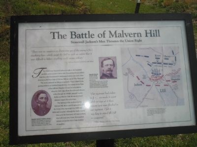
The Battle of Malvern Hill
Stonewall Jackson’s Men Threaten the Union Right
“There was no cessation or diminution yet of the enemy’s fire – musketry here – which swept the field to such an extent that it was difficult to believe anything could escape unhurt.”
- Lt. McHenry Howard, Confederate staff officer
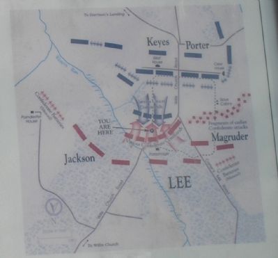
The 15,000 men of Stonewall Jackson brought to the battlefield saw little action on July 1 before dusk. Responding then to calls for help from other hard-pressed Confederates, Jackson sent most of two divisions up the front slope of Malvern Hill just east of “The Parsonage.”
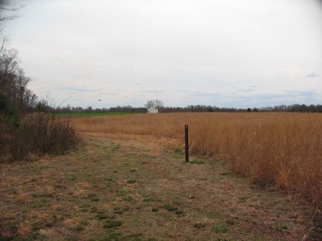
The attack sputtered out almost immediately. Units collided in the growing darkness, or wandered unguided into the swampy woods. Parts of four different brigades managed to find positions along this little ridge, where they delivered effective volleys through the twilight, primarily against Sickles and Barlow. Only the arrival of total darkness stopped the action here.
The fighting on the northeast end of Malvern Hill offers a partial explanation of how the Union army surprisingly lost 3,000 men killed and wounded. Although this battle is justly famous for the dominance of Union artillery, there still were many bitter, close-quarters infantry actions that led to large numbers of casualties.
“Our regiment had orders to fire … we made it count while we was at it there wasent won man flinched in our regiment. I felt it my duty to stand till I fell or conquered.”
- William Harman, 65th New York Infantry
Topics. This historical marker is listed in this topic list: War, US Civil. A significant historical month for this entry is July 1814.
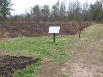
Location. 37° 25.049′ N, 77° 14.791′ W. Marker is near Henrico, Virginia, in Henrico County. Marker can be reached from Willis Church Road (Virginia Route 156), on the left when traveling south. Marker is located along a hiking trail of the Malvern Hill Battlefield that passes through a parking lot on the east side of Willis Church Road. Touch for map. Marker is at or near this postal address: 9051 Malvern Hill Battlefield Terrain, Henrico VA 23231, United States of America. Touch for directions.
Other nearby markers. At least 8 other markers are within walking distance of this marker. Infantry Against Infantry (a few steps from this marker); Twilight Action (within shouting distance of this marker); Malvern Hill Trail (within shouting distance of this marker); a different marker also named The Battle of Malvern Hill (about 300 feet away, measured in a direct line); Methodist Parsonage (about 400 feet away); Battle Commences (about 400 feet away); Willis Church Parsonage (about 500 feet away); The Gathering Storm (about 500 feet away). Touch for a list and map of all markers in Henrico.
More about this marker. The bottom left of the marker features a photograph

2. Malvern Hill - CWPT
Civil War Preservation Trust's efforts to preserve portions of the battlefield.
Click for more information.
Click for more information.
Also see . . .
1. Malvern Hill. CWSAC Battle Summaries. (Submitted on January 1, 2009, by Bill Coughlin of Woodland Park, New Jersey.)
2. Malvern Hill Battlefield Podcast. National Park Service website. (Submitted on January 1, 2009, by Bill Coughlin of Woodland Park, New Jersey.)
Credits. This page was last revised on July 7, 2021. It was originally submitted on January 1, 2009, by Bill Coughlin of Woodland Park, New Jersey. This page has been viewed 1,753 times since then and 19 times this year. Photos: 1. submitted on January 1, 2009, by Bill Coughlin of Woodland Park, New Jersey. 2. submitted on March 28, 2010, by Craig Swain of Leesburg, Virginia. 3. submitted on January 1, 2009, by Bill Coughlin of Woodland Park, New Jersey. 4, 5. submitted on March 31, 2010, by Craig Swain of Leesburg, Virginia.


