Mid-town Brandywine in Wilmington in New Castle County, Delaware — The American Northeast (Mid-Atlantic)
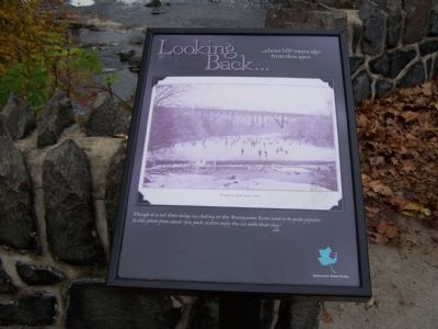
Looking Back…
…about 100 years ago from this spot
Skating on West Street Dam
Though it is not done today, ice skating on the Brandywine River used to be quite popular. In this photo from about 1913, park visitors enjoy the ice with their dogs!
Erected by Delaware State Parks.
Topics and series. This historical marker is listed in these topic lists: Animals • Entertainment • Parks & Recreational Areas • Waterways & Vessels. In addition, it is included in the Delaware State Parks series list. A significant historical year for this entry is 1913.
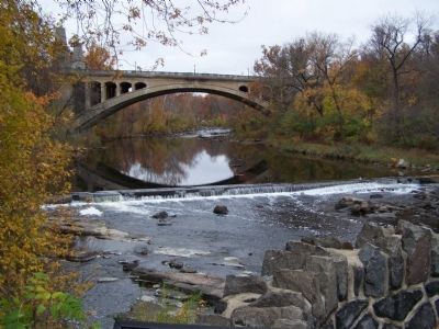
Location. This marker has been replaced by another marker nearby. It was located near 39° 45.07′ N, 75° 32.839′ W. Marker was in Wilmington, Delaware, in New Castle County. It was in Mid-town Brandywine. Marker was at the intersection of South Park Drive and West Street, on the right when traveling west on South Park Drive. Touch for map. Marker was in this post office area: Wilmington DE 19801, United States of America. Touch for directions.
Other nearby markers. At least 8 other markers are within walking distance of this location. Lower Dam and North Short Millrace (a few steps from this marker); a different marker also named Looking Back… (a few steps from this marker); First Presbyterian Church (within shouting distance of this marker); Presbyterian Meeting House (within shouting distance of this marker); McKinley (within shouting distance of this marker); Washington Street Bridge (about 400 feet away, measured in a direct line); Washington Memorial Bridge Centennial (about 500 feet away); Black Walnut (about 600 feet away). Touch for a list and map of all markers in Wilmington.
More about this marker. Marker has been replaced.
Related marker. Click here for another marker that is related to this marker. This marker has been replaced with the linked marker.
Credits. This page was last revised on February 10, 2023. It was originally submitted on November 14, 2008, by Bill Pfingsten of Bel Air, Maryland. This page has been viewed 1,471 times since then and 7 times this year. Last updated on May 23, 2021, by Carl Gordon Moore Jr. of North East, Maryland. Photos: 1, 2. submitted on November 14, 2008, by Bill Pfingsten of Bel Air, Maryland. • Devry Becker Jones was the editor who published this page.

