Wharton Township near Farmington in Fayette County, Pennsylvania — The American Northeast (Mid-Atlantic)
Surrender Negotiations
Fort Necessity National Battlefield
— National Park Service, U.S. Department of the Interior —
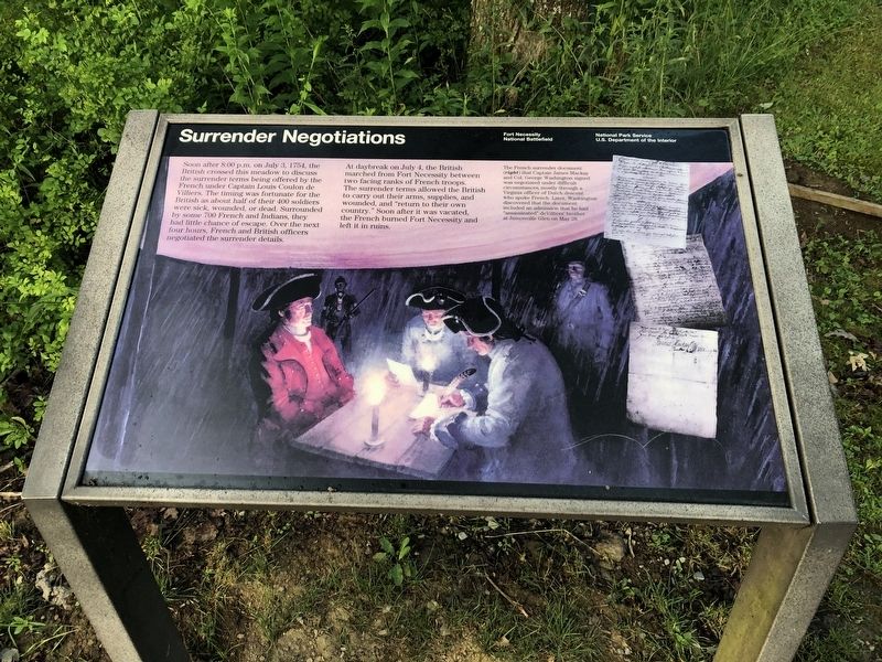
Soon after 8:00 p.m. on July 3, 1754, the British crossed this meadow to discuss the surrender terms being offered by the French under Captain Louis Coulon de Villiers. The timing was fortunate for the British as about half of their 400 soldiers were sick, wounded, or dead. Surrounded by some 700 French and Indians, they had little chance of escape. Over the next four hours, French and British officers negotiated the surrender details.
At daybreak on July 4, the British marched from Fort Necessity between two facing ranks of French troops. The surrender terms allowed the British to carry out their arms, supplies, and wounded, and "return to their own country." Soon after it was vacated, the French burned Fort Necessity and left it in ruins.
[Caption:]
The French surrender document (right) that Captain James Mackay and Col. George Washington signed was negotiated under difficult circumstances, mostly through a Virginia officer of Dutch descent who spoke French. Later, Washington discovered that the document included an admission that he had "assassinated" deVilliers' brother at Jumonville Glen on May 28.
Erected by National Park Service, U.S. Department of the Interior.
Topics. This historical marker is listed in these topic lists: Colonial Era • Forts and Castles • War, French and Indian. A significant historical date for this entry is May 28, 1754.
Location. 39° 48.872′ N, 79° 35.348′ W. Marker is near Farmington, Pennsylvania, in Fayette County. It is in Wharton Township. Marker can be reached from Washington Parkway, 0.4 miles south of National Pike (U.S. 40), on the right when traveling west. Touch for map. Marker is in this post office area: Farmington PA 15437, United States of America. Touch for directions.
Other nearby markers. At least 8 other markers are within walking distance of this marker. The French Attack (a few steps from this marker); British Defenses (a few steps from this marker); Fort Necessity (within shouting distance of this marker); Building Fort Necessity (within shouting distance of this marker); Civilian Conservation Corps at Fort Necessity (about 700 feet away, measured in a direct line); Do you measure up in Washington's Army? / Are you dressed for the campaign? (about 700 feet away); The Great Meadows Campaign (about 800 feet away); Fort Necessity National Battlefield (approx. 0.2 miles away). Touch for a list and map of all markers in Farmington.
Credits. This page was last revised on February 7, 2023. It was originally submitted on July 13, 2020, by Devry Becker Jones of Washington, District of Columbia. This page has been viewed 191 times since then and 6 times this year. Last updated on July 5, 2022, by Carl Gordon Moore Jr. of North East, Maryland. Photos: 1, 2. submitted on July 13, 2020, by Devry Becker Jones of Washington, District of Columbia.

