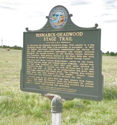
Near Meadow in Perkins County, South Dakota — The American Midwest (Upper Plains)
Bismarck-Deadwood Stage Trail
The first four-horse Concord stagecoaches, owned by the Northwestern Express, Stage and Transportation Company, started over the trail from Bismarck in April 1877 with daily service in operation by May. A typical run toon 36 hours and a one-way ticket cost $23. As many as 26 stagecoaches and more than 200 teams comprised the rolling stock. The Company also utilized many mule and oxen wagons to haul freight. Twenty relay stations and two overnight stations serviced the line.
A shorter trail to the Black Hills was later opened from Pierre, and by the late 1880 the Bismarck route was abandoned by official traffic. The trail subsequently served area ranchers and settlers until a modern road system was developed.
Partial funding for this marker made possible by the Deadwood Historic Preservation Commission.
Erected 2006 by Deadwood Historic Preservation Commission. (Marker Number 698.)
Topics and series. This historical marker is listed in this topic list: Roads & Vehicles. In addition, it is included in the South Dakota State Historical Society Markers series list. A significant historical year for this entry is 1877.
Location. 45° 28.702′ N, 102° 10.17′ W. Marker is near Meadow, South Dakota, in Perkins County. Marker is on South Dakota Route 73, 2.4 miles north of South Dakota Route 20, on the left when traveling north. Touch for map. Marker is in this post office area: Meadow SD 57644, United States of America. Touch for directions.
Other nearby markers. At least 1 other marker is within 7 miles of this marker, measured as the crow flies. WWII Bomber Crashes near Meadow, SD (approx. 6.6 miles away).
Also see . . . ND State Historical Society article on the Bismarck-Deadwood Stage Trail. (Submitted on July 31, 2020.)
Credits. This page was last revised on January 13, 2022. It was originally submitted on July 30, 2020, by Connor Olson of Kewaskum, Wisconsin. This page has been viewed 199 times since then and 14 times this year. Last updated on January 12, 2022. Photo 1. submitted on July 30, 2020, by Connor Olson of Kewaskum, Wisconsin. • J. Makali Bruton was the editor who published this page.
