Philippi in Barbour County, West Virginia — The American South (Appalachia)
Philippi
The Federal Attack
— The First Campaign —
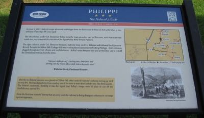
On June 2, 1861, Federal troops advanced on Philippi from the Baltimore & Ohio rail hub at Grafton in two columns of about 1500 men each.
The left column, under Col. Benjamin Kelley, took the train six miles east to Thornton, and then marched south over poor roads on the east side of the Tygart Valley River toward Philippi.
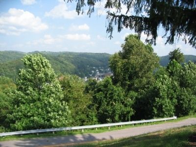
The right column, under Col. Ebenezer Dumont, rode the train south to Webster and followed the Fairmont-Beverly Turnpike to Talbott Hill (College Hill) where they placed cannons overlooking Philippi. Both columns slogged through torrents of rain and total darkness. Kelley's men became lost and arrived too late to cut off the Confederate retreat from the town.
"Cannon balls [were] crashing into their huts and stirring out the rebels like a stick into a hornet's nest."
-Whitelaw Reed, Cincinnati Gazette
After the two Federal cannon were placed on Talbott Hill, other units of Dumont's column moving up tried to stop Mrs. Thomas Humphreys from sending one of her sons to warn the Confederates. She fired a pistol. The Federal cannoners, thinking it was the signal that Kelley's troops were in place to cut off the Confederates, opened fire.
It was the first time in world history that an army used the railroad to bring divergent columns to converge upon an opponent.
Erected by West Virginia Civil War Trails.
Topics and series. This historical marker is listed in these topic lists: Railroads & Streetcars • War, US Civil. In addition, it is included in the Baltimore and Ohio Railroad (B&O), and the West Virginia Civil War Trails series lists. A significant historical date for this entry is June 2, 1861.
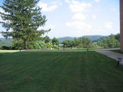
Location. Marker has been permanently removed. It was located near 39° 9.483′ N, 80° 2.831′ W. Marker was in Philippi, West Virginia, in Barbour County. Marker was on College Hill Drive, on the right when traveling south. Located between Burbick Hall and Wilcox Chapel on the campus of Alderson-Broaddus College. Touch for map. Marker was in this post office area: Philippi WV 26416, United States of America.
We have been informed that this sign or monument is no longer there and will not be replaced. This page is an archival view of what was.
Other nearby markers. At least 8 other markers are within walking distance of this location. Battle of Philippi (a few steps from this marker); Shearer Quadrangle (within shouting distance of this marker); "Apollo" (about 400 feet away, measured in a direct line); Birthplace - W.D. Zinn (about 600 feet away); Historic Campbell School (approx. 0.2 miles away); Benjamin F. Kelley (approx. 0.4 miles away); First Battle of a Long War (approx. 0.4 miles away); The Philippi Covered Bridge (approx. 0.4 miles away). Touch for a list and map of all markers in Philippi.
Credits. This page was last revised on November 30, 2022. It was originally submitted on August 1, 2010, by Craig Swain of Leesburg, Virginia. This page has been viewed 1,500 times since then and 20 times this year. Last updated on November 29, 2022, by Bradley Owen of Morgantown, West Virginia. Photos: 1, 2. submitted on August 1, 2010, by Craig Swain of Leesburg, Virginia. 3. submitted on November 29, 2022, by Bradley Owen of Morgantown, West Virginia. 4. submitted on August 1, 2010, by Craig Swain of Leesburg, Virginia. • Devry Becker Jones was the editor who published this page.


![Philippi Marker [Gone]. Click for full size. Philippi Marker [Gone] image. Click for full size.](Photos6/693/Photo693429.jpg?11302022111200AM)
