Berryville in Clarke County, Virginia — The American South (Mid-Atlantic)
King Wheat, Millwood & The Burwell-Morgan Mill

Photographed By Devry Becker Jones (CC0), October 11, 2020
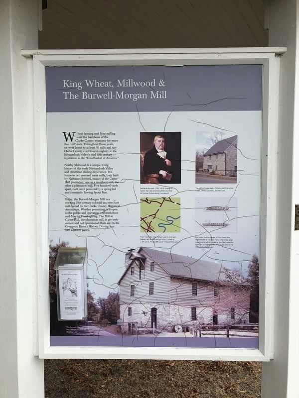
1. King Wheat, Millwood & The Burwell-Morgan Mill Marker
Wheat farming and flour milling were the backbone of the Clarke County economy for more than 150 years. Throughout those years, we were home to at least 60 mills and tiny Clarke County contributed mightily to the Shenandoah Valley's mid-19th-century reputation as the "breadbasket of America."
Nearby Millwood is a unique living history of this early Shenandoah Valley and American milling experience. It is home to two restored sister mills, both built by Nathaniel Burwell, master of the Carter Hall plantation; one as a merchant mill, the other a plantation mill. Five hundred yards apart, both were powered by a spring-fed and constantly flowing Spout Run.
Today, the Burwell-Morgan Mill is a working 18th-century colonial-era merchant mill owned by the Clarke County Historical Association. Weather permitting, it is open to the public and operating weekends from mid-May to Thanksgiving. The Mill at Carter Hall, the plantation mill, is privately owned and not operational. Both are on the Greenway District Historic Driving tour (see adjacent panel).
[Captions:]
Nathaniel Burwell (1750-1814) Master of Carter Hall. (Photo courtesy of Colonial Williamsburg Foundation)
The Mill at Carter Hall — Constructed in the late 1790s. (Photo courtesy Jennifer Lee)
From here take Main Street west to 2nd light. Make a left onto 340 and go south 3 miles to a left on Va. Route 255. Go 3 miles to Millwood.
Flat boats floating barrels of flour down the Shenandoah to Harpers Ferry, where the cargo was transferred to barges on the C&O canal for transport to Georgetown, and on by ship to the West Indies & Europe.
The Burwell Morgan Mill (Photo courtesy of Stephen Lee)
Topics and series. This historical marker is listed in these topic lists: Agriculture • Industry & Commerce • Waterways & Vessels. In addition, it is included in the Chesapeake and Ohio (C&O) Canal series list.
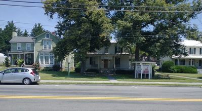
Location. 39° 9.033′ N, 77° 58.804′ W. Marker is in Berryville, Virginia, in Clarke County. Marker is on East Main Street (Virginia Route 7B) 0.1 miles west of Page Street, on the right when traveling west. Touch for map. Marker is at or near this postal address: 32 E Main St, Berryville VA 22611, United States of America. Touch for directions.
Other nearby markers. At least 8 other markers are within walking distance of this marker. Clarke County (here, next to this marker); Josephine School Community Museum & The African-American Experience (here, next to this marker); Stewardship & Conservation (here, next to this marker); Historic Districts (here, next to this marker); Berryville (a few steps from this marker); Benjamin Berry (within shouting distance of this marker); Bank of Clarke County (about 400 feet away, measured in a direct line); Clarke County Civil War Monument (about 500 feet away). Touch for a list and map of all markers in Berryville.
Credits. This page was last revised on August 7, 2022. It was originally submitted on October 11, 2020, by Devry Becker Jones of Washington, District of Columbia. This page has been viewed 272 times since then and 28 times this year. Last updated on April 29, 2021, by Bradley Owen of Morgantown, West Virginia. Photos: 1. submitted on October 11, 2020, by Devry Becker Jones of Washington, District of Columbia. 2. submitted on August 7, 2022, by Craig Doda of Napoleon, Ohio.
