Near Lake Ridge in Prince William County, Virginia — The American South (Mid-Atlantic)
Bacon Race Church
Confederate Occupation
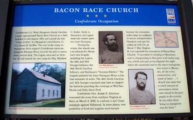
During the winter, the church was a storehouse for Hampton’s new brigade, including the Legion, the 14th and 19th Georgia Infantry, the 16th North Carolina Infantry, and Bachman’s “German Battery.” The brigade picketed the lower Occoquan River, a line that extended 12 miles. The 16th North Carolina and 14th Georgia remained near here to support the batteries guarding the crossings at Wolf Run Shoals and Sally-Davis Ford.
Confederate Gen. Joseph E. Johnston evacuated the army from northern Virginia at dawn on March 8, 1862, to confront a new Union campaign against Richmond. In some places, vast quantities of food and supplies were burned because the evacuation order came too suddenly to secure transportation. Hampton only got his orders at 3:30 P.M. on March 7. Maj. Stephen D. Lee reported the evacuation of Bacon Race Church: “I succeeded in sending to Manassas, and in transporting to this point with twelve wagons, which were put at my disposal the night before the movement and in return transportation trains to Manassas, all the arms, ammunition, and stores of value. … I should also state that a small amount of commissary stores were issued to the poor people in the vicinity by my order, there being no transportation for them.”
Erected by Virginia Civil War Trails.
Topics and series. This historical marker is listed in these topic lists: Churches & Religion • War, US Civil. In addition, it is included in the Virginia Civil War Trails series list. A significant historical month for this entry is March 1781.
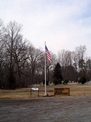
Location. 38° 41.485′ N, 77° 21.781′ W. Marker is near Lake Ridge, Virginia, in Prince William County. Marker is at the intersection of Davis Ford Road (Virginia Route 694) and Bacon Race Road, on the left when traveling west on Davis Ford Road. Marker is located at the Bacon Race Cemetery. Touch for map. Marker is at or near this postal address: 5213 Davis Ford Road, Woodbridge VA 22192, United States of America. Touch for directions.
Other nearby markers. At least 8 other markers are within 2 miles of this marker, measured as the crow flies. Bacon Race Church and Cemetery (within shouting distance of this marker); Military Operations (within shouting distance of this marker); Oak Grove - Bacon Race Church
(within shouting distance of this marker); World Trade Center Monument (approx. one mile away); Freedom Park (approx. one mile away); 9/11 Liberty Memorial (approx. 1.1 miles away); Roll of Honor (approx. 1.1 miles away); Washington-Rochambeau Wagon Route (approx. 1.7 miles away). Touch for a list and map of all markers in Lake Ridge.
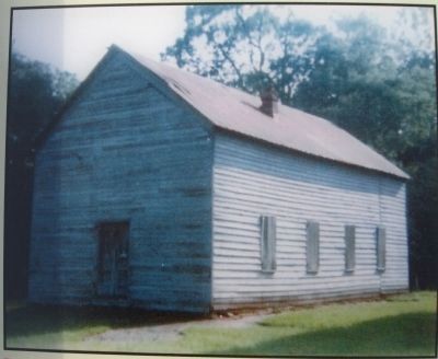
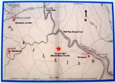
More about this marker. On the lower left of the marker is a photo captioned, Bacon Race Church. The middle of the marker has two portraits captioned, Gen. Wade Hampton and Gen. Stephen D. Lee. The upper right of the marker has a small map of the area with four stars denoting Civil War sites.
Credits. This page was last revised on October 20, 2023. It was originally submitted on February 11, 2009. This page has been viewed 3,287 times since then and 49 times this year. Last updated on October 3, 2023. Photos: 1, 2, 3, 4, 5. submitted on February 11, 2009. • Bill Pfingsten was the editor who published this page.
