Downtown in St. Louis, Missouri — The American Midwest (Upper Plains)
Commercial Beginnings
Jefferson National Expansion Memorial
— National Park Service, U.S. Department of the Interior —
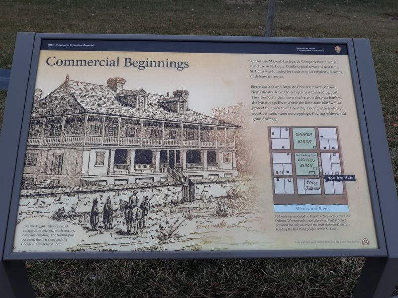
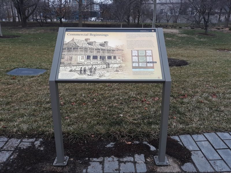
On this site Maxent, Laclede, & Company built the first structure in St. Louis. Unlike typical towns of that time, St. Louis was founded for trade, not for religious, farming, or defense purposes.
Pierre Laclede and Auguste Chouteau traveled from New Orleans in 1763 to set up a new fur-trading post. They found an ideal town site here on the west bank of the Mississippi River where the limestone bluff would protect the town from flooding. The site also had river access, timber, stone outcroppings, flowing springs, and good drainage.
St. Louis was modeled on French colonial cities like New Orleans. When people arrived by river, Market Street provided the only access to the bluff above, making this building the first thing people saw in St. Louis.
By 1787 Auguste Chouteau had enlarged the original, much smaller, company building. The trading post occupied the first floor and the Chouteau family lived above.
Erected by National Park Service, U.S. Department of the Interior.
Topics. This historical marker is listed in these topic lists: Architecture • Colonial Era • Industry & Commerce • Settlements & Settlers. A significant historical year for this entry is 1763.
Location. 38° 37.441′ N, 90° 11.149′ W. Marker is in St. Louis, Missouri. It is in Downtown. Marker is on Gateway Arch Trail, on the left when traveling north. At the intersection of 2nd and Washington you will find a paid parking area. Walk under the bridge and follow the path to the Arch. All markers are along the Gateway Arch Trail. Touch for map. Marker is at or near this postal address: 187 Gateway Arch Trail, Saint Louis MO 63102, United States of America. Touch for directions.
Other nearby markers. At least 8 other markers are within walking distance of this marker. Freedom Denied, Freedom Gained (within shouting distance of this marker); One Day, Three Nations (within shouting distance of this marker); Traders and Tribes (about 300 feet away, measured in a direct line); An Explosion Saves The City (about 400 feet away); First Conference, Society of Saint Vincent de Paul (about 400 feet away); Basilica of Saint Louis, King (about 400 feet away); Church Domain (about 500 feet away); To Honor Eero Saarinen, Architect, FAIA (about 500 feet away). Touch for a list and map of all markers in St. Louis.
Credits. This page was last revised on December 29, 2023. It was originally submitted on December 10, 2020, by Craig Doda of Napoleon, Ohio. This page has been viewed 125 times since then and 22 times this year. Last updated on November 27, 2023, by Darren Jefferson Clay of Duluth, Georgia. Photos: 1, 2. submitted on December 10, 2020, by Craig Doda of Napoleon, Ohio. • Devry Becker Jones was the editor who published this page.

