San José del Torreón in Ocampo, Guanajuato, Mexico — The Central Highlands (North America)
The Pre-Hispanic House
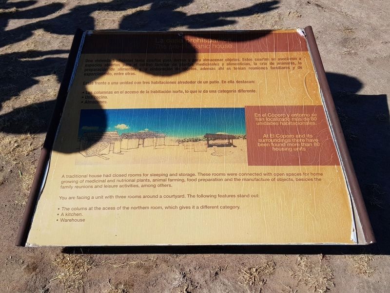
Una vivienda adicional tenia cuartos para dormir y para almacenar objetos. Estos cuartos se asociaron a espacios abiertos para el cultivo familiar de plantas inedicinales y alimenticias, la cria de animales, la preparación de alimentos y la elaboración de objetos, además ahi se tenían reuniones familiares y de esparcimiento, entre otras.
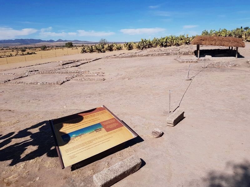
Estás frente a una unidad con tres habitaciones alrededor de un patio. En ella destacan:
Las columnas en el acceso de la habitación norte, lo que le da una categoria diferente.
Una cocina.
Almacenes.
En el Cóporo y entorno se han localizado más de 80 unidades habitacionales.
The pre-Hispanic house
A traditional house had closed rooms for sleeping and storage. These rooms were connected with open spaces for home growing of medicinal and nutrional plants, animal farming, food preparation and the manufacture of objects, besides the family reunions and leisure activities, among others.
You are facing a unit with three rooms around a courtyard. The following features stand out:
• The colums at the acess of the northern room, which gives it a different category.
• A kitchen.
• Warehouse
At El Cóporo and its surroundings there have been found more than 80 housing units.
Erected by Instituto Nacional de Antropología e Historia (INAH).
Topics. This historical marker is listed in these topic lists: Anthropology & Archaeology • Native Americans • Parks & Recreational Areas.
Location. 21° 28.709′ N, 101° 27.595′ W. Marker is in San José del Torreón, Guanajuato, in Ocampo. Marker can be reached from Camino a El Cóporo, on the left when traveling east. Touch for map. Marker is in this post office area: San José del Torreón GTO 37640, Mexico. Touch for directions.
Other nearby markers. At least 8 other markers are within 19 kilometers of this marker, measured as the crow flies. The Kitchen (within shouting distance of this marker); Sunset Square (about 90 meters away, measured in a direct line); The Transformation of the Landscape by Man (about 90 meters away); A City Under Cactus (about 120 meters away); The Sunset Room (about 120 meters away); El Cóporo (200 to 900 AD) (approx. 0.2 kilometers away); Father Hidalgo (approx. 19 kilometers away); Parish of San Juan Bautista (approx. 19 kilometers away). Touch for a list and map of all markers in San José del Torreón.
More about this marker. The El Cóporo Archaeological Site markers are accessible as part of a tour of the site. Access is during the site's normal hours of operation and a small fee is paid ($2 in 2020). The staff provides transportation to the site from the visitors center near San José del Torreón.
Credits. This page was last revised on December 30, 2020. It was originally submitted on December 29, 2020, by J. Makali Bruton of Accra, Ghana. This page has been viewed 70 times since then and 4 times this year. Photos: 1, 2. submitted on December 29, 2020, by J. Makali Bruton of Accra, Ghana.

