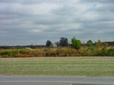
Pleasant Grove West in Chesapeake, Virginia — The American South (Mid-Atlantic)
Glencoe
"He was brave, gentle and polished"
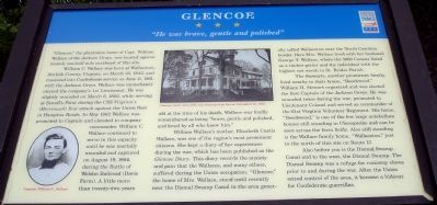
William C. Wallace was born at Wallaceton, Norfolk County, Virginia, on March 23, 1842, and mustered into Confederate service on June 11, 1861, with the Jackson Greys. Wallace was immediately elected the company’s 1st Lieutenant. He was slightly wounded on March 8, 1862, while serving at Sewell’s Point during the CSS Virginia’s (Merrimack) first attack against the Union fleet in Hampton Roads. In May 1862 Wallace was promoted to Captain and elevated to company commander. William C. Wallace continued to serve in this capacity until he was mortally wounded and captured on August 19, 1864 during the Battle of Weldon Railroad (Davis Farm). A little more than twenty-two years old at the time of his death, Wallace was fondly remembered as being “brave, gentle and polished, and loved by all who knew him.”
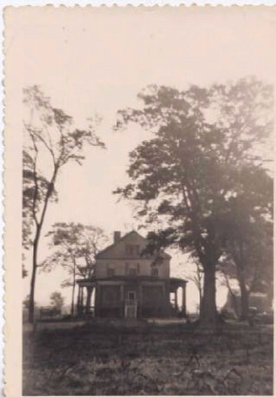
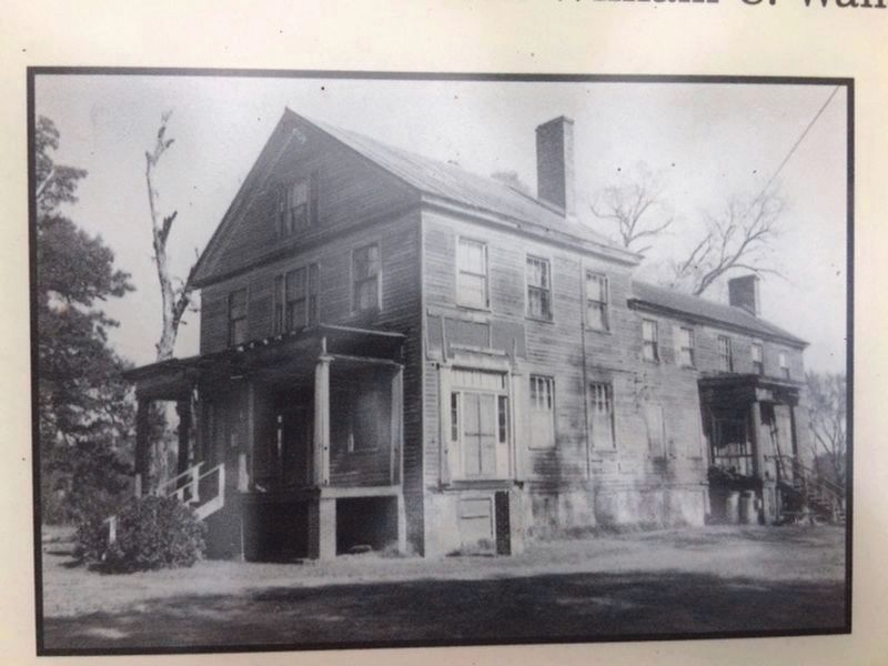
William Wallace’s mother, Elizabeth Custis Wallace, was one of the region’s most prominent citizens. She kept a diary of her experiences during the war, which has been published as the Glencoe Diary. This diary records the anxiety and pain that the Wallaces, and many others, suffered during the Union occupation. “Glencoe,” the home of Mrs. Wallace, stood until recently near the Dismal Swamp Canal in the area generally called Wallaceton near the North Carolina border. Here Mrs. Wallace lived with her husband, George T. Wallace, whom the 1860 Census listed as a timber-getter and the individual with the highest net worth in St. Brides Parish.
The Stewarts, another prominent family, lived nearby in their house, “Beechwood.” William H. Stewart organized and was elected the first Captain of the Jackson Greys. He was wounded twice during the war, promoted to Lieutenant Colonel and served as the commander of the 61st Virginia Volunteer Regiment. His home, “Beechwood,” is one of the few large antebellum houses still standing in Chesapeake and can be seen across the farm fields. Also still standing is the Wallace family home, “Wallaceton,” just to the north of this site on Route 17.
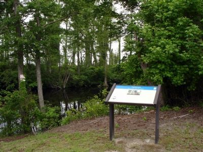
Also before you is the Dismal Swamp Canal and to the west, the Dismal Swamp. The Dismal Swamp was a refuge for runaway slaves prior to and during the war. After the Union seized control of the area, it became a hideout for Confederate guerrillas.
Erected by Virginia Civil War Trails.
Topics and series. This historical marker is listed in this topic list: War, US Civil. In addition, it is included in the Virginia Civil War Trails series list. A significant historical month for this entry is March 1792.
Location. 36° 36.35′ N, 76° 22.867′ W. Marker is in Chesapeake, Virginia. It is in Pleasant Grove West. Marker is on South George Washington Highway (U.S. 17), on the left when traveling north. Marker is off Ballahack Road along the Dismal Swamp Canal Trail. Touch for map. Marker is in this post office area: Chesapeake VA 23322, United States of America. Touch for directions.
Other nearby markers. At least 8 other markers are within 6 miles of this marker, measured as the crow flies. North West Canal (within shouting distance of this marker); The Superintendent's House... from Tolls to Tea (approx. 0.6 miles away); Dismal Swamp Canal (approx. 2.3 miles away); Outliers (approx. 2.6 miles away); Stone Mileposts along the Dismal Swamp Canal (approx. 2.8 miles away); From Towpath...to Highway...to "Toe" path (approx. 4 miles away); Herring (Heron) Ditch (approx. 5.3 miles away); Dismal Swamp Canal Trail (approx. 5½ miles away). Touch for a list and map of all markers in Chesapeake.
More about this marker. On the lower left is a photo Captain William C. Wallace. On the top center is a photo of the Glencoe house captioned, "Glencoe, built circa 1841, was destroyed by fire on November 23, 1979."
Regarding Glencoe. Note that the marker identifies William Wallace’s mother as Elizabeth Custis Wallace. It was actually Elizabeth Curtis Wallace (Curtis was her maiden name). Although there were ties to
the Custis-Lee family, Elizabeth's middle name, Curtis, refers to her father, Drayton Mills Curtis.
Related markers. Click here for a list of markers that are related to this marker. Dismal Swamp Canal Trail
Additional commentary.
1. Last person who lived in Glencoe plantation
I was the last person to live in Glencoe Plantation before it burned. It had a big ballroom with sliding doors to divide it into two spaces as needed. The double stairs spiraled up to a balcony above the drawing room. Behind the main house was the slave quarters. Many civil war bullets and trinkets have been found in the yard. It had fireplaces on all three levels and secret passageways that may have been used for the underground railway.
Editor's Note: Thank you for sharing some of your personal history related to this marker. If you have any pictures of Glencoe before it burned, please consider adding them to this page.
— Submitted August 22, 2011.
2. Taking Objection to a Previous Comment
Someone previously commented that he/she was the last person to live in Glencoe. Not true. My family was the last, and the house was boarded up immediately afterward. The only other possible "occupants" were vagrants
or delinquents who broke in and ultimately caused the fire that destroyed Glencoe. Also, it did not have "double stairs spiraling up to a balcony above the drawing room", but single stairs that spiraled from 2nd to 4th floor; no balcony and no drawing room below. There were fireplaces on 3 of 4 levels. There were no secret passageways - I lived there for over 10 years and explored every nook and cranny of the buildings there.
— Submitted March 8, 2019.
Credits. This page was last revised on May 28, 2023. It was originally submitted on January 12, 2008. This page has been viewed 6,056 times since then and 161 times this year. Last updated on January 11, 2021, by Faye Cox of Chesapeake, Virginia. Photos: 1, 2. submitted on January 12, 2008. 3, 4. submitted on January 11, 2021, by Faye Cox of Chesapeake, Virginia. 5. submitted on November 10, 2010, by Chris Bieber of Chesapeake, Virginia. • Bernard Fisher was the editor who published this page.
