Near Port Clinton in Ottawa County, Ohio — The American Midwest (Great Lakes)
Old French War - Pontiac's Conspiracy - Revolutionary War / French Expedition, 1754
Inscription.
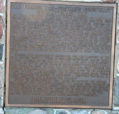
Colonel John Bradstreet's expedition for the recovery of the nine British posts captured in Pontiac's Conspiracy sailed their larger watercraft, 60 long boats with 1400 men, into Sandusky Bay and up to "the lower falls of the Sandusky" (Fremont), where they encamped Sept. 20, 1764, the western most point reached. Returning, encamped near where the old fort stood "on the carrying place between Lakes Sandusky and Erie," where Major Israel Putnam began "clearing the ground to construct a fort," but "October 18 whole decamped and embarked for Niagara."
During the Revolutionary War, Major De Peyster, the British Commandant, sent Butler's Rangers with cannon from Detroit, up to the lower falls of the Sandusky, where they supported the Indians in the repulse of Crawford's Expedition in 1782, which culminated in the burning of Colonel Crawford at the stake. Later "the British established a post at Lower Sandusky" (Fremont)
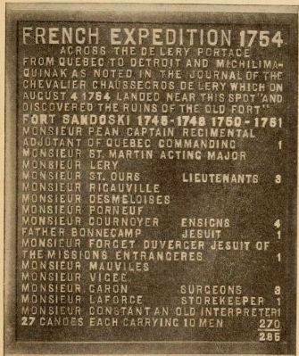
Across the de Lery Portage
Monsieur St. Martin, Acting Major
Monsieur Lery
Monsieur St. Ours • Lieutenants • 3
Monsieur Riganville
Monsieur Desmeloises
Monsieur Porneouf
Monsieur Cournover • Ensigns • 4
Father Bonnecamp, • Jesuit • 1
Monsieur Forget Duverger • Jesuit of the Missions etrangeres • 1
Monsieur Mauvilles
Monsieur Vigee
Monsieur Garon • Surgeons • 3
Monsieur Laforge, store keeper • 1
Monsieur Constant, an old interpreter • 1
27 canoes, each carrying 10 men • 270
Erected 1912 by Ohio Society Daughters of the American Revolution (DAR).
Topics and series. This historical marker is listed in these topic lists: Military • Native Americans • War, French and Indian • War, US Revolutionary. In addition, it is included in the Daughters of the American Revolution series list. A significant historical date for this entry is September 20, 1764.
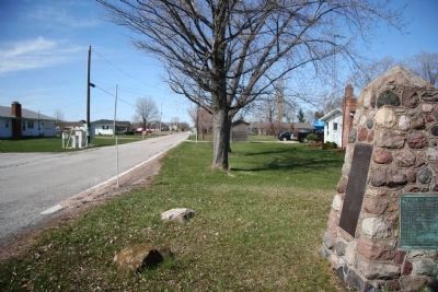
Location. 41° 29.207′ N, 82° 56.027′ W. Marker is near Port Clinton, Ohio, in Ottawa County. Marker is on Fulton Street, 0 miles south of Rohde Drive, on the left when traveling south. This historical marker is located just south of Port Clinton, Ohio, at the southern most end of Fulton Street, just off the northern shoreline of Sandusky Bay. Touch for map. Marker is in this post office area: Port Clinton OH 43452, United States of America. Touch for directions.
Other nearby markers. At least 8 other markers are within 2 miles of this marker, measured as the crow flies. Fort Sites / De Lery Portage / French Expedition 1754 (here, next to this marker); Battle Of Bataan War Memorial (approx. 1.6 miles away); Veterans Memorial Bench (approx. 1.6 miles away); a different marker also named Veterans Memorial Bench (approx. 1.6 miles away); Ottawa County Veterans Memorial
(approx. 1.6 miles away); Ottawa County Courthouse (approx. 1.6 miles away); Japanese Type 38 "I" Improved Field Gun (approx. 1.6 miles away); End of Harrison's Trail in Ohio - War of 1812 (approx. 1.7 miles away). Touch for a list and map of all markers in Port Clinton.
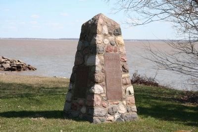
More about this marker. Please note this monument has a plaque on all four sides, but only two are listed here. Normally, the Historical Marker database would publish all four markers on this monument as one entry with text from all markers included. Due to the separate erecting organizations and dedication years, it was determined this could be published as an exception to that standard.
Regarding Old French War - Pontiac's Conspiracy - Revolutionary War / French Expedition, 1754. It appears from information in the book Old Fort Sandoski and the De Lery (see link below), the markers on this historical monument have been changed since its original dedication in 1912.
Also see . . .
1. Pontiac's Rebellion. Ohio History Central website entry (Submitted on July 4, 2009, by Dale K. Benington of Toledo, Ohio.)
2. John Butler (pioneer)
. Absolute Astronomy website entry (Submitted on July 4, 2009, by Dale K. Benington of Toledo, Ohio.)
3. John Bradstreet. Ohio History Central website entry (Submitted on July 4, 2009, by Dale K. Benington of Toledo, Ohio.)
4. Battle of the Sandusky. Ohio History Central website entry (Submitted on July 4, 2009, by Dale K. Benington of Toledo, Ohio.)
5. Old Fort Sandoski and the De Lery portage. Internet Archive website entry:
This book, by Lucy Elliot Keeler, published in 1912, highlights the "Erection of Historical Tablets on Memorial Day, May 30, 1912 at Port Clinton, OH." (Submitted on July 10, 2009, by Kevin W. of Stafford, Virginia.)
Credits. This page was last revised on February 22, 2024. It was originally submitted on July 4, 2009, by Dale K. Benington of Toledo, Ohio. This page has been viewed 1,639 times since then and 38 times this year. Last updated on February 13, 2024, by Carolyn Sanders of Plano, Texas. Photos: 1. submitted on July 4, 2009, by Dale K. Benington of Toledo, Ohio. 2. submitted on July 10, 2009, by Kevin W. of Stafford, Virginia. 3, 4. submitted on July 4, 2009, by Dale K. Benington of Toledo, Ohio. • Devry Becker Jones was the editor who published this page.


