Montclair in Prince William County, Virginia — The American South (Mid-Atlantic)
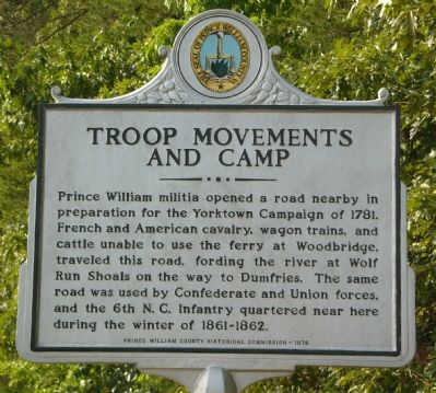
Troop Movements and Camp
Erected 1976 by Prince William County Historical Commission. (Marker Number 19.)
Topics and series. This historical marker is listed in these topic lists: Colonial Era • Roads & Vehicles • War, US Civil • War, US Revolutionary. In addition, it is included in the Virginia, Prince William County Historical Commission series list. A significant historical year for this entry is 1781.
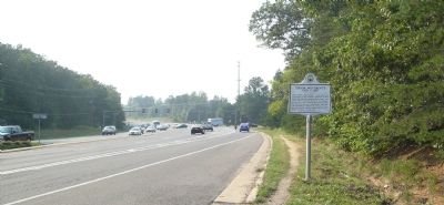
Location. 38° 36.078′ N, 77° 20.352′ W. Marker is in Montclair, Virginia, in Prince William County. Marker is on Dumfries Road (Virginia Route 234) 0.2 miles east of Country Club Drive, on the right. Touch for map. Marker is in this post office area: Dumfries VA 22026, United States of America. Touch for directions.
Other nearby markers. At least 8 other markers are within 2 miles of this marker, measured as the crow flies. “Camp Fisher” Civil War Campsite (approx. ¼ mile away); Rippon Lodge (approx. 0.4 miles away); Williams Ordinary (approx. half a mile away); Potomac Path (approx. half a mile away); Cabin Branch Pyrite Mine (approx. half a mile away); Weems Botts Museum (approx. half a mile away); Alexander Henderson (approx. 0.6 miles away); Barnes House (approx. 1.1 miles away). Touch for a list and map of all markers in Montclair.
Credits. This page was last revised on October 7, 2023. It was originally submitted on August 24, 2007, by Kevin W. of Stafford, Virginia. This page has been viewed 2,678 times since then and 106 times this year. Last updated on October 3, 2023, by N. Jozsa of Woodbridge, Virginia. Photos: 1, 2. submitted on August 24, 2007, by Kevin W. of Stafford, Virginia. • Bill Pfingsten was the editor who published this page.

