Near Culpeper in Culpeper County, Virginia — The American South (Mid-Atlantic)
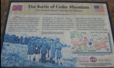
The Battle of Cedar Mountain
The Federal Attack Reaches Its Climax
Help Preserve Battlefields, Call CWPT at 1-888-606-1400
Friends of Fredericksburg Area Battlefields - www.fofab.org
This material is based upon work assisted by a grant from the Department of the Interior, National Park Service. Any opinions, findings and conclusions or recommendations expressed in this material are those of the author(s) and do not necessarily reflect the views of the Department of the Interior.
Erected by Civil War Preservation Trust
Friends of Fredericksburg Area Battlefields.
Topics. This historical marker is listed in this topic list: War, US Civil.
Location. Marker has been permanently removed. It was located near 38° 24.392′ N, 78° 3.906′ W. Marker was near Culpeper, Virginia, in Culpeper County. Marker could be reached from the intersection of Dove Hill Road (County Route 642) and James Madison Highway (U.S. 15), on the right when traveling north. Located at the third trail stop for the Civil War Preservation Trust's Cedar Mountain Battlefield walking trail. Touch for map. Marker was in this post office area: Culpeper VA 22701, United States of America.
We have been informed that this sign or monument is no longer there and will not be replaced. This page is an archival view of what was.
Other nearby markers. At least 8 other markers are within walking distance of this location. A different marker also named Battle of Cedar Mountain (here, next to this marker); a different marker also named Battle of Cedar Mountain (within shouting distance of this marker); a different marker also named Battle of Cedar Mountain (about 300 feet away, measured in a direct line); Tenth Maine (about 500 feet away); a different marker also named Battle of Cedar Mountain (about 600 feet away); a different marker also named Battle of Cedar Mountain (about 700 feet away); a different marker also named Battle of Cedar Mountain (approx. 0.2 miles away); a different marker also named The Battle of Cedar Mountain (approx. 0.2 miles away). Touch for a list and map of all markers in Culpeper.
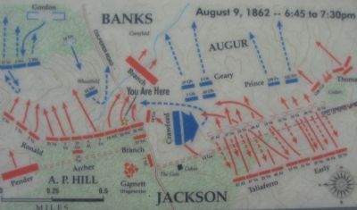
More about this marker. The background of the marker is a photo showing "Officers of the 10th Maine stand in the middle of the wheatfield (in front of you) where their regiment stood and fought. This photo, taken a few days after the battle, still shows evidence of the fighting that took place there." On the right a map shows the tactical situation on August 9, 1862 between 6:45 and 7:30 p.m. "As Jackson rallied his men in the woods behind you, A.P. Hill's division arrived on the scene. Hill's men launched a counterattack that sent the Federals in full retreat."
Regarding The Battle of Cedar Mountain. Since posting of this marker, the Friends of the Fredericksburg
Area Battlefields web site has moved to www.parksonline.org/fofab/index.htm.
This is one of several markers interpreting the Battle of Cedar Mountain. See the Battle of Cedar Mountain Virtual Tour by Markers linked below.
Photographed By Craig Swain, December 22, 2007
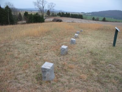
6. Unit Marking Stones
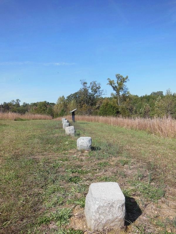
The six marking stones indicate the presence of several units at this point on the battlefield. The closest to the camera is inscribed "7th O" for the 7th Ohio Infantry regiment. The second is "66th O" for the 66th Ohio Infantry. The third with "109 PA" indicates the 109th Pennsylvania Infantry. Fourth is labeled "Bests Bal" in reference to Captain C. L. Best's Federal artillery. The fifth is "No 20 Penn Ca" which may reference the 1st Pennsylvania Cavalry which was engaged here. Last in line is "Knapps Bal" designating Captain J.M. Knapp's Federal artillery.
Photographed By Craig Swain, December 22, 2007
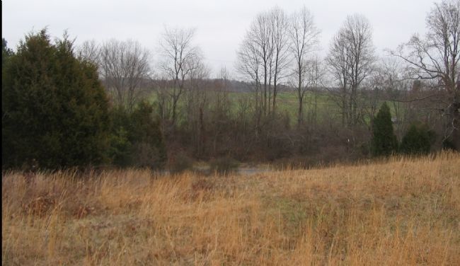
7. Crawford's Advance
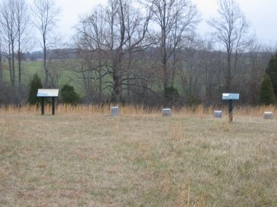
Looking northeast from the marker's location. Between 5:45 and 6:15 in the afternoon, Crawford's Brigade advanced from the high ground beyond Dove Hill Road against the Confederates line, mostly composed of Winder's (Stonewall) Division. Crawford's advance was on the west side of and generally parallel to the Orange and Culpeper Road. From east to west the regiments engaged were the 5th Connecticut, 28th New York, 46th Pennsylvania, and the 3rd Wisconsin. The 46th Pa Infantry entered the tree line behind the left flank of the 1st Virginia Battalion, thus turning the Confederate position.
Photographed By Craig Swain, December 22, 2007
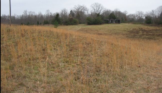
8. Collapse of the Confederate Line
Looking to the south from the marker. At the time of the battle this rise was heavily wooded. With three surges, Crawford managed to drive Garnett's Brigade back. In the course of these attacks, the Federal brigade had turned ninety degrees and then began advancing to the east on Crittenden Lane. As a result, the Confederate artillery in the area of the gate limbered and retreated. In addition the Confederate brigades of Taliaferro (who was now commanding Winder's Division) and Early were forced to fall back, lest they too be flanked by Crawford.
Credits. This page was last revised on October 21, 2021. It was originally submitted on December 31, 2007, by Craig Swain of Leesburg, Virginia. This page has been viewed 2,101 times since then and 45 times this year. Last updated on October 16, 2021, by Bradley Owen of Morgantown, West Virginia. Photos: 1. submitted on December 31, 2007, by Craig Swain of Leesburg, Virginia. 2. submitted on March 30, 2009, by Craig Swain of Leesburg, Virginia. 3, 4. submitted on December 31, 2007, by Craig Swain of Leesburg, Virginia. 5. submitted on March 16, 2021, by Bradley Owen of Morgantown, West Virginia. 6, 7, 8. submitted on January 1, 2008, by Craig Swain of Leesburg, Virginia. 9. submitted on March 16, 2021, by Bradley Owen of Morgantown, West Virginia. • Bernard Fisher was the editor who published this page.
