Lower Windsor Township in Long Level in York County, Pennsylvania — The American Northeast (Mid-Atlantic)
Latrobe's Survey of the Susquehanna
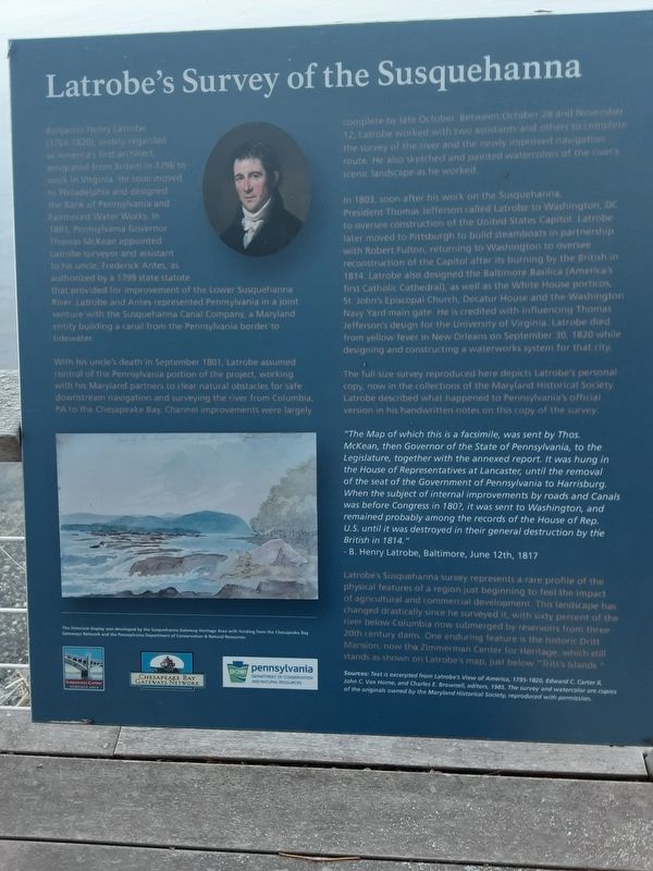
With his uncle's death in September 1801, Latrobe assumed control of the Pennsylvania portion of the project, working with his Maryland partners to clear natural obstacles for safe downstream navigation and surveying the river from Columbia, PA to the Chesapeake Bay. Channel improvements were largely complete by late October. Between October 28 and November 12, Latrobe worked with two assistants and others to complete the survey of the river and the newly improved navigation route. He also sketched and painted watercolors of the river's scenic landscape as he worked.
In 1803, soon after his work on the Susquehanna, President Thomas Jefferson called Latrobe to Washington, DC to oversee construction of the United States Capitol. Latrobe later moved to Pittsburgh to build steamboats in partnership with Robert Fulton, returning to Washington to oversee reconstruction of the Capitol after its burning by the British in 1814. Latrobe also designed the Baltimore Basilica (America's first Catholic Cathedral), as well as the White House porticos, St. John's Episcopal Church, Decatur House and the Washington Navy Yard main gate. He is credited with influencing Thomas Jefferson's design for the University of Virginia. Latrobe died from yellow fever in New Orleans on September 30, 1820 while designing and constructing a waterworks system for that city.
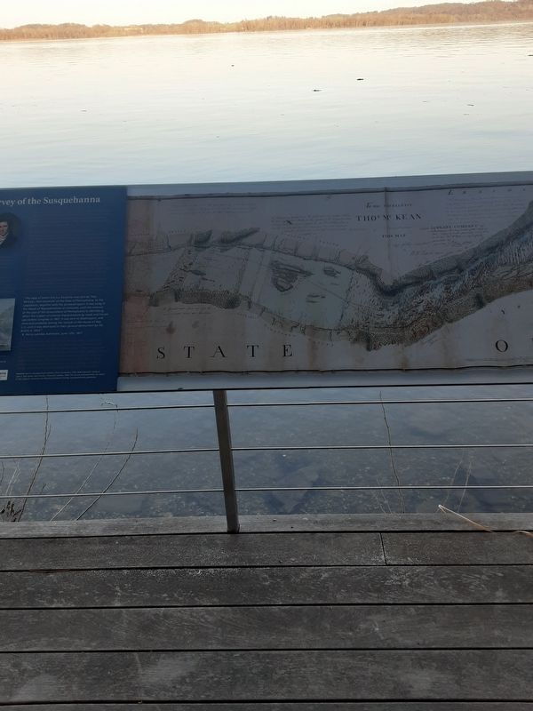
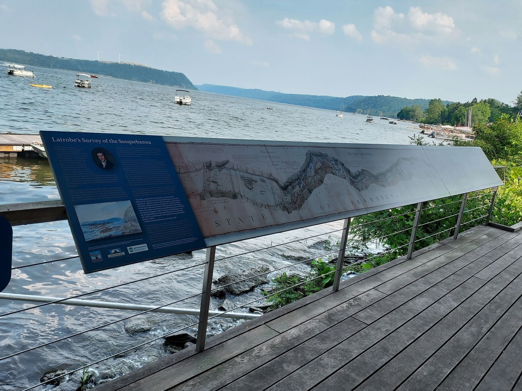
The full-size survey reproduced here depicts Latrobe's personal copy, now in the collections of the Maryland Historical Society. Latrobe described what happened to Pennsylvania's official version in his handwritten notes on this copy of the survey:
"The Map of which this is a facsimile, was sent by Thos. McKean, then Governor of the State of Pennsylvania, to the Legislature, together with the annexed report. It was hung in the House of Representatives at Lancaster, until the removal of the seat of the Government of Pennsylvania to Harrisburg. When the subject of internal improvements by roads and Canals was before Congress in 180?, it was sent to Washington, and remained
probably among the records of the House of Rep.
U.S. until it was destroyed in their general destruction by the British in 1814."
- B. Henry Latrobe, Baltimore, June 12th, 1817
Latrobe's Susquehanna survey represents a rare profile of the physical features of a region just beginning to feel the impact of agricultural and commercial development. This landscape has changed drastically since he surveyed it, with sixty percent of the river below Columbia now submerged by reservoirs from three 20th century dams. One enduring feature is the historic Dritt Mansion, now the Zimmerman Center for Heritage, which still stands as shown on Latrobe's map, just below "Tritt's Islands."
Sources: Text is excerpted from Latrobe's View of America, 1795-1820, Edward C. Carter II, John C. Van Horne, and Charles E. Brownell, editors, 1985. The survey and watercolor are copies of the originals owned by the Maryland Historical Society, reproduced with permission.
This historical display was developed by the Susquehanna Gateway Heritage Area with funding from the Chesapeake Bay Gateways Network and the Pennsylvania Department of Conservation & Natural Resources.
Susquehanna Gateway Pennsylvania
Chesapeake Bay Gateways Network
Pennsylvania Department of Conservation and Natural Resources
Topics. This historical marker is listed
in these topic lists: Architecture • Exploration. A significant historical date for this entry is June 12, 1817.
Location. 39° 58.679′ N, 76° 29.754′ W. Marker is in Long Level, Pennsylvania, in York County. It is in Lower Windsor Township. Marker is on Long Level Road (Pennsylvania Route 624), on the right when traveling north. This is on the river side of PA 624, in walking distance to north of 1706 Long Level Road, which is on the inland side of road. This is between the "Gateway to the Bay" plaque and the river. Touch for map. Marker is at or near this postal address: 1706 Long Level Road, Wrightsville PA 17368, United States of America. Touch for directions.
Other nearby markers. At least 8 other markers are within walking distance of this marker. Gateway to the Bay (a few steps from this marker); Captain Thomas Cresap (within shouting distance of this marker); The Dritt Mansion: A Home at the Center of History (within shouting distance of this marker); Thomas Cresap and the Border War (within shouting distance of this marker); The John & Kathryn Zimmerman Center for Heritage (within shouting distance of this marker); Native Lands Trailhead (within shouting distance of this marker); Cresap's Fort (approx. 0.3 miles away); Susquehanna and Tidewater Canal (approx. 0.9 miles away). Touch for a list and map of all markers in Long Level.
Photographed By Carl Gordon Moore Jr., April 5, 2021
5. Latrobe's Survey of the Susquehanna Marker
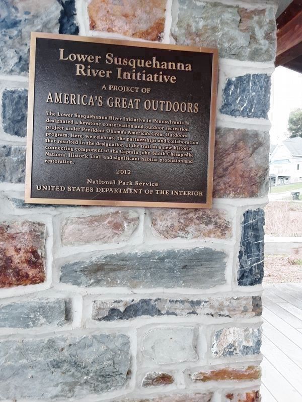
We face south to view this, with the subject marker behind us on the left.
Lower Susquehanna
River Initiative
A Product of
America's Great Outdoors
The Lower Susquehanna River Initiative in Pennsylvania is
designated a keystone conservation and outdoor recreation
project under President Obama's America's Great Outdoors
program. Here, we celebrate the partnerships and collaboration
that resulted in the designation of the trail as a new historic
connecting component of the Captain John Smith Chesapeake
National Historic Trail and significant habitat protection and restoration.
2012
National Park Service
United States Department of the Interior
River Initiative
A Product of
America's Great Outdoors
National Park Service
United States Department of the Interior
Credits. This page was last revised on June 17, 2023. It was originally submitted on March 25, 2021, by Carl Gordon Moore Jr. of North East, Maryland. This page has been viewed 215 times since then and 12 times this year. Last updated on June 4, 2023, by Annette Fillmore of York, Pennsylvania. Photos: 1. submitted on March 25, 2021, by Carl Gordon Moore Jr. of North East, Maryland. 2, 3. submitted on March 26, 2021, by Carl Gordon Moore Jr. of North East, Maryland. 4. submitted on June 17, 2023, by Annette Fillmore of York, Pennsylvania. 5. submitted on April 6, 2021, by Carl Gordon Moore Jr. of North East, Maryland. • Bill Pfingsten was the editor who published this page.
