Lower Windsor Township in Long Level in York County, Pennsylvania — The American Northeast (Mid-Atlantic)
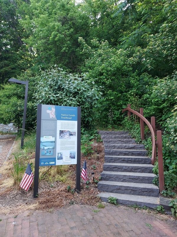
Native Lands Trailhead
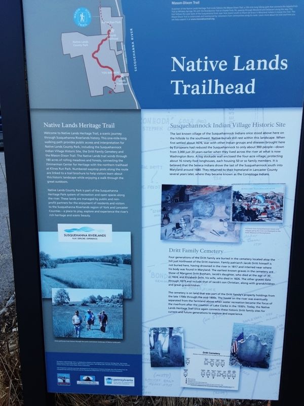
A portion of the Native Lands Heritage Trail route follows the Mason-Dixon Trail, a 193 mile long hiking path that connects the Appalachian Trail at Whiskey Spring, PA with the Brandywine Trail at Chadds Ford, PA passing through Maryland and Delaware along the way. The trail follows the west bank of the Susquehanna from near York Haven south to Havre de Grace in Maryland where it crosses the river. The Mason-Dixon Trail is constructed and maintained by volunteers from communities along its route. Learn more about the trail and how you can help support it at www.masondixontrail.org
[To left is sketch of the Park area.]
Native Lands Trailhead
Native Lands Heritage Trail
Welcome to Native Lands Heritage Trail, a scenic journey through Susquehanna Riverlands history. This one-mile-long walking path provides public access and interpretation for Native Lands County Park, including the Susquehannock Indian Village Historic Site, the Dritt Family Cemetery and the Mason-Dixon Trail. The Native Lands trail winds through 180 acres of rolling meadows and forests, connecting the Zimmerman Center for Heritage with the northern trailhead at Klines Run Park. Numbered waystop posts along the route are linked to a trail brochure to help visitors learn about this historic landscape while enjoying a walk through the great outdoors.
Native Lands County Park is part of the Susquehanna Heritage Park system of recreation and open spaces along the river. These lands are managed by public and non-profit partners for the enjoyment of residents and visitors to the Susquehanna Riverlands region of York and Lancaster Counties - a place to play, explore and experience the river's rich heritage and scenic beauty.
Play. Explore. Experience.
[caption:]
Grass pathways lead visitors through the scenic and historic landscape of Native Lands park.
The Native Lands Heritage Trail is a collaborative initiative of the Susquehanna Gateway Heritage Area, York County Department of Parks and Recreation, Mason-Dixon Trail System, York Hiking Club. Lancaster York Native Heritage Advisory Council and the Safe Harbor Power Corporation.
Trail interpretive materials have been developed by the Susquehanna Gateway Heritage Area with funding from the Chesapeake Bay Gateways Network and the Pennsylvania Department of Conservation & Natural Resources.
Susquehannock Indian Village Historic Site
The last known village of the Susquehannock Indians once stood above here on the hillside to the southwest. Native burials
still rest within this landscape. When
first settled about 1676, war with other Indian groups and diseases brought here
by Europeans had reduced the Susquehannock to only about 900 people-down
from 3,000 just 20 years earlier when they lived across the river at what is now
Washington Boro. A log stockade wall enclosed the four-acre village, protecting
about 16 ninety-foot longhouses, each housing 50 or so family members. It is
believed that the Seneca Indians drove the last of the Susquehannock south into
Maryland around 1680. They returned to their homeland in Lancaster County
several years later, where they became known as the Conestoga Indians.
[on picture:]
The Indian Fort Susquehanok
[caption:]
Artifacts from Susquehannock towns and villages along the river are displayed at the State Museum of Pennsylvania.
Dritt Family Cemetery
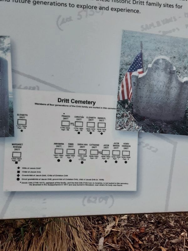
Four generations of the Dritt family are buried in the cemetery located atop the hill just northwest of the Dritt mansion. Family patriarch Jacob Dritt himself is not buried here, having drowned in the river in 1817 and interred near where his body was found in Maryland. The earliest known graves in the cemetery are those of Margaret Dritt Bonham, Jacob's daughter, who died at the age of 30 in 1824, and Elizabeth Dritt, his wife, who died in 1826. The other

Photographed By Carl Gordon Moore Jr., April 9, 2021
3. Native Lands Trailhead Marker
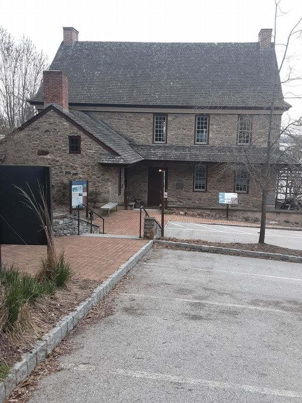
At far left is back of this ("Native Lands Trailhead") plaque. From left to right in background:
"Welcome to the Zimmerman Center for Heritage" plaque (sent to hmdb.org as accompaniment to next plaque),
"The John & Kathryn Zimmerman Center for Heritage" plaque (mounted directly on building),
"The Dritt Mansion: A Home at the Center of History" plaque.
"Welcome to the Zimmerman Center for Heritage" plaque (sent to hmdb.org as accompaniment to next plaque),
"The John & Kathryn Zimmerman Center for Heritage" plaque (mounted directly on building),
"The Dritt Mansion: A Home at the Center of History" plaque.
The cemetery is on land that was part of the Dritt family's property holdings from the late 1700s through the mid-1800s. The house on the river was eventually separated from the farmland above when water recreation became the focus of the riverfront after the creation of Lake Clarke in the 1930's. Today, the Native Lands Heritage Trail once again connects these historic Dritt family sites for current and future generations to explore and experience.
[diagram of Dritt family cemetery]
Erected by Zimmerman Center for Heritage.
Topics. This historical marker is listed in these topic lists: Colonial Era • Native Americans • Settlements & Settlers. A significant historical year for this entry is 1676.
Location. 39° 58.655′ N, 76° 29.796′ W. Marker is in Long Level, Pennsylvania, in York County. It is in Lower Windsor Township. Marker can be reached from Long Level Road (Pennsylvania Route 624), on the left when traveling north. Touch for map. Marker is at or near this postal address: 1706 Long Level Road, Wrightsville PA 17368, United States of America. Touch for directions.
Other nearby markers. At least 8 other markers are within walking distance of this marker. The John & Kathryn Zimmerman Center for Heritage (here, next to this marker); The Dritt Mansion: A Home at the Center of History
(a few steps from this marker); Thomas Cresap and the Border War (within shouting distance of this marker); Captain Thomas Cresap (within shouting distance of this marker); Gateway to the Bay (within shouting distance of this marker); Latrobe's Survey of the Susquehanna (within shouting distance of this marker); Cresap's Fort (approx. 0.3 miles away); Susquehanna and Tidewater Canal (approx. 0.9 miles away). Touch for a list and map of all markers in Long Level.
Credits. This page was last revised on June 17, 2023. It was originally submitted on April 7, 2021, by Carl Gordon Moore Jr. of North East, Maryland. This page has been viewed 140 times since then and 21 times this year. Last updated on June 3, 2023, by Annette Fillmore of York, Pennsylvania. Photos: 1. submitted on April 7, 2021, by Carl Gordon Moore Jr. of North East, Maryland. 2, 3. submitted on April 10, 2021, by Carl Gordon Moore Jr. of North East, Maryland. 4. submitted on June 12, 2023, by Annette Fillmore of York, Pennsylvania. • Bill Pfingsten was the editor who published this page.


