Near Havre de Grace in Harford County, Maryland — The American Northeast (Mid-Atlantic)
Rock Run Mill
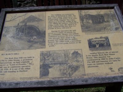
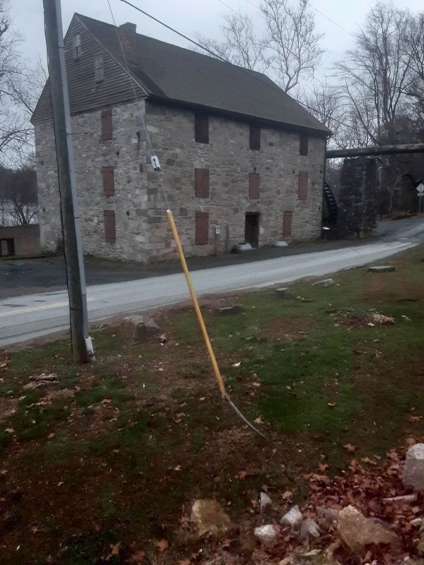
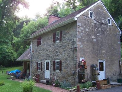
The Rock Run Mill was built in 1794 by John Stump, a prominent businessman, on land originally known as “Land of Promise.” The mill was in continuous operation until 1954. It is one of the oldest mills still standing in Harford County.
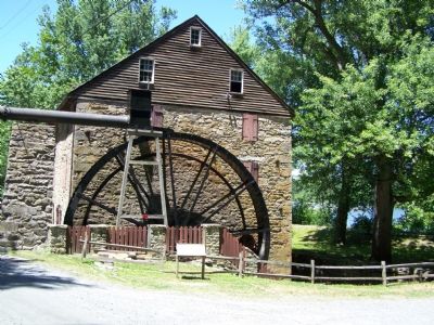
The building was restored by the State of Maryland in 1965. The huge water wheel, which drives the French-made mill stones, is an exact replica of the original. The water wheel turns from the weight of the water filling the buckets. Although it weighs twelve tons, the wheel is so finely balanced that less than two pounds of force will turn it.
During its operation the mill served as a center of activity for the community. Money was seldom exchanged between the local farmers—who brought their grain to be ground into meal—and the miller. Instead, the miller took a percentage of the processed grain, known as the “pottle.”
Another historic site of interest is the nearby Rock Run Manor House. This mansion was constructed in 1804 by John Carter. The mill and mansion are open for tours on summer weekend afternoons.
Erected by Peco Energy and the Lower Susquehanna Heritage Greenway.
Topics. This historical marker is listed in these topic lists: Industry & Commerce • Notable Buildings. A significant historical year for this entry is 1794.
Location. 39° 36.474′ N, 76° 8.532′ W. Marker is near Havre de Grace, Maryland, in Harford County. Marker is on Stafford Road south of Rock Run Road, on the left when traveling south. It is in Susquehannna State Park. Touch for map. Marker is in this post office area: Havre de Grace MD 21078, United States of America. Touch for directions.
Other nearby markers. At least 8 other markers are within walking distance of this marker. Rock Run Landing (about 300 feet away, measured in a direct line); Spring House (about 300 feet away); Toll House & Tidewater Canal (about 300 feet away); Explore Your Chesapeake (about 300 feet away); Carter-Archer House (about 400 feet away); Tollhouse and Covered Bridge at Rock Run (about 400 feet away); Miller's House (about 500 feet away); Rock Run (about 500 feet away). Touch for a list and map of all markers in Havre de Grace.
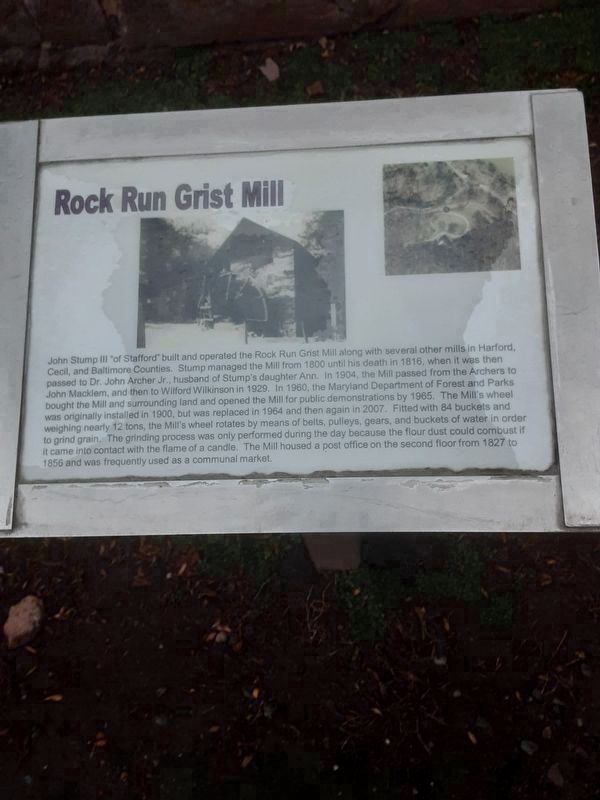
Regarding Rock Run Mill. The marker in photo 2 has this inscription:
John Stump II "of Stafford” built and operated the Rock Run Grist Mill along with several other mills in Harford,
Cecil, and Baltimore Counties. Stump managed the Mill from 1800 until his death in 1816, when it was then
passed to Dr. John Archer Jr., husband of Stump's daughter Ann. In 1904, the Mill passed from the Archers to
John Macklem, and then to Wilford Wilkinson in 1929. In 1960, the Maryland Department of Forest and Parks
bought the Mill and surrounding land and opened
the Mill for public demonstrations by 1965. The Mill's wheel
was originally installed in 1900, but was replaced in 1964 and then again in 2007. Fitted with 84 buckets and
weighing nearly 12 tons, the Mill's wheel rotates by means of belts, pulleys, gears, and buckets of water in order
to grind grain. The grinding process was only performed during the day because the flour dust could combust if
it came into contact with the flame of a candle. The Mill housed a post office on the second floor from 1827 to
1856 and was frequently used as a communal market.
Credits. This page was last revised on February 24, 2022. It was originally submitted on June 23, 2007, by Bill Pfingsten of Bel Air, Maryland. This page has been viewed 2,548 times since then and 80 times this year. Last updated on December 20, 2021, by Carl Gordon Moore Jr. of North East, Maryland. Photos: 1. submitted on June 23, 2007, by Bill Pfingsten of Bel Air, Maryland. 2. submitted on December 20, 2021, by Carl Gordon Moore Jr. of North East, Maryland. 3. submitted on December 22, 2021, by Carl Gordon Moore Jr. of North East, Maryland. 4. submitted on June 23, 2007, by Bill Pfingsten of Bel Air, Maryland. 5. submitted on June 27, 2007, by Bill Pfingsten of Bel Air, Maryland. 6. submitted on December 20, 2021, by Carl Gordon Moore Jr. of North East, Maryland.
