Dublin in Franklin County, Ohio — The American Midwest (Great Lakes)
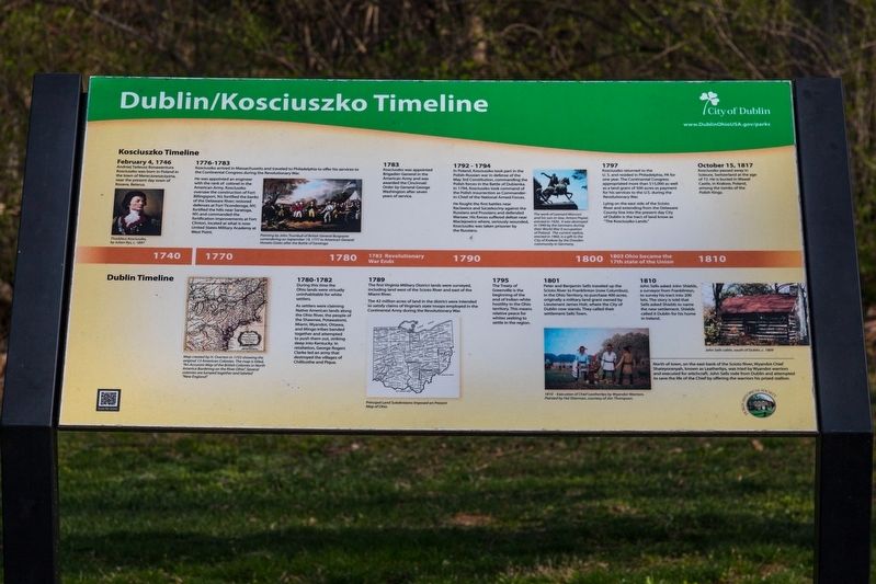
Dublin/Kosciuszko Timeline
Kościuszko Timeline
February 4, 1746. Andrzej Tadeusz Bonawentura Kościuszko was born in the town of Mereczowszczyzna, near the present-day town of Kosava, Belarus.
1776 – 1783. Kosciuszko arrived in Massachusetts and traveled to Philadelphia to offer his services to the Continental Congress during the Revolutionary War.
He was appointed an engineer with the rank of colonel in the American Army. Kosciuszko oversaw the construction of Fort Billingsport, NJ; fortified the banks of the Delaware River; restored defenses at Fort Ticonderoga, NY; fortified the hills near Saratoga, NY; and commanded the fortification improvements at Fort Clinton, located at what is now United States Military Academy at West Point.
1783. Kosciuszko was appointed Brigadier-General in the American Army and was awarded the Cincinnati Order by General George Washington after seven years of service.
1792 – 1794. In Poland, Kosciuszko took part in the Polish-Russian war in defense of the May 3rd Constitution, commanding the Polish forces in the Battle of Dubienka. In 1794, Kosciuszko took command of the Polish insurrection as Commander-in-Chief of the National Armed Forces.
He fought the first battles near Raclawice and Szczekociny against the Russians and Prussians and defended Warsaw. His forces suffered defeat near Maciejowice where, seriously wounded, Kosciuszko was taken prisoner by the Russians.
1797. Kosciuszko returned to the U. S. and resided in Philadelphia, PA for one year The Continental Congress appropriated more than $15.000 as well as a land grant of 500 acres as payment for his services to the U.S during the Revolutionary War,
Lying on the east side of the Scioto River and extending from the Delaware County line into the present day City of Dublin is the tract of land known as “The Kosciuszko Lands.”
October 15, 1817. Kosciuszko passed away in Soleure. Switzerland at the age of 72. He is buried in Wawel Castle, in Krakow, Poland, among the tombs of the Polish Kings.
Dublin Timeline
1780 – 1782/ During this time the Ohio lands were virtually uninhabitable for white settlers.
As settlers were claiming Native American lands along the Ohio River, the people of the Shawnee, Potawatomi, Miami, Wyandot, Ottawa, and Mingo tribes banded together and attempted to push them out, striking deep into Kentucky. In retaliation, George Rogers Clarke led an army
that destroyed the villages of Chillicothe and Piqua.
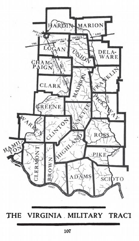
1789. The first Virginia Military District lands were surveyed, including land west of the Scioto River and east of the Miami River.
The 42 million acres of land in the district were intended to satisfy claims of Virginia's state troops employed in the Continental Army during the Revolutionary War.
1795. The Treaty of Greenville is the beginning of the end of Indian-white hostility in the Ohio territory. This means relative peace for whites seeking to settle in the region.
1801. Peter and Benjamin Sells traveled up the Scioto River to Franklinton (now Columbus), in the Ohio Territory, to purchase 400 acres, originally a military land grant owned by Lieutenant James Holt, where the City of Dublin now stands. They called their settlement Sells Town.
1810. John Sells asked John Shields, a surveyor from Franklinton, to survey his tract Into 200 lots. The story is told that Sells asked Shields to name the new settlement. Shields called it Dublin for his home in Ireland.
North of town, on the east bank of the Scioto River, Wyandot Chief Shateyoranyah, known as Leatherlips, was tried by Wyandot warriors and executed for witchcraft. John Sells rode from Dublin and attempted to save the life of the Chief by offering the warriors his prized
stallion.
Erected by City of Dublin and the Dublin Historical Society.
Topics. This historical marker is listed in these topic lists: Native Americans • Political Subdivisions • War, US Revolutionary. A significant historical date for this entry is February 4, 1746.
Location. 40° 7.3′ N, 83° 6.517′ W. Marker is in Dublin, Ohio, in Franklin County. Marker can be reached from the intersection of Hard Road and Riverside Drive (Ohio Route 257). It is in Thaddeus Kosciuszko Park, visible from the Hard Road parking lot. Touch for map. Marker is in this post office area: Dublin OH 43016, United States of America. Touch for directions.
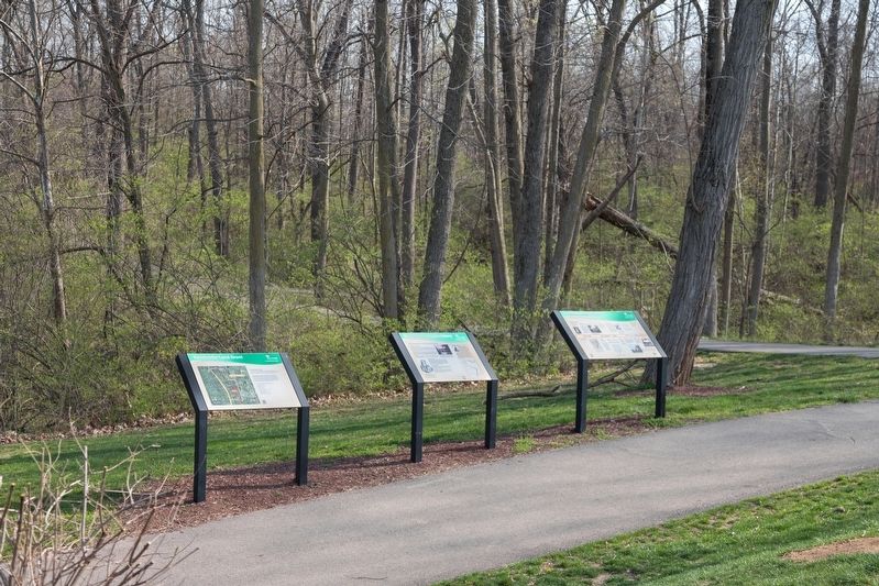
Other nearby markers. At least 8 other markers are within 2 miles of this marker, measured as the crow flies. Thaddeus Kosciuszko History (here, next to this marker); Kosciuszko Land Grant (here, next to this marker); Leatherlips (approx. 0.3 miles away); John I. and Bernice E. Thomas (approx. 0.9 miles away); a different marker also named Leatherlips (approx. 1.4 miles away); Dublin Veterans Park (approx. 1.4 miles away); Indian Run Cemetery (approx. 1.4 miles away); The Dublin Link (approx. 1.4 miles away). Touch for a list and map of all markers in Dublin.
More about this marker. This interpretive panel has seven illustrations captioned as follows:
- Thaddeus Kosciuszko, by Julian Rys, c.1897
- Painting by John Trumbull of British General Burgoyne surrendering on September 19, 1777 to American General Horatio Gates after the Battle of Saratoga
- The work of Leonard Marconi and his son-in-law, Anton Popiel erected on 1920 it was destroyed in 1940 by the Germans during their World War II occupation of Poland. The current replica, erected in 1960, is a gift to the City of Krakow by the Dresden community in Germany.
- Map created by H. Overton in 1755 showing the original 13 American Colonies. The map is titled, “An Accurate Map of the British Colonies in North America Bordering on the River Ohio.” Several colonies are lumped together and labeled “New England.”
- Principal Land Subdivisions Imposed on Present Map of Ohio.
- Execution of Chief Leatherlips by Wyondot Warriors. Painted by Hal Sherman, courtesy of Jim Thompson.
- John Sells cabin, south of Dublin, c. 1809.
Credits. This page was last revised on April 14, 2021. It was originally submitted on April 12, 2021, by J. J. Prats of Powell, Ohio. This page has been viewed 202 times since then and 24 times this year. Photos: 1, 2, 3, 4. submitted on April 12, 2021, by J. J. Prats of Powell, Ohio.


