Near Rapidan in Culpeper County, Virginia — The American South (Mid-Atlantic)
Battle of Cedar Mountain
The Battlefield Since 1862
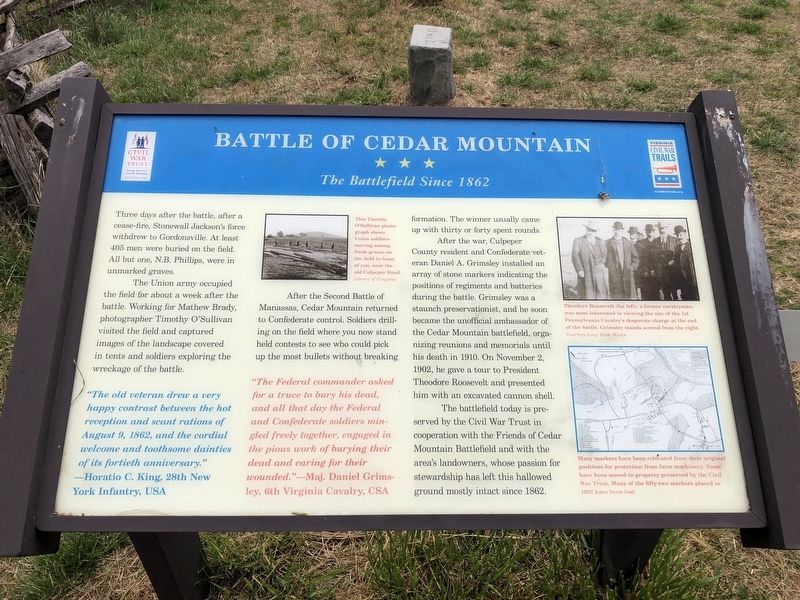
Three days after the battle, after cease-fire, Stonewall Jackson's force withdrew to Gordonsville. At least 405 men were buried on the field. All but one, N.B. Phillips, were in unmarked graves.
The Union army occupied the field for about a week after the battle. Working for Mathew Brady, photographer Timothy O'Sullivan visited the field and captured images of the landscape covered in tents and soldiers exploring the wreckage of the battle.
After the Second Battle of Manassas, Cedar Mountain returned to Confederate control. Soldiers drilling on the field where you now stand held contests to see who could pick up the most bullets without breaking formation. The winner usually came up with thirty or forty spent rounds.
After the war, Culpeper County resident and Confederate veteran Daniel A. Grimsley installed an array of stone markers indicating the positions of regiments and batteries during the battle. Grimsley was a staunch preservationist, and he soon became the unofficial ambassador of the Cedar Mountain battlefield, organizing reunions and memorials until his death in 1910. On November 2, 1902, he gave a tour to President Theodore Roosevelt and presented him with an excavated cannon shell.
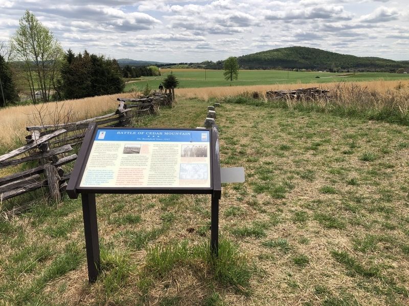
The battlefield today is preserved by the Civil War Trust in cooperation with the Friends of Cedar Mountain Battlefield and with the area's landowners, whose passion for stewardship has left this hallowed ground mostly intact since 1862.
"The old veteran drew a very happy contrast between the hot reception and scant rations of August 9, 1862 and the cordial welcome and toothsome dainties of its fortieth anniversary." — Horatio C. King, 28th New York Infantry, USA
"The Federal commander asked for a truce to bury his dead, and all that day the Federal and Confederate soldiers mingled freely together, engaged in the pious work of burying their dead and caring for their wounded." — Maj. Daniel Grimsley, 6th Virginia Cavalry, CSA
[Captions:]
This Timothy O'Sullivan photograph shows Union soldiers moving among fresh graves on the field in front of you, near the old Culpeper Road.
Theodore Roosevelt (far left), a former cavalryman, was most interested in viewing the site of the 1st Pennsylvania Cavalry's desperate charge at the end of the battle. Grimsley stands second from the right.
Many markers have been relocated from their original positions for protection from farm machinery. Some have been moved to property preserved by the Civil War Trust. Many of the fifty-two markers placed in 1902 have been lost.
Erected by
Topics and series. This historical marker is listed in these topic lists: Cemeteries & Burial Sites • Notable Events • War, US Civil. In addition, it is included in the Former U.S. Presidents: #26 Theodore Roosevelt, and the Virginia Civil War Trails series lists. A significant historical date for this entry is August 9, 1862.
Location. This marker has been replaced by another marker nearby. It was located near 38° 24.393′ N, 78° 3.906′ W. Marker was near Rapidan, Virginia, in Culpeper County. Marker could be reached from North James Madison Highway (Route 642) 0.1 miles north of North James Madison Highway (U.S. 15), on the left when traveling north. Marker is located at Stop 5 on the Cedar Mountain Battlefield Interpretive Trail. Touch for map. Marker was at or near this postal address: 10111 N James Madison Hwy, Culpeper VA 22701, United States of America. Touch for directions.
Other nearby markers. At least 8 other markers are within walking distance of this location. A different marker also named Battle of Cedar Mountain (here, next to this marker); a different marker also named Battle of Cedar Mountain (about 300 feet away, measured in a direct line); a different marker also named Battle of Cedar Mountain (about 300 feet away); Tenth Maine (about 500 feet away); a different marker also named Battle of Cedar Mountain (about 600 feet away); a different marker also named Battle of Cedar Mountain (about 700 feet away); a different marker also named Battle of Cedar Mountain (approx. 0.2 miles away); a different marker also named The Battle of Cedar Mountain (approx. 0.2 miles away). Touch for a list and map of all markers in Rapidan.
More about this marker. Marker is located at the intersection of the Main Interpretive Trail and the 10th Maine Trail.
Related marker. Click here for another marker that is related to this marker. New Marker At This Location also titled "Battle of Cedar Mountain".
Credits. This page was last revised on December 12, 2023. It was originally submitted on April 19, 2021, by Devry Becker Jones of Washington, District of Columbia. This page has been viewed 199 times since then and 22 times this year. Last updated on October 22, 2021, by Bradley Owen of Morgantown, West Virginia. Photos: 1, 2. submitted on April 19, 2021, by Devry Becker Jones of Washington, District of Columbia.

