Sheperdsville in Bullitt County, Kentucky — The American South (East South Central)
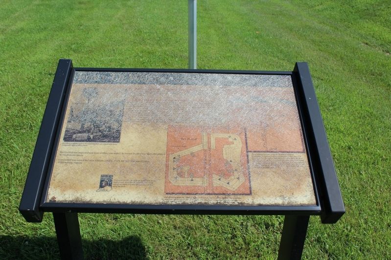
Fort DeWolf
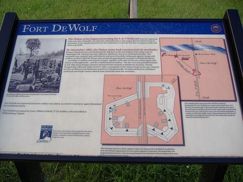
By December 1862, the Union army had constructed six stockades between Elizabethtown and Sheperdsville (Big Run trestle and Sulphur Fork trestle both on Muldraugh Hill, Lebanon Junction, Belmont, Bardstown Junction and Sheperdsville). The stockades were manned only with infantry and proved woefully inadequate against troops with artillery. In March 1863 the Union army proposed upgrading the stockade in Sheperdsville by “…erect[ing] an artillery and infantry parapet, together with a line of rifle pits connecting it with abattis or entanglements…and the establishment of artillery.” The fort was only partially finished in July 1863 when Morgan attacked and burned the stockade at Bardstown Junction. During Morgan’s July 1863 raid, Major Israel N. Stiles, commander of the Union troops in the area, ordered his men at Belmont and Bardstown Junction to Sheperdsville. He believed that his unfinished earthwork and single cannon offered more protection than the stockades.
Fort DeWolf was improved and more artillery was added, as a result it was never again threatened by Confederate forces.
Fort DeWolf was named for Lieut. William DeWolf, 3rd US Artillery, who was killed at Williamsburg, Virginia.
(captions)
According to official reports the completed fort was armed with three 12-pounder light artillery pieces.
The completed fort was across the Salt River south of Sheperdsville. Fort DeWolf was constructed so that the L&N literally passed through it. Between the fort and the river was a barracks and along the railroad a brick water tank. Constructed between the river and the fort was a line of inclined palisades, a wooden wall five feet high, made of sharpened posts. The line of palisades was designed to protect the barracks and to keep an attack from flanking the fort.
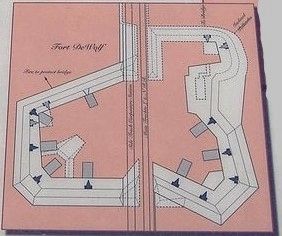
This drawing made by a Union engineer shows the layout of Fort DeWolf. The solid lines show how the fort appeared at the time of the engineer’s inspection. The dotted lines are proposed improvements. Later drawings found at the National Archives indicate that most of the improvements were made.
Erected by Kentucky Heartland Civil War Trails Commission. (Marker Number 35.)
Topics and series. This historical marker is listed in these topic lists: Forts and Castles • War, US Civil. In addition, it is included in the John Hunt Morgan Heritage Trail in Kentucky series list. A significant historical month for this entry is July 1863.
Location. 37° 59.023′ N, 85° 43.043′ W. Marker is unreadable. Marker is in Sheperdsville, Kentucky, in Bullitt County. Marker is at the intersection of Preston Highway (Kentucky Route 61) and Old Preston Highway South (Kentucky Route 480c), on the left when traveling north on Preston Highway. Marker is located in front of Maraman Billings Funeral Home. Touch for map. Marker is at or near this postal address: 605 Preston Highway, Shepherdsville KY 40165, United States of America. Touch for directions.
Other nearby markers. At least 8 other markers are within walking distance of this location. L & N Bridge - Civil War (here, next to this marker); Morgan - On To Ohio (here, next to this marker); The 1917 Train Wreck (approx. ¼ mile away); Adam Shepherd (approx. 0.3 miles away); County Named, 1796 (approx. 0.3 miles away); Bullitt County Veterans Memorial (approx. 0.3 miles away); Shepherdsville Pioneer Graveyard (approx. 0.3 miles away); Alma Wallace Lesch (approx. half a mile away).
Credits. This page was last revised on April 23, 2021. It was originally submitted on August 18, 2018, by Tom Bosse of Jefferson City, Tennessee. This page has been viewed 332 times since then and 26 times this year. Last updated on April 22, 2021, by Bradley Owen of Morgantown, West Virginia. Photos: 1, 2, 3, 4. submitted on August 18, 2018, by Tom Bosse of Jefferson City, Tennessee. • J. Makali Bruton was the editor who published this page.


