West Columbia in Brazoria County, Texas — The American South (West South Central)
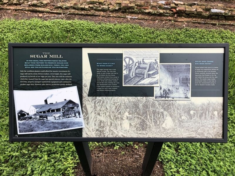
The Sugar Mill
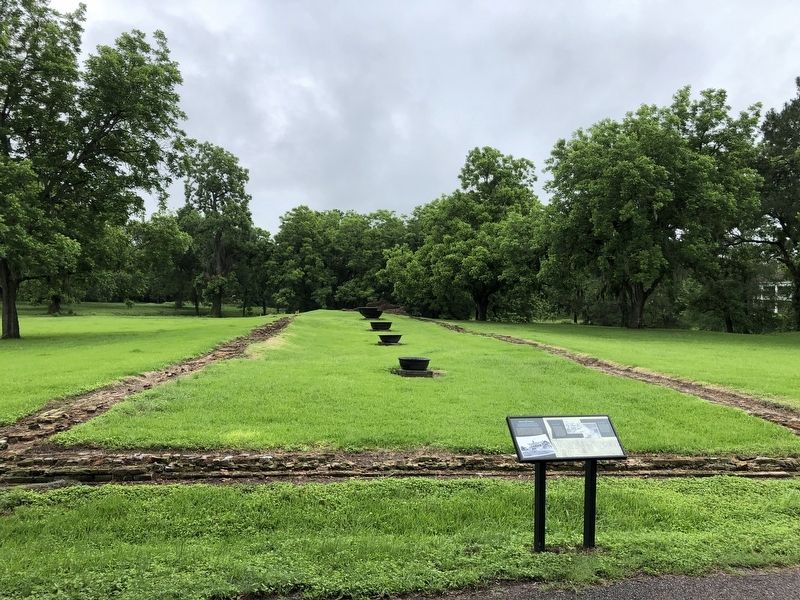
In the 1840s, the Patton family slaves built this factory to produce sugar and molasses from sugarcane. Today, you can still see the outline of its foundation.
Only the wealthiest planters could afford the massive investment of a sugar mill and its steam-driven crushers. At its height, this sugar mill produced 275 barrels of raw sugar per year. They also sold the molasses, which they drained from the sugar into special cisterns. Later, after the Civil War, property managers updated the equipment and continued to produce sugar here. However, after slavery, production quickly declined.
What Was It Like To Work Here?
The sugar harvest was a race against winter. The crop was ready in mid-October and had to be cut before the first freeze. Field slaves worked from sunup to sundown cutting and hauling the cane. At the Mill, slaves worked around the clock, feeding the cane into mechanized cane crushers. A few slaves worked as mechanics to keep the mill's cane crushers and boilers working properly.
What Are Those Big Iron Pots?
Slaves boiled cane juice in a series of large iron evaporation kettles set in brickwork over a hot furnace. Slaves carefully strained away the impurities that floated to the top and ladled the syrup into the next kettle. The master sugar maker determined when it was time to move the concentrated syrup to cool in shallow wooden tanks.
Topics. This historical marker is listed in these topic lists: African Americans • Agriculture • Industry & Commerce. A significant historical year for this entry is 1840.
Location. 29° 9.852′ N, 95° 38.297′ W. Marker is in West Columbia, Texas, in Brazoria County. Marker is on North 13th Street east of Hogg Ranch Road, on the right when traveling east. The marker is at the Varner-Hogg Plantation State Historic Site. Touch for map. Marker is in this post office area: West Columbia TX 77486, United States of America. Touch for directions.
Other nearby markers. At least 8 other markers are within 2 miles of this marker, measured as the crow flies. The Slave Quarters (about 400 feet away, measured in a direct line); Oil Field Row (approx. 0.2 miles away); Home of George B. McKinstry (approx. 1.1 miles away); Vietnam Veterans Memorial (approx. 1.4 miles away); Near Site of First Capitol of the Republic of Texas (approx. 1.4 miles away); Religion in the New Capital (approx. 1˝ miles away); From Republic to Statehood (approx. 1˝ miles away); Stephen Fuller Austin (approx. 1˝ miles away). Touch for a list and map of all markers in West Columbia.
Credits. This page was last revised on August 28, 2021. It was originally submitted on May 24, 2021, by Chris Kneupper of Brazoria, Texas. This page has been viewed 172 times since then and 13 times this year. Last updated on August 26, 2021, by Chris Kneupper of Brazoria, Texas. Photos: 1, 2. submitted on May 24, 2021, by Chris Kneupper of Brazoria, Texas. • J. Makali Bruton was the editor who published this page.

