Near Antwerp in Paulding County, Ohio — The American Midwest (Great Lakes)
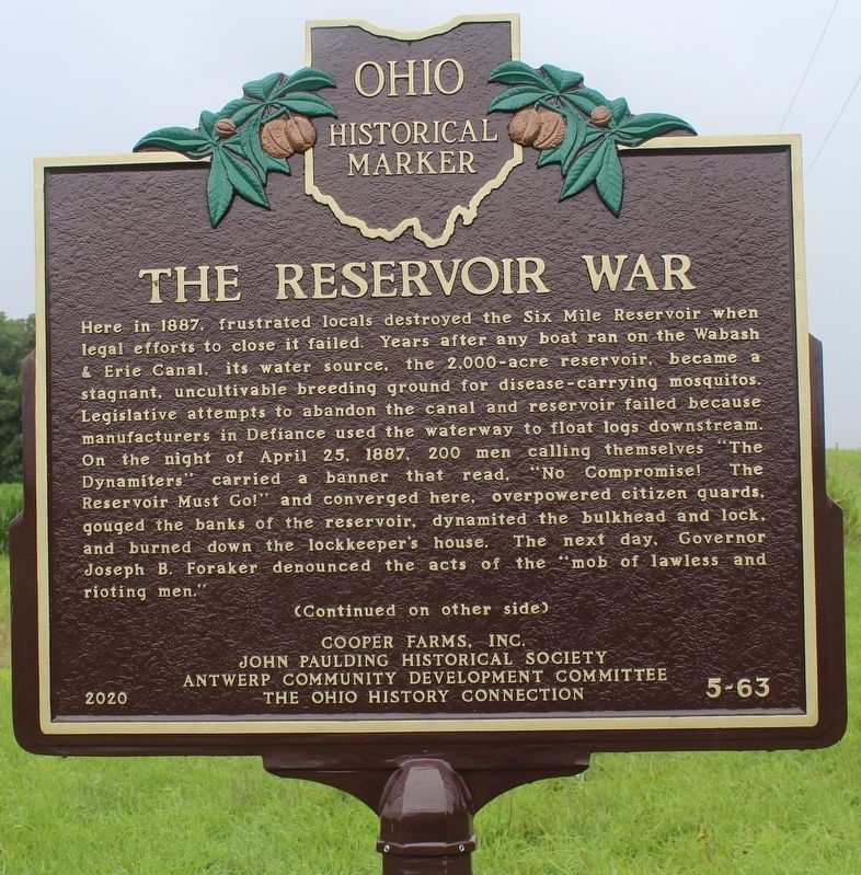
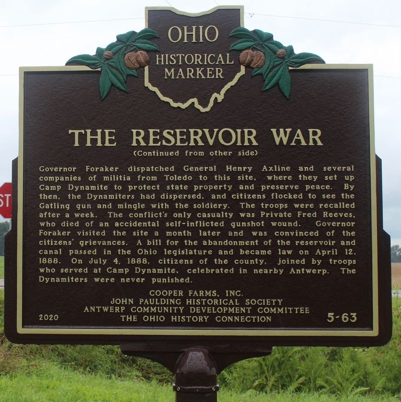
The Reservoir War
Here in 1887, frustrated locals destroyed the Six Mile Reservoir when legal efforts to close it failed. Years after any boat ran on the Wabash & Erie Canal, its water source, the 2,000-acre reservoir, became a stagnant, uncultivable breeding ground for disease-carrying mosquitos. Legislative attempts to abandon the canal and reservoir failed because manufacturers in Defiance used the waterway to float logs downstream. On the night of April 25, 1887, 200 men calling themselves "The Dynamiters" carried a banner that read, "No Compromise! The Reservoir Must Go!" and converged here, overpowered citizen guards, gouged the banks of the reservoir, dynamited the bulkhead and lock, and burned down the lockkeeper's house. The next day, Governor Joseph B. Foraker denounced the acts of the "mob of lawless and rioting men."
Governor Foraker dispatched General Henry Axline and several companies of militia from Toledo to this site, where they set up Camp Dynamite to protect state property and preserve peace. By then, the Dynamiters had dispersed, and citizens flocked to see the Gatling gun and mingle with the soldiery. The troops were recalled after a week. The conflict's only casualty was Private Fred Reeves, who died of an accidental self-inflicted gunshot wound. Governor Foraker visited the site a month later and was convinced of the citizens' grievances. A bill for the abandonment of the reservoir and canal passed in the Ohio legislature and became law on April 12, 1888. On July 4, 1888, citizens of the county, joined by troops who served at Camp Dynamite, celebrated in nearby Antwerp. The Dynamiters were never punished.
Erected 2020 by Cooper Farms, Inc., John Paulding Historical Society, Antwerp Community Development Committee, the Ohio History Connection. (Marker Number 5-63.)
Topics and series. This historical marker is listed in these topic lists: Industry & Commerce • Notable Events • Waterways & Vessels. In addition, it is included in the Ohio Historical Society / The Ohio History Connection series list. A significant historical date for this entry is April 25, 1887.
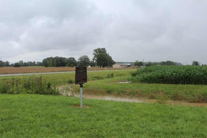
Location. 41° 11.515′ N, 84° 39.633′ W. Marker is near Antwerp, Ohio, in Paulding County. Marker is at the intersection of County Highway 180 and Local Road T77, on the left when traveling east on County Highway 180. Touch for map. Marker is at or near this postal address: 8404 Co Hwy 180, Antwerp OH 45813, United States of America. Touch for directions.
Other nearby markers. At least 8 other markers are within 4 miles of this marker, measured as the crow flies. Forder Bridge (approx. 2.2 miles away); Antwerp's Korean War Era - Vietnam Era Veterans Memorial (approx. 4 miles away); All Gave Some ★ Some Gave All (approx. 4 miles away); Antwerp's World War I Era Veterans Memorial (approx. 4 miles away); Antwerp's World War II Era - Korean War Era Veterans Memorial (approx. 4 miles away); Antwerp's World War I Era - World War II Era Veterans Memorial (approx. 4 miles away); Antwerp's World War II Era Veterans Memorial (approx. 4 miles away); Antwerp's Vietnam Era Veterans Memorial (approx. 4 miles away). Touch for a list and map of all markers in Antwerp.
Also see . . . ‘No Compromise!’ The Canal and the Reservoir War. West Bend News website entry:
On the night of April 25, 1887, 200 to 400 men, armed with pick-axes, shovels and dynamite, and carrying a banner that read, “No Compromise” on one side, and “The Reservoir Must Go” on the other, descended on the Six Mile Reservoir and the two locks to the east—one at Tate’s Landing, and the other west of Junction. The men overpowered the guards, and at the appointed hour of midnight, dynamited the banks of the reservoir and the locks.(Submitted on July 17, 2021, by Robert Baughman of Bellefontaine, Ohio.)
Water rushed out of the reservoir and through the canal all the way to the city of Defiance, where Flickinger and other outraged businessmen, upon hearing the news the next morning, sent telegrams to Ohio Governor John Foraker declaring that a lawless mob had destroyed state property, and urged him to take action.
Credits. This page was last revised on June 21, 2023. It was originally submitted on July 17, 2021, by Robert Baughman of Bellefontaine, Ohio. This page has been viewed 501 times since then and 74 times this year. Last updated on June 7, 2023, by Grant & Mary Ann Fish of Galloway, Ohio. Photos: 1, 2, 3. submitted on July 17, 2021, by Robert Baughman of Bellefontaine, Ohio. • Devry Becker Jones was the editor who published this page.


