New Madrid in New Madrid County, Missouri — The American Midwest (Upper Plains)
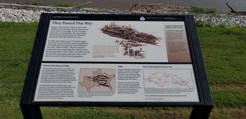
They Passed This Way
They Passed This Way
Home to thousands of men, women, and children, the Cherokee Nation once spread across parts of Georgia, North Carolina, Tennessee and Alabama. The 1830 Indian Removal Act required that the Cherokee surrender their land and move west.
In 1838, more than 15,000 Cherokee began their trek west from their eastern homeland to Indian Territory (present-day Oklahoma) over the "Trail of Tears." They traveled by roads and rivers, including this stretch of the Mississippi River. More than 1,000 died during the journey westward, and more 4,000 died as a result of their forced migration.
I have no more land. I am driven
away from home, driven up the
red waters, let us all go, let us
die together and somewhere upon
the banks we will be there.
From Sin-e-cha's Song, heard on removal boats along the Trail of Tears.
Federal Indian Removal Policy
Federal Indian removal policy aroused fierce and bitter debate. Supporters of the policy claimed it was a benevolent action to save the tribes east of the Mississippi River from being overwhelmed and lost in the onslaught of an expanding American population. Opponents decried its inhumanity and the tragic consequences it had for the Indian peoples. One thing was certain; removal freed millions of acres of desired Indian lands for use by white settlers.
The Indian Removal Act of 1830 resulted in the removal of thousands of American Indians from their ancestral lands for new homes in Indian Territory (present-day Oklahoma). They traveled by existing roads and rivers. Many groups left in the fall, hoping to avoid the disease and heat of summer travel, and instead faced treacherous winter weather. Many died during the ordeal of the Trail of Tears.
Today
Despite the hardships of the journey, members of the five removed tribes established new lives in the West. They stand as successful sovereign nations, proudly preserving cultural traditions, while adapting to the challenges of the 21st century.
Cherokee who survived the Trail of Tears created a new sovereign nation in present-day Oklahoma. Some Cherokee remained in North Carolina and, due to a special exemption, formed the Eastern Band of Cherokee Indians.
Dangers of Water Travel along the Trail of Tears
Few groups of Cherokee traveled by water. After hearing of the difficulties faced by military-led groups that had traveled by the water route, Cherokee leaders petitioned for permission to manage the removal of their own people.
They decided to remove over land routes to avoid the dangers of travel by boat, including the quick spread of sickness onboard, fear of disease along the river lowlands, and unpredictable water levels and weather patterns.
Trail of Tears National Historic Trail
By helping to preserve historic sites and trail segments, and developing areas for public use, the story of the forced removal of the Cherokee people and other American Indian tribes is remembered and told by the National Park Service and its partners.
You can visit more sites along the Trail of Tears National Historic Trail.
Learn more at www.nps.gov/trte
Erected by New Madrid and the Trail of Tears; National Park Service, U.S. Department of the Interior; Trail of Tears Association.
Topics and series. This historical marker is listed in these topic lists: Native Americans • Roads & Vehicles. In addition, it is included in the Trail of Tears series list. A significant historical year for this entry is 1830.
Location. 36° 35.009′ N, 89° 31.732′ W. Marker is in New Madrid, Missouri, in New Madrid County. Marker is on Levee Road near Church Street, on the right when traveling east. Touch for map. Marker is in this post office area: New Madrid MO 63869, United States of America. Touch for directions.
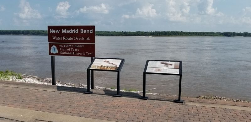
Other nearby markers. At least 8 other markers are within walking distance of this marker. Water Route to Indian Territory (here, next to this marker); New Madrid (about 600 feet away, measured in a direct line); Fort Bankhead (about 600 feet away); Bissell's Submergible Saw (about 600 feet away); New Madrid & Island No. Ten (about 600 feet away); Battle of Island No. 10 (about 600 feet away); Higgerson School (approx. 0.2 miles away); The King's Road (approx. 0.2 miles away). Touch for a list and map of all markers in New Madrid.
More about this marker. Located atop the levee, and the terminus of Church Street
Additional keywords. forced removal
Credits. This page was last revised on December 31, 2022. It was originally submitted on August 1, 2021, by Cajun Scrambler of Assumption, Louisiana. This page has been viewed 228 times since then and 33 times this year. Last updated on December 30, 2022, by Carl Gordon Moore Jr. of North East, Maryland. Photos: 1, 2. submitted on August 1, 2021, by Cajun Scrambler of Assumption, Louisiana. • Devry Becker Jones was the editor who published this page.

