Charleston in Kanawha County, West Virginia — The American South (Appalachia)
Charleston Trails / Illustrated History of the Midland Trail
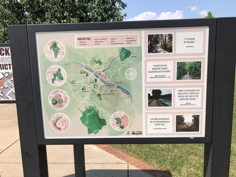
Charleston Trails
"It is solved by walking."
- Latin proverb
"A taste for the beautiful is most cultivated out of doors."
- Henry David Thoreau
American writer & naturalist, 1817 - 1862
"Come to the woods, for here is rest. There is no repose like that of the green deep woods."
- John Muir
American naturalist, 1838 - 1914
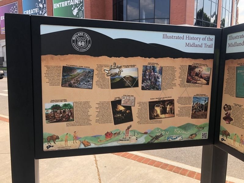
Illustrated History of the Midland Trail
First Inhabitants ≈ 8,000 - 6,000 BC
Evidence that nomadic Early Archaic people inhabited the Kanawha Valley was discovered in excavations on the banks of the Great Kanawha River at St. Albans in 1964-68. Archaeologists unearthed about 1,100 flint projectile points, knives, hoes, drills, scrapers, hammer stones and anvils, which have been radiocarbon dated to 8,200-8,930 BC.
Adena Moundbuilders ≈ 500 BC - 150 AD
The Adena lived here in farmsteads, cultivated sunflowers, had a social hierarchy, built 50+ burial mounds and had extensive trade networks, as evidenced by the elaborate burial tomb, 13 skeletons and prehistoric artifacts made from Gulf Coast shell and Great Lakes copper found in the 1883 Smithsonian excavation of the South Charleston Mound.
Early Settlement 17th Century - 1774
Great buffalo herds and nomadic natives blazed this east-west path across the Appalachians for the pioneers who followed. In 1755 about 50 European families lived in the Greenbrier Valley, but few westward due to Indian hostilities. That year Shawnee captive Mary Draper Ingles (Follow the River) escaped using the path in her courageous 500-mile return home. By 1774 Greenbrier Valley had grown to 300 families, and the Morris family built the Kanawha Valley's first permanent settlement at present day Cedar Grove.
First Official Mid-Land Trail
George Washington 1770 - 1790
For his service in the French and Indian War, George Washington was awarded land in the Ohio and Kanawha Valleys. At his death in 1799 he owned 60,000+ acres. In 1784 Washington garnered funding from the Virginia Assembly to clear a Mid-Land Route from the Atlantic Ocean to Cedar Grove where the Kanawha River could be navigated to the Ohio and then Mississippi Rivers.
Cedar Grove Launches River Travel 1790 - 1824
Midland Trail's completion in 1790 brought a steady flow of goods and settlers across Virginia to Cedar Grove where the journey westward switched to boat. Kanawha Valley's 1st settlement flourished as a hub for the shipping trade, manufacturing flatboats, barrels and soon the salt business. Kanawha flat boaters became world-renowned

Photographed By Devry Becker Jones (CC0), July 30, 2021
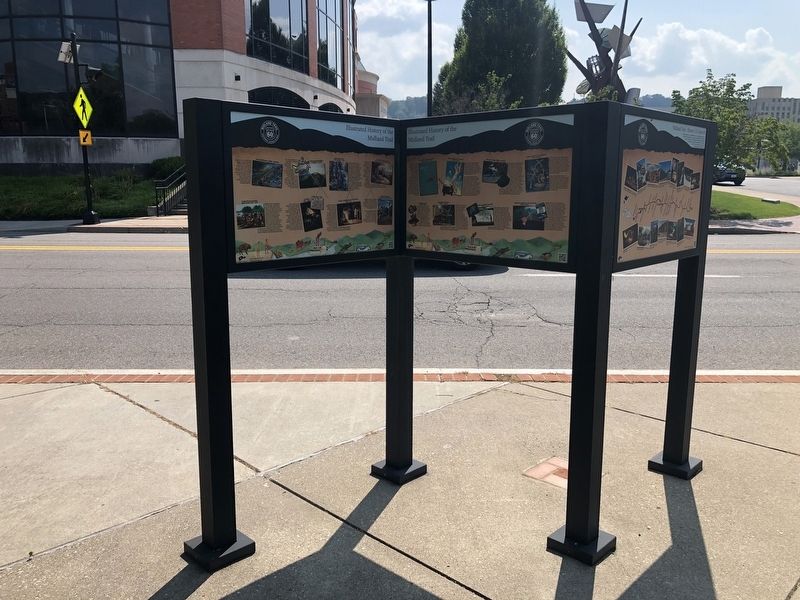
2. Illustrated History of the Midland Trail side of the marker
Civil War 1861 - 1865 / A New State 1863
The Civil War turned neighbor against neighbor in this region, as several important battles were fought all along the Midland Trail. Gauley Bridge, gateway to Kanawha Valley and originally with the South was taken and retaken 3 times and its bridge burned twice, last by retreating Confederate soldiers in 1862. By 1863 Union sympathies had grown so strong in western Virginia that it seceded from confederate Virginia and was re-admitted to the Union as the new state of West Virginia.
Booker T. Washington Up From Slavery
1856 - 1915
In 1865 nine-year old Booker T. Washington walked 200+ miles with his newly freed family from the Burroughs Plantation in Virginia to Malden, WV, where he learned to read and nourished his burning desire for an education. Part of the last generation born into slavery, Booker became a renowned educator, author, orator, and advisor to US president. His autobiography Up From Slavery is #3 on NY Times list of Top 100 Books Written in 20th Century. Visit his boyhood home in Malden.
Collis P. Huntington
C&O Railroad 1871 -

Photographed By Devry Becker Jones (CC0), July 30, 2021
3. Charleston Trails / Illustrated History of the Midland Trail Marker
Industrialist Collis P. Huntington brought the C&O Railroad from Richmond, VA along the New and Kanawha Rivers thru the Kanawha Valley to the Ohio River, where he established the planned city of Huntington, WV, in 1871.
Next he expanded the eastern end from Richmond to the Atlantic Ocean at Newport News in 1881-2, facilitating the development of coal resources on the New and Gauley Rivers. Passenger trains soon replaced stage coaches. By 1883 the Kanawha Valley was WV's largest coal-producing area.
Erected by Charleston Area Alliance; The West Virginia Center for African American Art & Culture, Inc. & The Northside Historic Community Group; America's Byways; Midland Trail Scenic Highway Association, Inc.
Topics. This historical marker is listed in these topic lists: African Americans • Anthropology & Archaeology • Native Americans • War, US Civil. A significant historical year for this entry is 1817.
Location. 38° 20.925′ N, 81° 37.752′ W. Marker is in Charleston, West Virginia, in Kanawha County. Marker is on Washington Street East (U.S. 60) just west of Sentz Street, on the right when traveling west. Touch for map. Marker is at or near this postal address: 1108 Washington St E, Charleston WV 25301, United States of America. Touch for directions.
Other nearby markers. At least 8 other markers are within walking distance of this marker. Mary Price Ratrie Greenspace / Illustrated History of the Midland Trail (here, next to this marker); The Block Historic District / Midland Trail (here, next to this marker); Mary Price Ratrie Greenspace (within shouting distance of this marker); The Block (about 600 feet away, measured in a direct line); Garnet High School (approx. 0.2 miles away); World War I Memorial (approx. 0.2 miles away); Saint John's Episcopal Church (approx. 0.2 miles away); Mattie V. Lee Home, Inc. (approx. 0.2 miles away). Touch for a list and map of all markers in Charleston.
Credits. This page was last revised on February 23, 2024. It was originally submitted on August 2, 2021, by Devry Becker Jones of Washington, District of Columbia. This page has been viewed 209 times since then and 19 times this year. Last updated on February 10, 2024, by Carl Gordon Moore Jr. of North East, Maryland. Photos: 1, 2, 3. submitted on August 2, 2021, by Devry Becker Jones of Washington, District of Columbia. • J. Makali Bruton was the editor who published this page.
