Near Burgess in Dinwiddie County, Virginia — The American South (Mid-Atlantic)
The Battle of Hatcher’s Run
To Cut the Remaining Supply Lines, February 5-7, 1865
Inscription.
By early 1865 the Federal army’s two remaining objectives along the Petersburg front were the Boydton Plank Road, an intermediate wagon supply route into the city, and the South Side Railroad, a major transportation artery from Lynchburg and the Shenandoah Valley. Union forces had already cut the Weldon Railroad as far south as Hicksford (now Emporia), forcing the Confederates to unload supplies at the station there, load them on wagons, and haul them cross-country through the Meherrin River valley to the plank road. This route took them through Dinwiddie Court House on their way to Petersburg.
On February 5, in the seventh offensive movement of the Union siege of Petersburg, Federal commander Ulysses S. Grant sent Brigadier General David McMurtrie Gregg’s cavalry division, supported by Major General Andrew A. Humphreys’ Second Corps and Major General Gouverneur K. Warren’s Fifth Corps, toward Dinwiddie Court House to cut the Confederate supply line. Upon reaching the Hatcher’s Run area, Humphreys took position north of the stream at the Vaughan Road crossing and Armstrong’s Mill. His corps would guard the rest of the army from this location.
Humphreys’ men began entrenching across a small creek known as Rocky Branch. Meanwhile, Confederate Brigadier General Henry Heth’s division, supported on the right by Brigadier General Clement Evans’ division of Major General John B. Gordon’s Second Corps, prepared to attack.
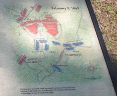
Beginning about 3:45 p.m. and lasting more than an hour, the Confederates made three unsuccessful assaults on Humphrey’s line. Though unable to break the Federals, the Southerners continued with sporadic artillery fire until dark.
With Humphrey’s corps hold the Southerners at Hatcher’s Run, Gregg’s cavalry was able to reach the Boydton Plank Road. The Federal horsemen captured fewer than two-dozen wagons before being ordered back to the Vaughan Road with Warren’s troops. The plank road having been scouted, Grant now gave the order to push on for the South Side Railroad. He also sent reinforcements from the Sixth and Ninth Corps to strengthen Humphreys’ position.
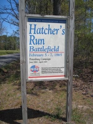
Erected by Civil War Preservation Trust.
Topics. This historical marker is listed in this topic list: War, US Civil. A significant historical month for this entry is February 1861.
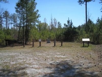
Location. 37° 7.484′ N, 77° 29.812′ W. Marker is near Burgess, Virginia, in Dinwiddie County. Marker is on Dabney Mill Road (Virginia Route 613), on the right when traveling east. Located in the 50 acre Hatcher's Run Battlefield preservation tract. Touch for map. Marker is in this post office area: Burgess VA 22432, United States of America. Touch for directions.
Other nearby markers. At least 8 other markers are within 2 miles of this marker, measured as the crow flies. Brigadier General John Pegram (a few steps
from this marker); a different marker also named The Battle of Hatcher’s Run (a few steps from this marker); a different marker also named Battle of Hatcher’s Run (a few steps from this marker); Hatcher's Run Battlefields (approx. 1.4 miles away); a different marker also named Hatcher's Run Battlefields (approx. 1.4 miles away); a different marker also named Hatcher's Run Battlefields (approx. 1½ miles away); a different marker also named Hatcher's Run Battlefields (approx. 1.7 miles away); Quaker Road Engagement (approx. 1.7 miles away). Touch for a list and map of all markers in Burgess.
More about this marker. The bottom left of the marker features a photo of Gen. Gregg with the caption Union General David McMurtrie Gregg commanded the Army of the Potomac’s 2nd Division of Cavalry at Petersburg. Gregg resigned his commission on February 3, 1865, and his resignation was officially accepted on the 9th.
The upper center of the marker has a photo of Gen. Heth, with the caption Confederate General Henry Heth began his war service as a colonel of the 45th Virginia before becoming a general in 1862. He fought at Chancellorsville and was responsible for opening the Battle of Gettysburg where he was wounded. At Petersburg his division served in General A.P. Hill’s Third Corps.
The right of the marker contains a map of the February 5, 1865 battle, with the caption Confederates launched three unsuccessful attacks on the Union lines between 3:45 and 5 p.m. on February 5. The Confederates fell back to the safety of their trenches that night.
Regarding The Battle of Hatcher’s Run. The marker was placed by the Civil War Preservation Trust, and displays their slogan, Help Preserve Battlefields, call CWPT at 1-888-606-1400. At the bottom of the marker is a disclaimer, This material is based upon work assisted by a grant from the Department of the Interior, National Park Service. Any applications, findings and conclusions or recommendations expressed in this material are those of the author(s) and do not necessarily reflect the views of the Department of the Interior.
Also see . . .
1. Hatcher’s Run. American Battlefield Trust (Submitted on March 23, 2008, by Bill Coughlin of Woodland Park, New Jersey.)
2. The Battle of Hatcher’s Run (or Dabney’s Mill): February 5-7, 1865. The Siege of Petersburg Online website entry (Submitted on December 21, 2008.)
Credits. This page was last revised on January 22, 2024. It was originally submitted on March 23, 2008, by Bill Coughlin of Woodland Park, New Jersey. This page has been viewed 5,292 times since then and 42 times this year. Last updated on August 29, 2021, by Bradley Owen of Morgantown, West Virginia. Photos: 1, 2, 3, 4. submitted on March 23, 2008, by Bill Coughlin of Woodland Park, New Jersey. • Bernard Fisher was the editor who published this page.


