Estell Manor in Atlantic County, New Jersey — The American Northeast (Mid-Atlantic)
Introduction
Bethlehem Loading Country History Trail
— N 39° 23.932, W 74° 44.450 —
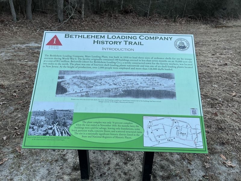
The Bethlehem Loading Company, Mays Landing Plant, was built in 1918 to load three sizes of ordnance shells for use by troops overseas during World War I. The facility originally contained 199 buildings erected in less than seven months on an 18,000-acre site at a cost of $12 million. Belcoville (short for Bethlehem Loading Co.), a newly constructed town for the factory workers, was located two miles to the north. The plant was one of fourteen shell-loading plants nationwide and was one of six shell-loading plants located in New Jersey. At the height of production, over 2,000 people were employed and more than 134,000 shells loaded.
The plant complex was only 70 percent complete when the war ended in November 1918. Six months later, the buildings were sold for salvage, leaving only foundations, some brick partition walls, concrete floors, and scattered structural ruins. The site is a nationally significant historic district listed in the State and National Registers of Historic Places.
[Captions:]
Drawn circa 1919, this aerial view shows the entire shell-loading complex as it would have looked if all the buildings had been erected. (Images courtesy of the Hagley Museum and Library)
Much of the land on which the loading plant was built had to be cleared before construction could begin.
Erected by Atlantic County, New Jersey. (Marker Number 1.)
Topics. This historical marker is listed in this topic list: War, World I. A significant historical month for this entry is November 1918.
Location. 39° 23.922′ N, 74° 44.44′ W. Marker is in Estell Manor, New Jersey, in Atlantic County. Marker can be reached from Atlantic County Park, 0.3 miles east of New Jersey Route 50, on the right when traveling east. Touch for map. Marker is at or near this postal address: 109 NJ-50, Mays Landing NJ 08330, United States of America. Touch for directions.
Other nearby markers. At least 8 other markers are within walking distance of this marker. Welcome to Atlantic County Park at Estell Manor! (about 500 feet away, measured in a direct line); Ginkgo (about 500 feet away); 8-inch Finishing Building (approx. ¼ mile away); Belcoville 1917 (approx. ¼ mile away); 8-Inch Pouring Building (approx. 0.3 miles away); The Estellville Methodist Church (approx. 0.4 miles away); 8-Inch Plant Receiving Building (approx. 0.4 miles away); The Daniel Estell House (approx. half a mile away). Touch for a list and map of all markers in Estell Manor.
Credits. This page was last revised on January 6, 2023. It was originally submitted on January 23, 2022, by Devry Becker Jones of Washington, District of Columbia. This page has been viewed 83 times since then and 17 times this year. Last updated on January 4, 2023, by Carl Gordon Moore Jr. of North East, Maryland. Photos: 1, 2. submitted on January 23, 2022, by Devry Becker Jones of Washington, District of Columbia. • Michael Herrick was the editor who published this page.

