Port Colborne in Niagara Region, Ontario — Central Canada (North America)
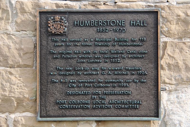
Humberstone Hall
1852 – 1970
The original hall with its local Welland Canal stone and Palladian windows was designed by architect John Latshaw in 1852.
The rear Lock-up wing for wayward travellers was designed by architect G. A. Mitchell in 1906.
The hall was renovated for community use by the City of Port Colborne in 1981.
by the
Port Colborne Local Architectural
Conservation Advisory Committee
Topics. This historical marker is listed in this topic list: Notable Buildings. A significant historical year for this entry is 1852.
Location. 42° 54.056′ N, 79° 14.873′ W. Marker is in Port Colborne, Ontario, in Niagara Region. Marker is at the intersection of Main Street West (Highway 3) and Highway 3A, on the right when traveling east on Main Street West. Touch for map. Marker is at or near this postal address: 76 Main St W, Port Colborne ON L3K 3V2, Canada. Touch for directions.
Other nearby markers. At least 8 other markers are within 24 kilometers of this marker, measured as the crow flies. The Welland Canal (approx. 1.6 kilometers away); Main Street Bridge (Bridge 13)/Pont de la Rue Main (Pont 13) (approx. 10.1 kilometers away); Welland County Court House (approx. 10.2 kilometers away); Battle of Cook's Mill (approx. 12.3 kilometers away); Capture of the "Somers" and "Ohio" (approx. 15.7 kilometers away); The Old Welland Canal (approx. 19.8 kilometers away); To the Memory of the Pioneers (approx. 23.3 kilometers away); Charles Green (approx. 23.3 kilometers away).
Also see . . . Humberstone Township Hall. Canadian Register of Historic Places entry on the building. (Submitted on April 23, 2022, by Duane and Tracy Marsteller of Murfreesboro, Tennessee.)

cmh2315fl via Flickr (CC BY-NC 2.0), July 28, 2017
2. Humberstone Hall Marker
The building is now a visitor centre.
Credits. This page was last revised on April 23, 2022. It was originally submitted on April 23, 2022, by Duane and Tracy Marsteller of Murfreesboro, Tennessee. This page has been viewed 94 times since then and 17 times this year. Photos: 1, 2. submitted on April 23, 2022, by Duane and Tracy Marsteller of Murfreesboro, Tennessee.
