Near Burkittsville in Frederick County, Maryland — The American Northeast (Mid-Atlantic)
Burkittsville: Henry Burkitt’s Town
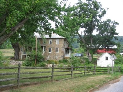
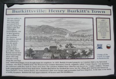
The first settlers in this area cleared their farm land and raised their families along two Indian trails that crossed here. Joshua Harley, one of these pioneers and a veteran of the American Revolution, started the settlement’s first dry goods store. In 1824 Harley’s store became Harley’s post office. Henry Burkitt moved here from Pennsylvania about 1825 and laid out a town along the east-west trail, subdividing larger tracts bought from his neighbors. In 1829, Burkitt donated property on Cemetery Hill to the Reformed Germans, who built a church on it. The Resurrection German Reformed Church, originally called “Union Church,” was shared by the Lutherans until they built St. Paul’s next door. The cemetery behind these churches was known as “Union Cemetery,” because both congregations buried their dead there. Burkitt died before he finished his town, but the village grew and became known as Henry Burkitt’s Town. Joshua Harley, the community’s first store keeper and postmaster had been forgotten. At the time of the Battle of South Mountain, Burkittsville had approximately 50 houses and 200 inhabitants.
Donated to the people of the United States in loving memory of our daughter-in-law, sister-in-law, wife, and mother, Bridget Towne Riedel by her family--the Riedels of Virginia.
(caption)
Charge of the Union VI Corps at Burkittsville
Erected by Blue and Gray Education Society.
Topics. This historical marker is listed in these topic lists: Settlements & Settlers • War, US Civil. A significant historical year for this entry is 1824.
Location. 39° 24.087′ N, 77° 38.27′ W. Marker is near Burkittsville, Maryland, in Frederick County. Marker is on Gapland Road, on the right when traveling south. Touch for map. Marker is in this post office area: Burkittsville MD 21718, United States of America. Touch for directions.
Other nearby markers. At least 8 other markers are within walking distance of this marker. “Sealed With Their Lives” (here, next to this marker); Chew’s Ashby Artillery (here, next to this marker); Gath's Empty Tomb (approx. ¼ mile away); Mausoleum (approx. ¼ mile away); The Confusion of Battle (approx. ¼ mile away); The 15th North Carolina (approx. ¼ mile away); Brownsville Pass: Semmes’ Gamble (approx. ¼ mile away); GATH: The Man and His Mountain (approx. ¼ mile away). Touch for a list and map of all markers in Burkittsville.
Also see . . .
1. Our History - Burkittsville, MD. Town website homepage (Submitted on August 12, 2007.)
2. Burkittsville Preservation Association. Association website homepage (Submitted on January 15, 2022.)
Additional commentary.
1. Interesting Coincidence
Just South of the Lutheran Church stands the Dr. Tilghman Biser House. At the time of the Battle on Crampton’s Gap, the doctor’s nephew, Lewis Lamar was studying medicine at the house. Lewis was distantly related to John B. and Jefferson M. Lamar, both of whom were members of Cobb’s Georgia Brigade and both died of wounds in the fighting.
— Submitted August 12, 2007, by Craig Swain of Leesburg, Virginia.

Photographed By Craig Swain, August 5, 2007
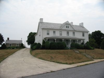
4. David Arnold House and Farm
The Arnold family homestead sits between the two Indian paths. The original portions of this house were built in 1798 and major additions to the house were made in the later half of the 1800s. During the Battle of South Mountain, the Vermont Brigade deployed around this house to attack the Confederate battle line further up hill.
Credits. This page was last revised on August 7, 2022. It was originally submitted on August 12, 2007, by Craig Swain of Leesburg, Virginia. This page has been viewed 3,346 times since then and 22 times this year. Last updated on January 12, 2022, by Bradley Owen of Morgantown, West Virginia. Photos: 1, 2, 3, 4. submitted on August 12, 2007, by Craig Swain of Leesburg, Virginia. • Bernard Fisher was the editor who published this page.


