Cobalt in Timiskaming District, Ontario — Central Canada (North America)
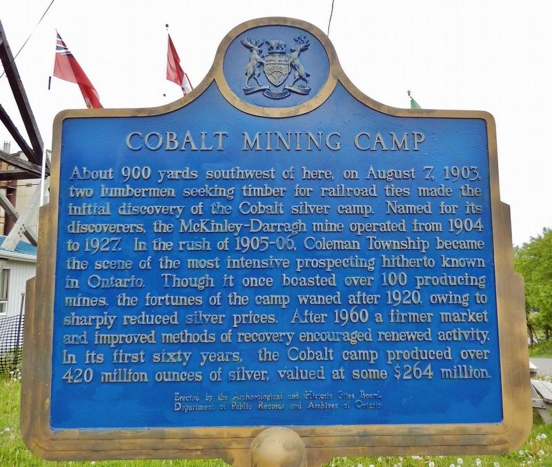
Cobalt Mining Camp
About 900 yards southwest of here, on August 7, 1903, two lumbermen seeking timber for railroad ties made the initial discovery of the Cobalt silver camp. Named for its discoverers, the McKinley-Darragh mine operated from 1904 to 1927. In the rush of 1905-06, Coleman Township became the scene of the most intensive prospecting hitherto known in Ontario. Though it once boasted over 100 producing mines, the fortunes of the camp waned after 1920, owing to sharply reduced silver prices. After 1960 a firmer market and improved methods of recovery encouraged renewed activity. In its first sixty years, the Cobalt camp produced over 420 million ounces of silver, valued at some $264 million.
Erected by Archaeological and Historic Sites Board, Department of Public Records and Archives of Ontario.
Topics and series. This historical marker is listed in these topic lists: Industry & Commerce • Settlements & Settlers. In addition, it is included in the Canada, Ontario Heritage Foundation series list. A significant historical date for this entry is August 7, 1903.
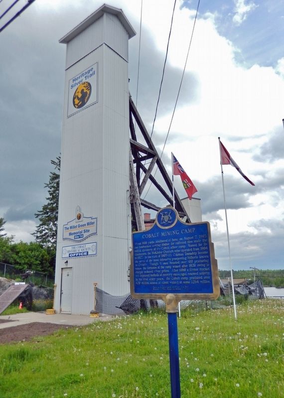
Location. 47° 23.722′ N, 79° 41.137′ W. Marker is in Cobalt, Ontario, in Timiskaming District. Marker is at the intersection of Silver Street and Bunker Lane, on the right when traveling north on Silver Street. Marker is located in front of the Pan Silver Headframe and directly across the street from the Cobalt Mining Museum. Touch for map. Marker is at or near this postal address: 21 Silver Street, Cobalt ON P0J 1C0, Canada. Touch for directions.
Other nearby markers. At least 8 other markers are within 8 kilometers of this marker, measured as the crow flies. Silver Mining in Canada / Production de L'argent au Canada (here, next to this marker); Cobalt Mining / L’exploitation Minière de Cobalt (a few steps from this marker); The Cobalt Town Hall / L'hôtel-de-ville de Cobalt (within shouting distance of this marker); William Henry Drummond (approx. 0.3 kilometers away); Townsite #1 Shaft / Le puits n°1 de la mine Townsite (approx. half a kilometer away); The Glory Hole / Le Glory Hole (approx. half a kilometer away); Nipissing Vein No. 96 (approx. 1.4 kilometers away); Haileybury Fire Department (approx. 7 kilometers away). Touch for a list and map of all markers in Cobalt.
More about this marker. Both sides of this marker have the same English inscription.
Regarding Cobalt Mining Camp. In "History of the Cobalt Mining Camp" in this entry, a sentence is seen to end in "explode". This was also found in the linked article, therefore no trailing "d" is added.
By 1905 there were sixteen mines in the area, and in 1911 production exceeded 30,000,000 ounces. Cobalt was the biggest silver mining
camp in the world and was known by everyone in North America who ever picked up a newspaper. Mining continued until the 1930's, then slowed to a trickle. Activity renewed in the 1950's then slowly dropped off, and there are no longer any operating mines in the area.
Also see . . . The Cobalt Mining District National Historic Site of Canada: Heritage Silver Trail. Cobalt Historical Society website entry (Submitted on June 16, 2023, by Larry Gertner of New York, New York.)
Credits. This page was last revised on December 1, 2023. It was originally submitted on October 21, 2022, by Cosmos Mariner of Cape Canaveral, Florida. This page has been viewed 125 times since then and 15 times this year. Last updated on April 5, 2023, by Carl Gordon Moore Jr. of North East, Maryland. Photos: 1, 2, 3. submitted on October 21, 2022, by Cosmos Mariner of Cape Canaveral, Florida. • J. Makali Bruton was the editor who published this page.


