Doniphan in Ripley County, Missouri — The American Midwest (Upper Plains)
Pioneer Log Cabin
Inscription.
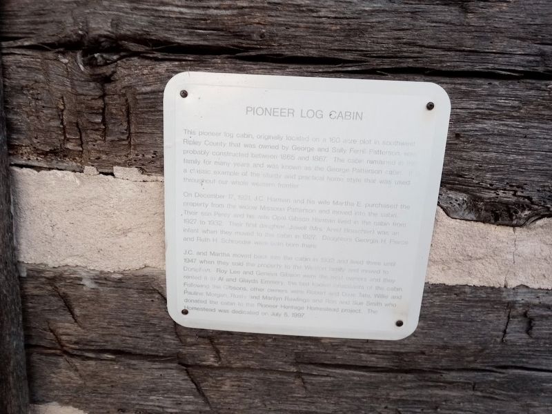
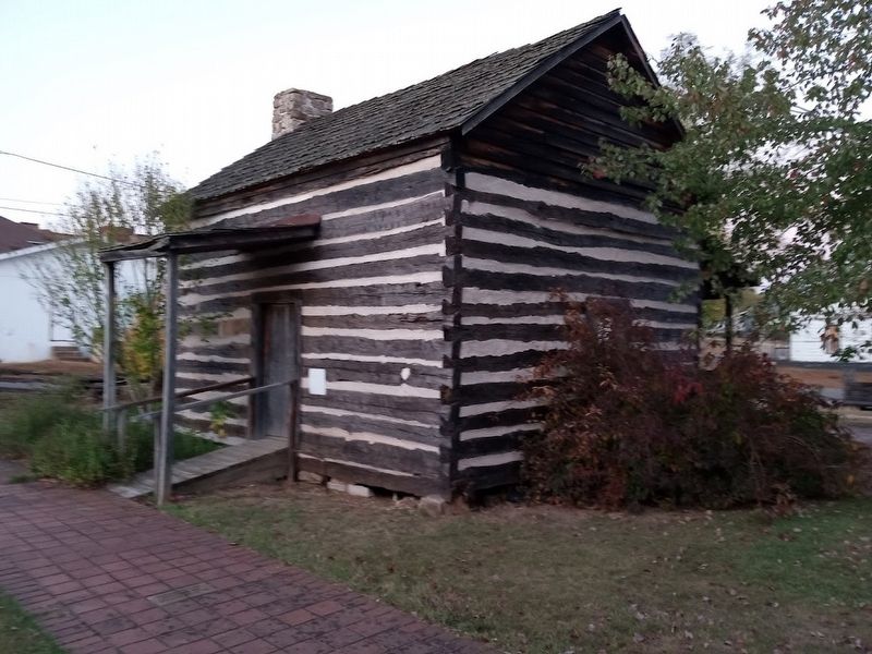
This pioneer log cabin, originally located on a 160 acre plot in southwest Ripley County that was owned by George and Sally Ferrill Patterson was probably constructed between 1865 and 1867. The cabin remained in the family for many years and was known as the George Patterson cabin. It is a classic example of the sturdy and practical home style that was used throughout our whole western frontier.
On December 17, 1921, J.C. Harman and his wife Martha E. purchased the property from the widow Missouri Patterson and moved into the cabin. Their son Percy and his wife Opal Gibson Harman lived in the cabin from 1927 to 1932. Their first daughter, Jewell (Mrs. Arvel Braschier) was an infant when they moved to the cabin in 1927. Daughters Georgia H. Pierce and Ruth H. Schroeder were both born there.
J.C. and Martha moved back into the cabin in 1932 and lived there until 1947 when they sold the property to the Weston family and moved to Doniphan. Roy Lee and Geneva Gibson were the next owners and they rented it to Al and Glayds Emmery, the last known inhabitants of the cabin. Following the Gibsons, other owners were Robert and Dixie Tate, Willie and Pauline Morgan, Rusty and Marilyn Rawlings and Rod and Sue Smith who donated the cabin to the Pioneer Heritage Homestead project. The Homestead was dedicated on July 5, 1997.
Topics. This historical marker is listed in this topic list: Landmarks. A significant historical date for this entry is July 5, 1997.
Location. 36° 36.988′ N, 90° 49.666′ W. Marker is in Doniphan, Missouri, in Ripley County. Marker can be reached from Franklin Street south of Charles Street. Touch for map. Marker is at or near this postal address: 200 Franklin St, Doniphan MO 63935, United States of America. Touch for directions.
Other nearby markers. At least 8 other markers are within walking distance of this marker. A different marker also named Pioneer Log Cabin (a few steps from this marker); Wheat Drills (a few steps from this marker); Pioneer Log Barn (a few steps from this marker); Tom Kennon's Blacksmith Shop (a few steps from this marker); Heritage Homestead (a few steps from this marker); Zebedee Washington Stephens (within shouting distance of this marker); Old Time Cemetery (within shouting distance of this marker); War Memorial (about 400 feet away, measured in a direct line). Touch for a list and map of all markers in Doniphan.
Credits. This page was last revised on October 28, 2022. It was originally submitted on October 28, 2022, by Jason Voigt of Glen Carbon, Illinois. This page has been viewed 62 times since then and 11 times this year. Photos: 1, 2. submitted on October 28, 2022, by Jason Voigt of Glen Carbon, Illinois.

