Weldon in Halifax County, North Carolina — The American South (South Atlantic)
Weldon Railroads
A Convergence of Commerce
— Landscape of the Iron Horse —
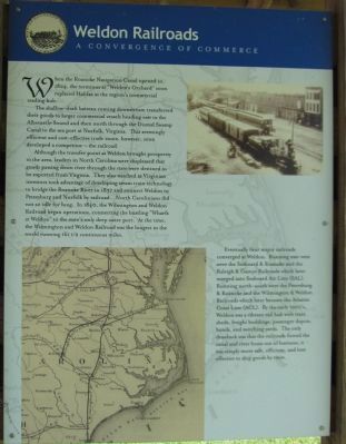
The shallow-draft batteau coming downstream transferred their goods to larger commercial vessels heading east to the Albemarle Sound and then north through the Dismal Swamp Canal to the sea port at Norfolk, Virginia. This seemingly efficient and cost-effective trade route, however, soon developed a competitor - the railroad.
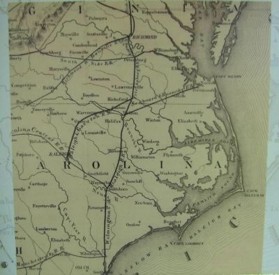
Although the transfer point at Weldon brought prosperity to the area, leaders in North Carolina were displeased that goods passing down the river through the state were destined to be exported from Virginia. They also watched as Virginian investors took advantage of developing steam train technology to bridge the Roanoke River in 1837 and connect Weldon to Petersburg and Norfolk by railroad. North Carolinians did not sit idle for long. In 1840, the Wilmington and Weldon Railroad began operations, connecting the bustling "Wharfs at Weldon" to the state's only deep water port. At the time, the Wilmington and Weldon Railroad was the longest in the world running 161 1/2 continuous miles.
Eventually four major railroads converged at Weldon. Running east-west were the Seaboard & Roanoke and the Raleigh & Gaston Railroads which later merged into Seaboard Air Line (SAL). Running north-south were the Petersburg & Roanoke and the Wilmington & Weldon Railroads which later became the Atlantic Coast Line (ACL). By the early 1900s, Weldon was a vibrant rail hub with train sheds, freight buildings, passenger depots, hotels, and switching yards. The only drawback was that the railroads forced the canal and river boats out of business, it was simply more save, efficient, and cost effective to ship goods by train.
Landscape of the Iron Horse
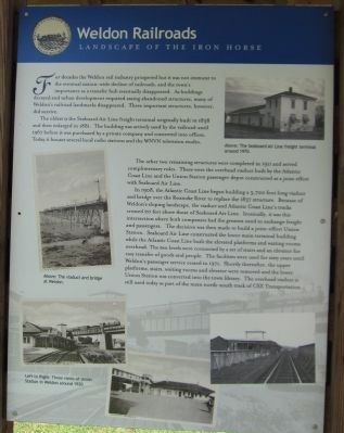
For decades the Weldon rail industry prospered but it was not immune to the eventual nation-wide decline of railroads, and the town's importance as a transfer hub eventually disappeared. As buildings decayed and urban development required razing abandoned structures, many of Weldon's railroad landmarks disappeared. Three important structures, however, did survive.
The oldest is the Seaboard Air Line freight terminal originally built in 1838 and then enlarged in 1881. The building was actively used by the railroad until 1967 before it was purchased by a private company and converted into offices. Today it houses several local radio stations and the WNVN television studio.
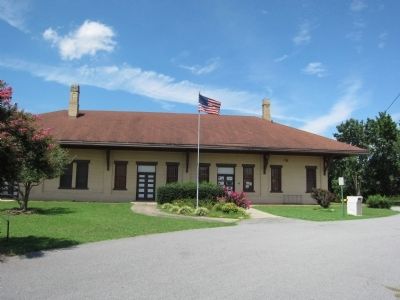
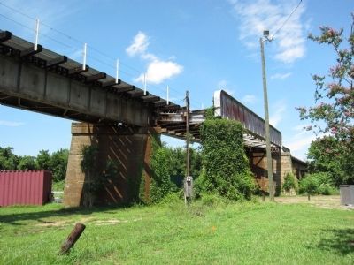
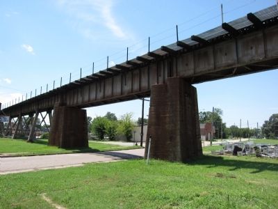
The other two remaining structures were completed in 1911 and served complementary roles. These were the overhead viaduct built by the Atlantic Coast Line and the Union Station passenger depot constructed as a joint effort with Seaboard Air Line.
In 1908, the Atlantic Coast Line began building a 3,700 foot long viaduct and bridge over the Roanoke River to replace the 1837 structure. Because of Weldon's sloping landscape, the viaduct and the Atlantic Coast Line's tracks crossed 20 feet above those of Seaboard Air Line. Ironically, it was this intersection where both companies had the greatest need to exchange freight and passengers. The decision was then made to build a joint-effort Union Station. Seaboard Air Line constructed the lower main terminal building while the Atlantic Coast Line built the elevated platforms and waiting rooms overhead. The two levels were connected by a set of stairs and an elevator for easy transfer of goods and people. The facilities were used for sixty years until Weldon's passenger service ceased in 1971. Shortly thereafter, the upper platforms, stairs, waiting rooms and elevator were removed and the lower Union Station was converted into the town library. The overhead viaduct is still used today as part of the main north-south track of CSX Transportation.
Topics. This historical marker is listed in this topic list: Railroads & Streetcars. A significant historical year for this entry is 1824.
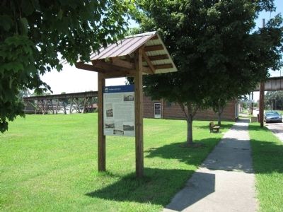
Location. 36° 25.707′ N, 77° 35.786′ W. Marker is in Weldon, North Carolina, in Halifax County. Marker is on West 1st Street, on the right when traveling east. Touch for map. Marker is at or near this postal address: 45 W 1st St, Weldon NC 27890, United States of America. Touch for directions.
Other nearby markers. At least 8 other markers are within walking distance of this marker. Historic Weldon Railroad (within shouting distance of this marker); Wilmington and Weldon Railroad (about 400 feet away, measured in a direct line); Roanoke Canal (about 500 feet away); Veterans Memorial (about 600 feet away); Rockfish Capital of the World (about 700 feet away); The Weldon Cotton Manufacturing Company (approx. 0.2 miles away); The Mills at Weldon (approx. 0.2 miles away); Wilmington & Weldon RR Trestle (approx. ¼ mile away). Touch for a list and map of all markers in Weldon.
Credits. This page was last revised on May 5, 2023. It was originally submitted on April 27, 2013, by Craig Swain of Leesburg, Virginia. This page has been viewed 703 times since then and 31 times this year. Last updated on May 5, 2023, by Michael Buckner of Durham, North Carolina. Photos: 1, 2, 3, 4, 5, 6, 7. submitted on April 27, 2013, by Craig Swain of Leesburg, Virginia. • Bernard Fisher was the editor who published this page.
