Damascus in Washington County, Virginia — The American South (Mid-Atlantic)
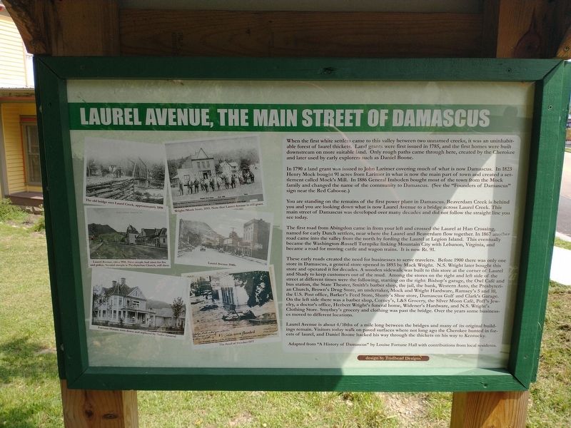
Laurel Avenue, The Main Street of Damascus
In 1790 a land grant was issued to John Larimer covering much of what is now Damascus. In 1823 henry Mock bought 91 acres from Larimer in what is now the main part of town and created a settlement called Mock's Mill. In 1886 General Imboden bought most of the town from the Mock family and changed the name of the community to Damascus. (See "Founders of Damascus" sign near the Red Caboose.)
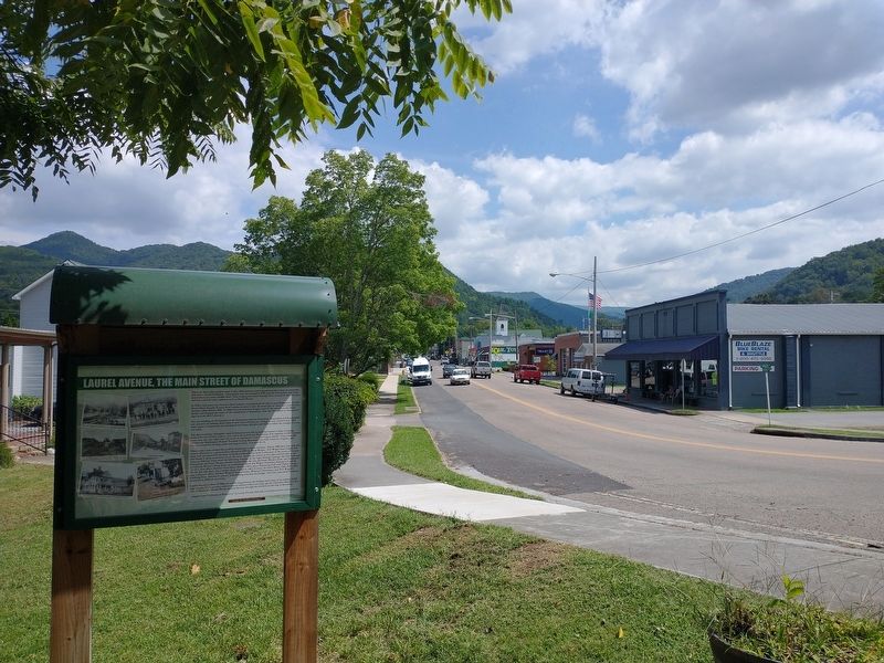
You are standing on the remains of the first power plant in Damascus. Beaverdam Creek is behind you and you are looking down what is now Laurel Avenue to a bridge across Laurel Creek. This main street of Damascus was developed over many decades and did not follow the straight line you see today.
The first road from Abingdon came in from your left and crossed the Laurel at Han Crossing, named for early Dutch settlers, near where the Laurel and Beaverdam flow together. In 1867 another road came into the valley from the north by fording the Laurel at Legion Island. This eventually became the Washington-Russell Turnpike linking Mountain City with Lebanon, Virginia, and became a road for moving cattle and wagon trains. In is to Rt. 91.
These early roads created the need for businesses to serve travelers. Before 1900 there was only one store in Damascus, a general store opened in 1893 by Mack Wright. N.S. Wright later bought this store and operated it for decades. A wooden sidewalk was built to this store at the corner of Laurel and Shady to keep customers out of the mud. Among the stores on the right and left side of the street at different times were the following, starting on the right: Bishop's garage, the Owl Cafe and bus station, the State Theater, Smith's barber shop, the jail, the bank, Western Auto, the Presbyterian Church, Brown's Drug Store, an undertaker, Mock and Wright Hardware, Ramsey's 5 and 10, the U.S. Post Office, Barker's Feed Store, Shorty's Shoe store, Damascus Gulf and Clark's Garage. On the left side there was a barber shop, Corney's, L&S Grocery, the Silver Moon Cafe, Poff's Jewelry, a doctor's office, Herbert Wright's funeral home, Widener's Hardware, and N.S. Wright's Clothing Store. Smythey's grocery and clothing was past the bridge. Over the years some businesses moved to different locations.
Laurel Avenue is about 4/10ths of a mile long between the bridges and many of its original buildings remain. Visitors today walk on paved surfaces where not long ago the Cherokee hunted in forests of laurel, and Daniel Boone hacked his way through the thickets on his way to Kentucky.
Adapted from "A History of Damascus" by Louis Hall with contributions from local residents.
(cpations)
The old bridge over Laurel Creek, approximately 1890.
Wright / Mock Store, 1893. Note that Laurel Avenue is still grass.
Laurel Avenue, circa 1910. First steeple had siren for fire and police. Second steeple is Presbyterian Church, still here.
Laurel Avenue 1940s
Fortune House, torn down and replace by Dollar General
The flood of October 1977
Erected by Damascus History Tour. (Marker Number 11.)
Topics. This historical marker is listed in this topic list: Settlements & Settlers. A significant historical month for this entry is October 1977.
Location. 36° 38.141′ N, 81° 47.478′ W. Marker is in Damascus, Virginia, in Washington County. Marker is at the intersection of West Laurel Avenue (U.S. 58) and North Smith Street, on the left when traveling east on West Laurel Avenue. Touch for map. Marker is in this post office area: Damascus VA 24236, United States of America. Touch for directions.
Other nearby markers. At least 8 other markers are within walking distance of this marker. Founders of Damascus (within shouting distance of this marker); Damascus (within shouting distance of this marker); Electricity Comes to Damascus (about 400 feet away, measured in a direct line); Damascus Old Mill (about 500 feet away); Damascus Presbyterian Church (about 600 feet away); Churches of Damascus (about 600 feet away); Water Tanks (approx. 0.2 miles away); Virginia Creeper Trail (approx. ¼ mile away). Touch for a list and map of all markers in Damascus.
Also see . . . The Virginia Creeper National Recreation Trail. (Submitted on November 23, 2022.)
Credits. This page was last revised on February 2, 2023. It was originally submitted on November 22, 2022, by Tom Bosse of Jefferson City, Tennessee. This page has been viewed 153 times since then and 31 times this year. Photos: 1, 2. submitted on November 22, 2022, by Tom Bosse of Jefferson City, Tennessee. • Bernard Fisher was the editor who published this page.

