Near Munfordville in Hart County, Kentucky — The American South (East South Central)
Battle of Rowletts Station
December 17, 1861
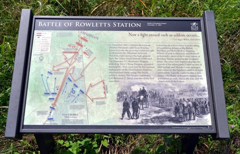
Now a fight ensued such as seldom occurs …In December 1861, Confederate General Thomas Hindman came from Bowling Green to probe the growing Union strength at Munfordville. Hindman believed that if he could occupy the high ground here, the Union would retreat northward. On December 17, Hindman’s Brigade, including Terry’s Texas Rangers, occupied the heights. They were met by the German immigrants of the 32nd Indiana Infantry, who repulsed them using Old World military tactics. The Texans’ namesake, Col. Benjamin F. Terry, was one of the first casualties.
- Colonel August Willich, 32nd Indiana
Following the Union Army’s earlier string of humiliating defeats at Big Bethel, Bull Run, and Ball’s Bluff in Virginia, Wilson’s Creek in Missouri, and Belmont in Kentucky, news of the Union victory at Rowletts Station spread in the Northern press. The news only improved when the reports of the subsequent Union success at Mill Springs and Middle Creek emerged, and suddenly the Northern resolve to fight rebounded. Lincoln could breathe a little easier–the Battle of Rowletts Station had prevented an early end to the war, and the dissolution of the Union.
(Illustration Caption)
The combined Union army under General Alexander McDowell McCook, encamped on the north bank of Green River, observes the distant action at Rowletts Station and provides artillery fire in support of the Union forces.
(Battle Map Notes from Top to Bottom)
“Hindman’s Legion” included the 8th TX Cavalry, the 1st AR Infantry Battalion under Lt. Col. John S. Marmaduke, the 2nd AR Infantry under Lt. Col. Joseph W. Bocage, the 6th AR Infantry under Col. Alexander T. Hawthorn, the 6th Battalion of AR Cavalry (Phifer’s) under Maj. Charles W. Phifer, and Swett’s Battery of the Warren (MS) Light Artillery under Capt. Charles Swett.
Col. Benjamin Franklin Terry, namesake of “Terry’s Texas Rangers” is slain in the battle’s opening moments.
Seeking cover among haystacks, 32nd IN Company C is surrounded by Confederates. Lt. Max Sachs refuses to surrender and is slain.
Major Charles W. Phifer’s 6th AR Cavalry flanks the Union right, preventing the 32nd from reaching the high ground on Mrs. Lewis’ Hill.
Firing at first from the cover of a rail fence at the edge of a wooded field, 32nd IN Companies B,F, and K pull back, leaving Co. G in position to defend against the rebel cavalry using a carrere, or “Roman Box” maneuver–a tactic they had learned as soldiers in the Prussian army.
Companies E and H of the 32nd IN hold position in reserve along the L&N Turnpike to prevent the Confederates from advancing along the pike.
Co. H repels a cavalry advance.
The commander of the 32nd Indiana Infantry Regiment, Col. August Willich, was away when the battle began. Command during battle fell to Lt. Col. Henry von Trebra. Under von Trebra, the German immigrant forces of Companies A, B, C, D, E, F, G, H, I, and K withstood forces more than three times their number, with the support of the 1st OH Light Artillery (Cotter’s Battery) firing from the north bank of the Green River.
Erected by Battle for the Bridge Historic Preserve.
Topics. This historical marker is listed in this topic list: War, US Civil. A significant historical date for this entry is December 17, 1861.
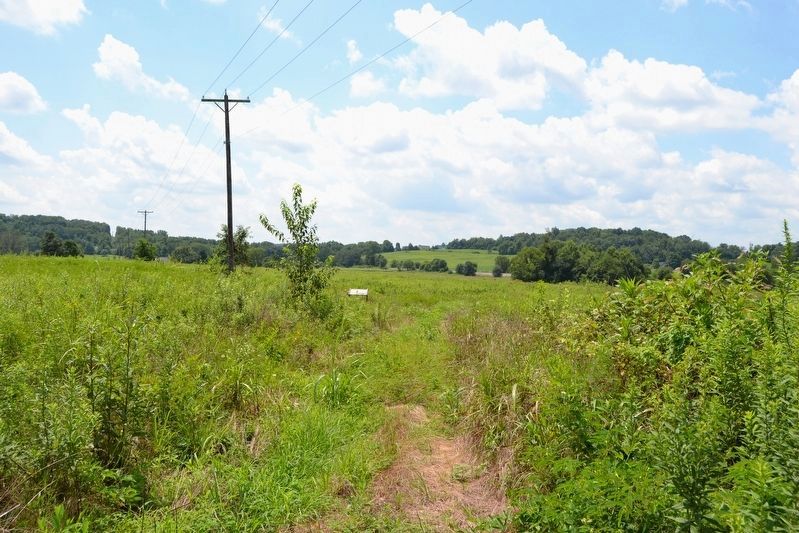
Location. 37° 15.058′ N, 85° 53.459′ W. Marker is near Munfordville, Kentucky, in Hart County. Marker can be reached from C. Miller Logging & Lumber Co. Driveway, 0.1 miles west of S. Dixie Highway (U.S. 31W). The marker is on the Rowletts Station Trail, 300 feet south of the driveway; the above directions are to the trailhead parking. Touch for map. Marker is in this post office area: Munfordville KY 42765, United States of America. Touch for directions.
Other nearby markers. At least 8 other markers are within walking distance of this marker. A different marker also named Battle of Rowletts Station (about 600 feet away, measured in a direct line); Battle of Munfordville (approx. ¼ mile away); Rowlett's Station (approx. 0.3 miles away); Battle of Munfordville: Day 1
(approx. 0.4 miles away); Battle of Munfordville: Siege (approx. 0.4 miles away); Anthony Woodson Farm (approx. half a mile away); Kentucky and the Western War (approx. half a mile away); The Raider (approx. half a mile away). Touch for a list and map of all markers in Munfordville.
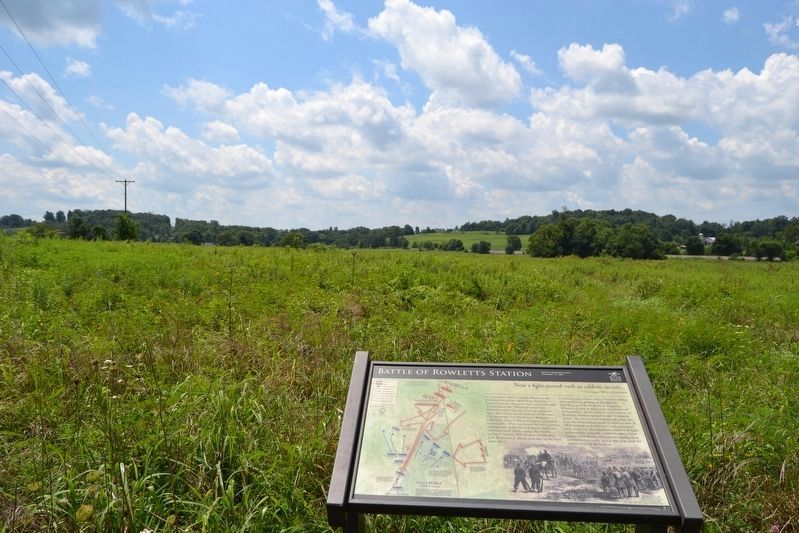
Regarding Battle of Rowletts Station. The marker and the surrounding site is part of the Battle for the Bridge Historic Preserve, and the battlefield has been preserved with the help of the Civil War Trust.
Also see . . .
1. Battle of Rowlett's Station - Wikipedia entry. (Submitted on August 13, 2016.)
2. Battle for the Bridge Historic Preserve. Official website of the preserve. (Submitted on August 13, 2016.)
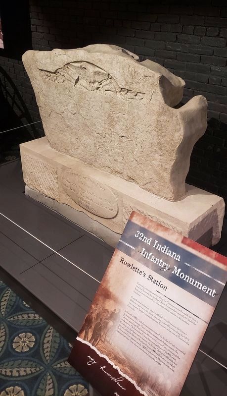
Photographed By Bradley Owen, October 12, 2019
5. 32nd Indiana Volunteer Infantry Regiment Monument
Although it is no longer in its original location, the 32nd Indiana Monument is generally considered to be the oldest surviving memorial to the American Civil War. It is now located at the Frazier History Museum, 829 West Main Street, Louisville, KY.
Credits. This page was last revised on February 23, 2023. It was originally submitted on August 13, 2016, by Duane Hall of Abilene, Texas. This page has been viewed 848 times since then and 72 times this year. Last updated on February 20, 2023, by Darryl R Smith of Cincinnati, Ohio. Photos: 1, 2, 3, 4. submitted on August 13, 2016, by Duane Hall of Abilene, Texas. 5. submitted on March 31, 2021, by Bradley Owen of Morgantown, West Virginia. • J. Makali Bruton was the editor who published this page.
