Shiloh in Hardin County, Tennessee — The American South (East South Central)
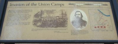
Invasion of the Union Camps
As the sun rose, Union soldiers camped here and at nearby sites looked forward to a peaceful and leisurely Sunday. A flood of Rebel infantry, however, was about to engulf them from the southwest.
Whitelaw Reid, a Northern reporter, described the lack of preparation in the Union camps, "Some, particularly among our soldiers, were not yet out of bed. Others were dressing, others washing, others cooking, a few eating their breakfasts. Many guns were unloaded, accouterments lying pell-mell, ammunition was ill-supplied - in sort, the camps were virtually surprised...."
By the end of the day, the Southerners had overrun most of the camps. Many Union soldiers spent the night without food, bedding, or other supplies left behind in haste.
"Shells were hurtling through the tents while, before there was time for thought of preparation, there came rushing through the woods the lines of battle sweeping the whole fronts of the division-camps....".
-Whitelaw Reid
War Correspondent, Cincinnati Gazette
Topics. This historical marker is listed in this topic list: War, US Civil.
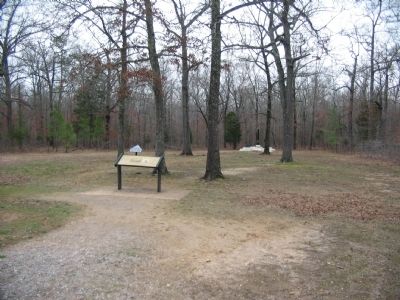
Location. 35° 7.615′ N, 88° 20.827′ W. Marker is in Shiloh, Tennessee, in Hardin County. Marker is at the intersection of Peabody Road and Reconnoitering Road, on the left when traveling east on Peabody Road. Located at stop 10, "Invasion of the Union Camps," near the Peabody Memorial, on the driving tour of Shiloh National Military Park. Touch for map. Marker is in this post office area: Shiloh TN 38376, United States of America. Touch for directions.
Other nearby markers. At least 8 other markers are within walking distance of this marker. Camp of 25th Missouri Infantry (a few steps from this marker); 25th Missouri Infantry (within shouting distance of this marker); Hungry Soldiers and Souvenirs (within shouting distance of this marker); Vision for Victory (within shouting distance of this marker); Colonel Everett Peabody (within shouting distance of this marker); 12th Michigan Infantry (about 600 feet away, measured in a direct line); Wood's Brigade (approx. ¼ mile away); 21st Missouri Infantry (approx. ¼ mile away). Touch for a list and map of all markers in Shiloh.
More about this marker. In the center is a drawing depicting the fighting in this sector of the battlefield. To the right is a portrait of Col. Everett Peabody. Col. Everett Peabody already suffering from four wounds, was killed near his headquarters here when a minie ball struck him in the head. Peabody had wisely sent out a reconnaissance patrol that discovered the approach of the Confederates. To the far right is a map showing the Union camps, the lines of Confederate advance, and the tour road. At the top is a timeline
of the battle.

Photographed By Wikipedia
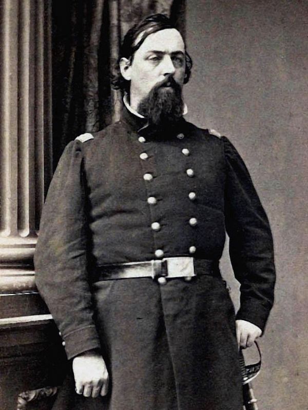
3. Col. Everett Peabody
Col. Everett Peabody already suffering from four wounds, was killed near his headquarters here when a minie ball struck him in the head. Peabody had wisely sent out a reconnaissance patrol that discovered the approach of the Confederates.
January 1, 1865 Photo - Wilson’s Creek National Battlefield - WICR 30677
January 1, 1865 Photo - Wilson’s Creek National Battlefield - WICR 30677
Credits. This page was last revised on August 23, 2023. It was originally submitted on September 1, 2009, by Craig Swain of Leesburg, Virginia. This page has been viewed 1,160 times since then and 11 times this year. Last updated on August 22, 2023, by Carl Gordon Moore Jr. of North East, Maryland. Photos: 1, 2. submitted on September 1, 2009, by Craig Swain of Leesburg, Virginia. 3, 4. submitted on October 9, 2020, by Allen C. Browne of Silver Spring, Maryland. • James Hulse was the editor who published this page.


