Marker Logo HMdb.org THE HISTORICAL
MARKER DATABASE
“Bite-Size Bits of Local, National, and Global History”
Near Hepburn in Hardin County, Ohio — The American Midwest (Great Lakes)
 

Old Sandusky Trail and Shawnee Ford


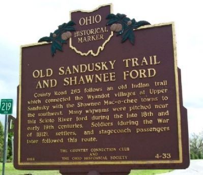
Old Sandusky Trail and Shawnee Ford Marker image. Click for full size.
Photographed By Dale K. Benington, September 5, 2009
1. Old Sandusky Trail and Shawnee Ford Marker
Inscription. County Road 265 follows an old Indian trail which connected the Wyandot villages at Upper Sandusky with the Shawnee Mac-o-chee towns to the southwest. Many wigwams were pitched near this Scioto River ford during the late 18th and early 19th centuries. Soldiers (during the War of 1812), settlers, and stagecoach passengers later followed this route.
 
Erected 1988 by The Country Connection Club and The Ohio Historical Society. (Marker Number 4-33.)
 
Topics and series. This historical marker is listed in these topic lists: MilitaryNative AmericansWar of 1812Wars, US Indian. In addition, it is included in the Ohio Historical Society / The Ohio History Connection series list.
 
Location. 40° 37.15′ N, 83° 29.998′ W. Marker is near Hepburn, Ohio, in Hardin County. Marker is at the intersection of County Road 265 and County Road 146, on the right when traveling north on County Road 265. South of Pfeiffer Station, along the banks of the Scioto River and shoulder of C.R. 265, east of Kenton. Touch for map. Marker is in this post office area: Kenton OH 43326, United States of America. Touch for directions.
 
Other nearby markers. At least 8 other markers are within 5 miles of this marker, measured as the crow flies. Wheeler Tavern (approx. ¼ mile away); Six Points, Goshen Township
Paid Advertisement
Click on the ad for more information.
Please report objectionable advertising to the Editor.
Click or scan to see
this page online
(approx. 3.4 miles away); The Black and White Schoolhouse (approx. 4.1 miles away); Hardin County Veterans Memorial Park (approx. 4.3 miles away); Hardin County New Veterans Memorial (approx. 4.8 miles away); Jacob Parrott (approx. 4.9 miles away); Hardin County Ohio Civil War Soldier Monument (approx. 5 miles away); Hardin County Viet Nam Memorial (approx. 5.1 miles away).
 
Old Sandusky Trail and Shawnee Ford Marker image. Click for full size.
Photographed By Dale K. Benington, September 5, 2009
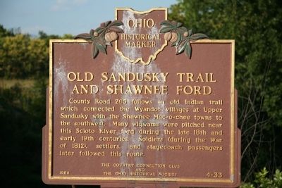
2. Old Sandusky Trail and Shawnee Ford Marker
View of historical marker along the east side of the roadway, on the south side of the bridge over the Scioto River.
Old Sandusky Trail and Shawnee Ford Marker image. Click for full size.
Photographed By Dale K. Benington, September 5, 2009
3. Old Sandusky Trail and Shawnee Ford Marker
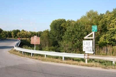
View of historical marker located at the northeast corner of the intersection of County Road 265 and County Road 219, in Hardin County.
Old Sandusky Trail and Shawnee Ford Marker image. Click for full size.
Photographed By William Fischer, Jr., May 9, 2009
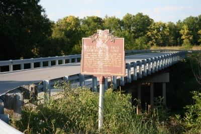
4. Old Sandusky Trail and Shawnee Ford Marker
 
 
Credits. This page was last revised on June 29, 2018. It was originally submitted on September 7, 2009, by Dale K. Benington of Toledo, Ohio. This page has been viewed 2,150 times since then and 41 times this year. Photos:   1, 2, 3. submitted on September 7, 2009, by Dale K. Benington of Toledo, Ohio.   4. submitted on October 3, 2009, by William Fischer, Jr. of Scranton, Pennsylvania. • Kevin W. was the editor who published this page.
Share this page.  
Share on Tumblr
m=22266

CeraNet Cloud Computing sponsors the Historical Marker Database.
This website earns income from purchases you make after using our links to Amazon.com. We appreciate your support.
Paid Advertisement
Apr. 19, 2024