Beverly in Randolph County, West Virginia — The American South (Appalachia)
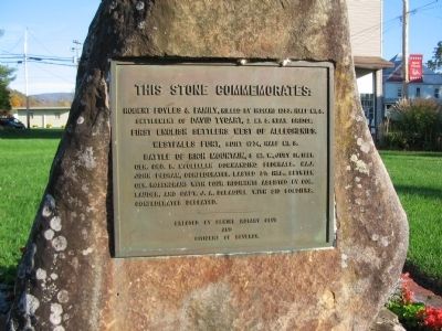
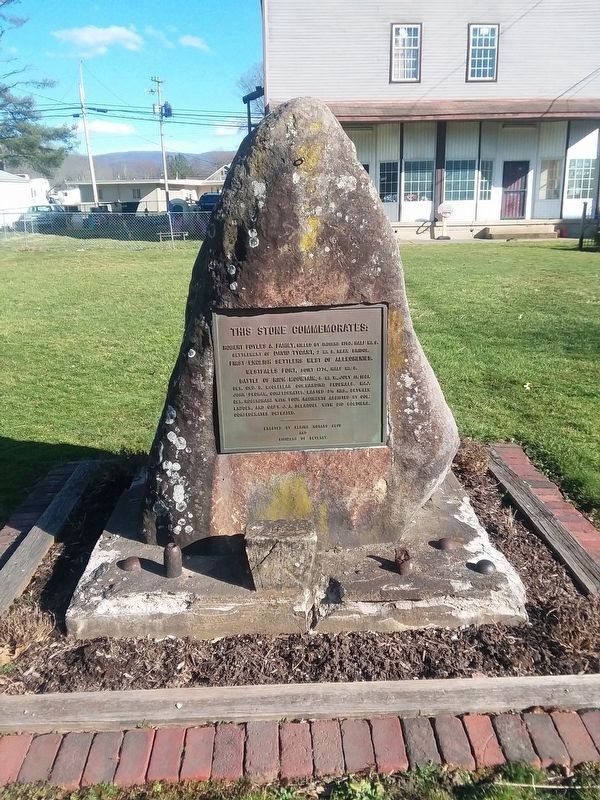
Robert Foyles & Family
Robert Foyles & Family, killed by Indians 1753, half mi. S.
settlement of David Tygart, 2 mi. S. near bridge.
First English settlers west of Alleghenies.
Westfalls Fort, built 1774, half mi. S.
Battle of Rich Mountain, 5 mi. W. July 11, 1861.
Gen. Geo. B. McClellan commanding Federals. Maj.
John Pegram, Confederates, lasted 3 1/2 hrs., between
Gen. Rosencrans with four regiments assisted by Col.
Lauder, and Capt. J.A. DeLaguel with 310 soldiers.
Confederates defeated.
Erected by Elkins Rotary Club and Citizens of Beverly.
Topics and series. This historical marker is listed in these topic lists: Forts and Castles • Settlements & Settlers • War, US Civil • Wars, US Indian. In addition, it is included in the Rotary International series list. A significant historical month for this entry is July 1753.
Location. 38° 50.451′ N, 79° 52.51′ W. Marker is in Beverly, West Virginia, in Randolph County. Marker is on Main Street (U.S. 219), on the right when traveling north. Located on the town square. Touch for map. Marker is in this post office area: Beverly WV 26253, United States of America. Touch for directions.
Other nearby markers. At least 8 other markers are within walking distance of this marker. Beverly Public Square (here, next to this marker); Beverly (a few steps from this marker); Randolph Co Jail - 1813 (a few steps from this marker); Blackman-Bosworth Store (a few steps from this marker); a different marker also named Beverly (a few steps from this marker); The First Campaign (a few steps from this marker); a different marker also named Beverly (a few steps from this marker); Beverly Bank (a few steps from this marker). Touch for a list and map of all markers in Beverly.
Also see . . . The Beginning of Beverly. Page from the Historic Beverly web site. (Submitted on November 15, 2009, by Craig Swain of Leesburg, Virginia.)

Photographed By Craig Swain, October 11, 2009
2. Town Square
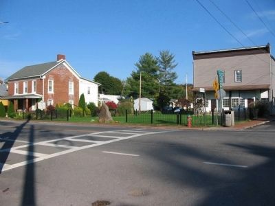
The state marker for Beverly stands to the left, near the end of the fence. The memorial for the Robert Foyles family (and other events near Beverly) stands in the middle of an opening in the fence. The interpretive marker for the town square is in the middle, behind the memorial.
Credits. This page was last revised on January 22, 2021. It was originally submitted on November 15, 2009. This page has been viewed 1,270 times since then and 57 times this year. Last updated on June 27, 2020, by Carl Gordon Moore Jr. of North East, Maryland. Photos: 1, 2. submitted on November 15, 2009, by Craig Swain of Leesburg, Virginia. 3, 4. submitted on January 19, 2021, by Craig Doda of Napoleon, Ohio. • J. Makali Bruton was the editor who published this page.


