Near Mechanicsburg in Hampshire County, West Virginia — The American South (Appalachia)
Fort Mill Ridge
General Information
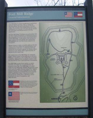
The Fort Mill Ridge Foundation in partnership with the West Virginia Department of Natural Resources has undertaken the preservation and interpretation of Fort Mill Ridge. A trail system with interpretive signs explains the fort's design and construction and highlights the Civil War events related to its occupation.
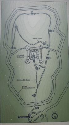
Signage along an easily accessible pathway into the center of the fort outlines the general history and establishment of the fort. A continuing trail loop around the fort includes signage discussing related historical events. Please allow approximately 40 minutes for the entire loop.
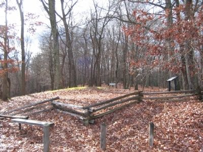
The earthworks at Fort Mill Ridge are extremely fragile. Please remain on the pathways at all times. Walking or climbing on the earthworks is strictly prohibited. Hiking in the woodlands outside the fort (beyond the outer entrenchments) is permitted.
(Administrative details were inserted here.)
The 1st National Flag of the Confederacy.
54th Pennsylvania Volunteer Infantry Regimental Colors
(Captions are in italics below in "More about this marker".)
Topics and series. This historical marker is listed in these topic lists: Forts and Castles • War, US Civil. In addition, it is included in the Battlefield Trails - Civil War series list. A significant historical month for this entry is June 1863.
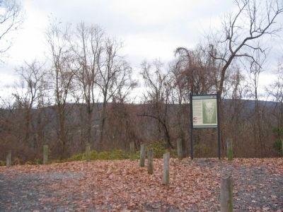
Location. 39° 19.473′ N, 78° 47.591′ W. Marker is near Mechanicsburg, West Virginia, in Hampshire County. Marker is on Fort Mill Ridge Park Road, on the right when traveling east. Located at the entrance to Fort Mill Ridge Park. Access from Buck Run Road, off US 50 about 2 miles west of Romney, West Virginia. Touch for map. Marker is in this post office area: Burlington WV 26710, United States of America. Touch for directions.
Other nearby markers. At least 8 other markers are within walking distance of this marker. The Civil War in the South Branch Valley (a few steps from this marker); Construction of Fort Mill Ridge (within shouting distance of this marker); The Central Redoubt (within shouting distance of this marker); Interior of the Central Redoubt (about 300 feet away, measured in a direct line); Control of the Mechanicsburg Gap (about 300 feet away); Engagement with McNeill's Rangers (about 400 feet away); An Outpost in Enemy Territory (about 400 feet away); Abandonment of Fort Mill Ridge (about 500 feet away). Touch for a list and map of all markers in Mechanicsburg.
More about this marker. On the right
side of the marker is a trail map of the park showing the locations of earthworks and the interpretive markers. On the upper right and lower left are illustrations depicting the 1st National Flag of the Confederacy and the 54th Pennsylvania Volunteer Infantry Regimental Colors. Regarding the Confederate flag, This flag was later replaced by the 2nd National or Stainless flag because the 1st National was being confused in battle with the Federal Stars and Stripes. The 1st National flag was used as a pattern for the local "Romney" flag captured June 13, 1861 by Col. Lew Wallace of the 11th Indiana Zouaves infantry from confederate forces under the command of Col. Arthur Cummings. A caption for the 54th Pennsylvania colors reads: This flag was the typical issue for the Pennsylvania Volunteer troops by then Pennsylvania Governor Curtin.
Related markers. Click here for a list of markers that are related to this marker. Tour of Fort Mill Ridge by markers.
Credits. This page was last revised on March 6, 2021. It was originally submitted on December 3, 2009, by Craig Swain of Leesburg, Virginia. This page has been viewed 1,708 times since then and 22 times this year. Last updated on March 6, 2021, by Carl Gordon Moore Jr. of North East, Maryland. Photos: 1, 2, 3, 4. submitted on December 3, 2009, by Craig Swain of Leesburg, Virginia. • Bernard Fisher was the editor who published this page.


