Central Office District in Richmond, Virginia — The American South (Mid-Atlantic)
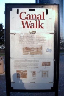
Canal Walk
Railroads
Richmond has been a railroad center since the 1830ís.
In 1838, the Richmond & Petersburg Railroad had its main depot and shops at 8th & Byrd streets. A short north-south link, the R&P was the parent company of the Atlantic Coast Line Railroad. In 1967, the ACL merged with Seaboard Air Line Railroad to form the Seaboard Coast Line Railroad, now part of CSX.
The Richmond & Danville Railroad opened its main depot on the James River below Shockoe Slip in 1850. Its shops were across the River. In 1894, the R&D became the Southern Railway which, through mergers, is now part of Norfolk Southern.
The Richmond & Alleghany Railroad bought the right-of-way of the James River & Kanawha Canal and laid its tracks or the canalís towpath. The first R&A train ran in 1880. In 1888, the R&A was purchased by the Chesapeake & Ohio Railway. A C&O freight yard was developed on the site of the Great Basin in the 1880s, and operated until the 1960ís. In 1981, as part of the Chessie system, C&0 was merged with Seaboard Coast Line Railroad to form CSX.
The Richmond, Fredericksburg & Potomac & Richmond & Petersburg Connection Company line linked Byrd Street Station with the RF&Pís Broad Street yards from 1867 to 1891. At just over a mile long, it included a 900-foot tunnel under Gambles Hill and was called “the shortest railroad with the longest name in the world.”
Tobacco
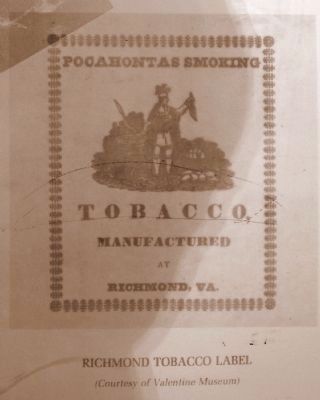
Until the 1960ís, tobacco was the leading Richmond product, and from the early 18th century until 1970, the area around Kanawha Plaza was a center of tobacco business.
Hogsheads of tobacco sent down the Kanawha Canal were received at the Public Warehouse, which occupied the site of Kanawha Plaza from 1809 to 1865. Here tobacco was stored, inspected, and auctioned. Private dealers traded out of nearby warehouses.
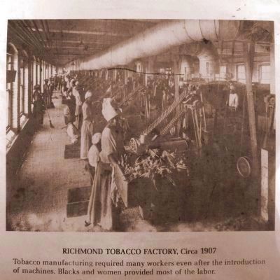
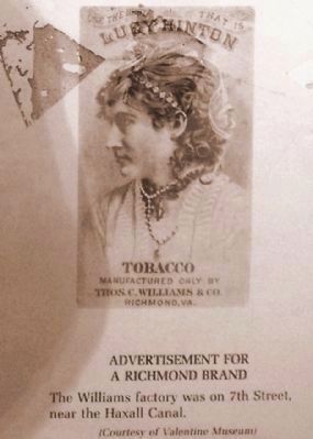
Richmond factories began to manufacture tobacco products in the early 19th century and many were in this vicinity. Until the late 1800ís, most of the tobacco was made into plug, sweetened and pressed into blocks for chewing. In the 1870ís, the Allen & Ginter Company at 6th & Cary streets began making handrolled cigarettes.
The period from the 1890ís to the 1920ís saw great growth and change in the tobacco industry. Smaller regional firms, including most of the firms in this area, were surpassed by national companies. The American Tobacco Company, in particular, reigned from 1890 to 1911. The cigarette, made by machines, became the main product, and marketing became first national, and then international.
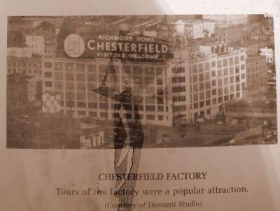
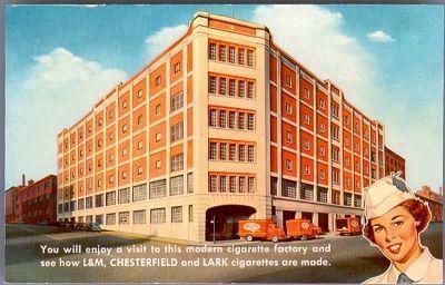
Most of the new Richmond factories in these years were erected along Tobacco Row, to the east of here. One exception came in 1921, when the Allen & Ginter Branch of Liggett & Myers opened a new factory on 7th Street, between Cary and Canal Streets. The Chesterfield Factory remained a Richmond landmark until it closed in 1970. The building has since been renovated for use as offices.
(rear panel)
James River & Kanawha Canal
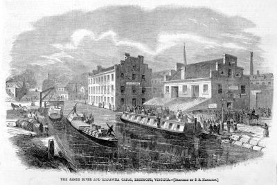
In 1774, George Washington proposed that a canal be built along the James River to promote trade and traffic with the territories to the west. Washington was the first president of the James River Company, which in 1789 opened a sequence of two canals in the Richmond area. This “James River Canal” was the first towpath canal system in North America. James River batteaux navigated the 250 miles of the James River above the Falls and entered Richmond by way of the canals to the Great Basin.
In 1835, the re-organized James River & Kanawha Company, ante-bellum Virginiaís largest corporation, continued work up the James River on a towpath canal designed for horse-and-mule-drawn canal boats. The companyís plan was to link Richmond with the Kanawha River (in what is now West Virginia), and from there link up with the Ohio River.
In 1837, 3,300 workers were building the Canal. By 1840, the Richmond
January 13, 2010
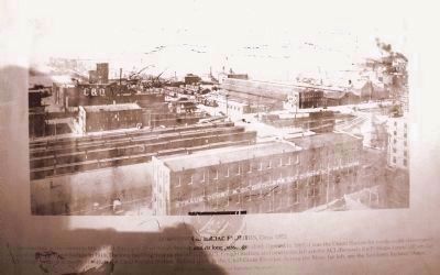
3. Downtown Railroad Facilities, Circa 1905
The intersection at the center is 9th & Byrd. Far right, Byrd Street Station and its long passenger shed. Opened in 1887, it was the Union Station for north-south routes until replaced by Broad Street Station in 1919. The long building next on the left is the ACL Freight Station, and next to the left are the ACL (formerly R&P) Shops. Lower left are the C&O freight yards and partly visible is the C&O Freight Station. Behind them is the C&O Grain Elevator. Across the River, far left, are the Southern Railway Shops. (Photo by Cook, Courtesy of Valentine Museum)
In 1854, the Tidewater Connection, a series of locks, allowed boats to pass from the Great Basin and canal down to the Richmond Dock, and thence to the tidewater portion of the James River.
The best days of the Canal were the 1850s. Hard times and railroads weakened the Canal Company after 1865, and it folded in 1880.
The Great Basin
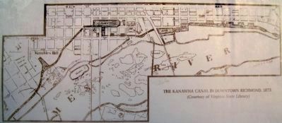
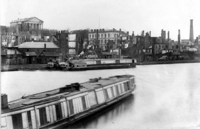
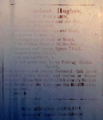
Finished in 1800, the Great Basin was the eastern terminus of the Canal. It was a block wide and three blocks long and was located between Cary and Canal, and 8th and 12th Streets. The Basin was up to 50 feet deep and was probably made by damming a stream valley at its east end (12th Street). Warehouses and trading firms surrounded the Basin and the docks along its stone walls were active. In addition to allowing the long, narrow canalboats to turn around for the trip back up the Canal, the Basin supplied water to various mills around its edge. Railroad yards covered half the Basin in the 1880ís. By the 1920s the Basin had been completely covered over. Construction excavation on the site for the James center in 1983-86 yielded the hulls of batteaux, canalboats, and other artifacts of the canal era, some of which have been saved.
Topics. This historical marker is listed in these topic lists: Agriculture • Bridges & Viaducts • Industry & Commerce • Railroads & Streetcars • Waterways & Vessels. A significant historical year for this entry is 1838.
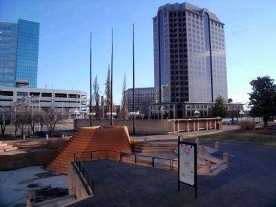
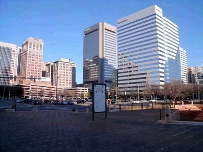
Location. 37° 32.206′ N, 77° 26.348′ W. Marker is in Richmond, Virginia. It is in the Central Office District. Marker can be reached from East Canal Street near South 8th Street. This panel is located in Kanawha Plaza. Touch for map. Marker is in this post office area: Richmond VA 23219, United States of America. Touch for directions.
Other nearby markers. At least 8 other markers are within walking distance of this marker. Kanawha Plaza (a few steps from this marker); Basin Race (within shouting distance of this marker); Downtown Richmond Millsites (within shouting distance of this marker); Evacuation of Richmond (about 400 feet away, measured in a direct line); Evacuation Fire (about 400 feet away); Great Turning Basin (approx. 0.2 miles away); a different marker also named Great Turning Basin (approx. 0.2 miles away); The First National Bank Building (approx. 0.2 miles away). Touch for a list and map of all markers in Richmond.
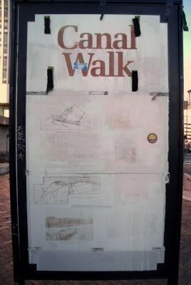
More about this marker. These panels are in extremely poor condition. Several of the images are completely faded and the captions are illegible including: Packet Station
at 7th Street, Lynchburg was a 33-hour trip. The artist made his sketch from theÖ (Print from W.L. Sheppard drawing, Courtesy of Valentine Museum) and Kanawha Canal at Hollywood, 1870, Altough this print is based on a photograph by Anderson, the artist used his imagination in depicting theÖ Canalboats and batteaux were much less sleek, and much more practical, than the boats shown here. TheÖ of a boat, lower right, was also dreamed up by artist. (Print from “Harperís Weekly.” Courtesy of Valentine Museum)
Also see . . .
1. Riverfront Canal Walk in Richmond. Venture Richmond (Submitted on November 11, 2021.)
2. James River and Kanawha Canal Historic District. National Register of Historic Places (Submitted on January 18, 2010.)
Photographed By Colourpicture Publishers, Inc. Boston
8. L&M, Chesterfield, and Lark cigarette factory
[on front]: You will enjoy a visit to this modern cigarette factory and see how L&M, Chesterfield and Lark Cigarettes are made. [on back]: Richmond, VA. You are invited to take a hostess-conducted tour through this modern cigarette factory conveniently located at Sixth & Cary Streets. Visiting hours 8:00 to 11:15 A.M. and 12:30 to 3:30 P.M. Monday through Friday. VCU Libraries Digital Collections - Rarely Seen Richmond
January 13, 2010
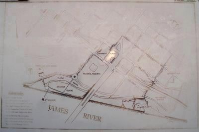
11. The Canal Walk
The Canal Walk is a self-guided history tour of Richmondís downtown riverfront. The Walk crosses the old bed of the Kanawha Canal, and leads to the wild and vital James River.
Along the way, banner poles, special bricks, and historic plaques mark the route of the Canal Walk. Take a stroll through history.
Credits. This page was last revised on February 1, 2023. It was originally submitted on January 18, 2010, by Bernard Fisher of Richmond, Virginia. This page has been viewed 2,007 times since then and 58 times this year. Photos: 1, 2, 3. submitted on January 18, 2010, by Bernard Fisher of Richmond, Virginia. 4. submitted on January 18, 2010. 5, 6, 7, 8, 9, 10, 11, 12, 13, 14, 15. submitted on January 18, 2010, by Bernard Fisher of Richmond, Virginia.
