Cypress in Suffolk, Virginia — The American South (Mid-Atlantic)
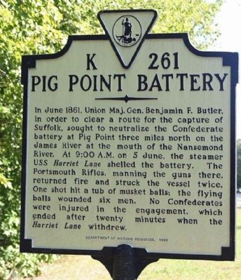
Pig Point Battery
Erected 1998 by Department of Historic Resources. (Marker Number K-261.)
Topics and series. This historical marker is listed in this topic list: Notable Events. In addition, it is included in the Virginia Department of Historic Resources (DHR) series list. A significant historical month for this entry is June 1861.
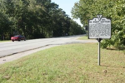
Location. 36° 46.146′ N, 76° 28.157′ W. Marker is in Suffolk, Virginia. It is in Cypress. Marker is on U.S. 58 (U.S. 460), on the right. This marker is located further down the road past marker Z-235, west of Hampton Roads Executive Airport between I-664 and Nansemond Parkway. Touch for map. Marker is in this post office area: Suffolk VA 23434, United States of America. Touch for directions.
Other nearby markers. At least 8 other markers are within 5 miles of this marker, measured as the crow flies. Sunray (approx. 3.4 miles away); Revolutionary Camp (approx. 3˝ miles away); Site of the Nansemond Indian Public School #9 (approx. 3.9 miles away); James Bowser, Revolutionary Soldier (approx. 4 miles away); Florence Graded School (approx. 4 miles away); Glebe Church (approx. 4.1 miles away); Hargrove's Tavern (approx. 4.1 miles away); Bennett's Home (approx. 4.1 miles away). Touch for a list and map of all markers in Suffolk.
Additional commentary.
1. Three Miles?
Am I missing something? Pig Point seems to be much more than 3 miles from this marker.
And yet this is where VA DHR decided to plant this marker! My guess is that this marker was written for erection on US 17 near VA 135 and it ended up here “temporarily” because of road construction in 1998. —Ed.
— Submitted February 9, 2020, by Bill Sanford of Norfolk, Virginia.
Credits. This page was last revised on February 1, 2023. It was originally submitted on October 2, 2007, by Laura Troy of Burke, Virginia. This page has been viewed 3,883 times since then and 164 times this year. Photos: 1. submitted on October 23, 2011, by Mike Stroud of Bluffton, South Carolina. 2. submitted on October 2, 2007, by Laura Troy of Burke, Virginia. 3. submitted on October 23, 2011, by Mike Stroud of Bluffton, South Carolina. • J. J. Prats was the editor who published this page.


