Kure Beach in New Hanover County, North Carolina — The American South (South Atlantic)
Union Fiasco - The First Battle
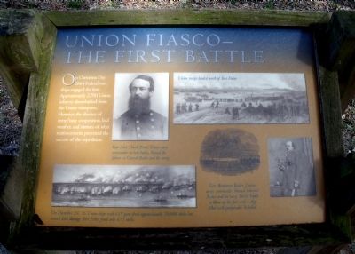
On Christmas Day 1864 Federal warships engaged the fort. Approximately 2,700 Union infantry disembarked from the Union transports. However, the absence of army/navy cooperation, bad weather, and rumors of rebel reinforcements prevented the success of the expedition.
Erected by Fort Fisher State Historic Site. (Marker Number 10.)
Topics. This historical marker is listed in these topic lists: Forts and Castles • War, US Civil. A significant historical year for this entry is 1864.
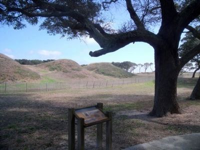
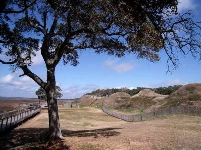
Location. 33° 58.277′ N, 77° 55.179′ W. Marker is in Kure Beach, North Carolina, in New Hanover County. Marker can be reached from Fort Fisher Boulevard South (U.S. 421) near Battle Acre Road. This marker is located along the quarter-mile tour trail at Fort Fisher State Historic Site. Touch for map. Marker is at or near this postal address: 1610 Fort Fisher Boulevard South, Kure Beach NC 28449, United States of America. Touch for directions.
Other nearby markers. At least 8 other markers are within walking distance of this marker. Capture! (within shouting distance of this marker); Shepherd’s Bombproof (about 300 feet away, measured in a direct line); Shepherd’s Battery (about 300 feet away); Fort Fisher Since 1865 (about 300 feet away); Restoration of Shepherd’s Battery (about 300 feet away); a different marker also named Shepherd’s Battery (about 400 feet away); Growth of Fort Fisher, 1861-1862 (about 400 feet away); History Trail (about 400 feet away). Touch for a list and map of all markers in Kure Beach.
More about this marker. On the upper left is a portrait with the caption, "Rear Adm. David Porter, Union navy commander in both battles, blamed the failure on General Butler and the army."
On the upper right is a drawing of the Union landing with the caption, "Union troops landed north of Fort Fisher."
On the lower left is a drawing of the Union naval bombardment with the caption, "On December 24, 56 Union ships with 619 guns fired approximately 20,000 shells but caused little damage. Fort Fisher fired only 672 shells."
On the right is a drawing of the powder boat and a photo with the caption, "Gen. Benjamin Butler, Union army commander, blamed Admiral Porter and the navy. Butler hoped to blow up the fort with a ship filled with gunpowder. It failed."
Also see . . . Fort Fisher. North Carolina Historic Sites (Submitted on March 16, 2010, by Bernard Fisher of Richmond, Virginia.)
Credits. This page was last revised on February 27, 2021. It was originally submitted on March 16, 2010, by Bernard Fisher of Richmond, Virginia. This page has been viewed 878 times since then and 13 times this year. Photos: 1, 2, 3. submitted on March 16, 2010, by Bernard Fisher of Richmond, Virginia.


