Alamance in Burlington in Alamance County, North Carolina — The American South (South Atlantic)
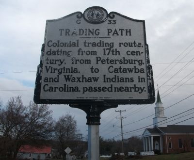
Trading Path
Erected 1983 by Division of Archives and History. (Marker Number G-33.)
Topics and series. This historical marker is listed in these topic lists: Anthropology & Archaeology • Colonial Era • Native Americans • Settlements & Settlers. In addition, it is included in the North Carolina Division of Archives and History series list.
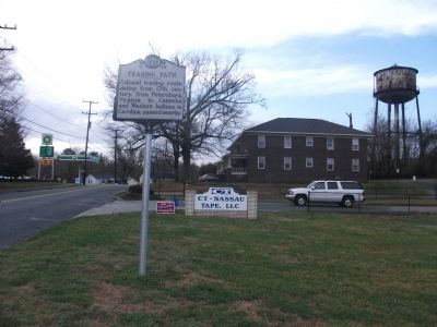
Location. 36° 2.2′ N, 79° 29.157′ W. Marker is in Burlington, North Carolina, in Alamance County. It is in Alamance. Marker is on North Carolina 62, 0.1 miles south of Pond Road, on the right when traveling south. From Interstate 85/40 in Burlington, N.C., exit number 143. Travel south on NC Highway 62, also called Alamance Road. Travel approximately 3 miles to the the Village of Alamance. Marker is on your right, in front of CT-Nassau Corporation. Touch for map. Marker is at or near this postal address: 4101 South NC Highway 62, Burlington NC 27215, United States of America. Touch for directions.
Other nearby markers. At least 8 other markers are within 2 miles of this marker, measured as the crow flies. Alamance Mill Village (approx. 0.2 miles away); Alamance Cotton Mill (approx. 0.2 miles away); Johnston Moves West (approx. 0.2 miles away); Tryon’s Camp (approx. 0.2 miles away); St. Paul's Lutheran Church (approx. 1.1 miles away); Oak Grove Plantation (approx. 1.2 miles away); a different marker also named Oak Grove Plantation (approx. 1.2 miles away); Battle of Alamance (approx. 1.9 miles away). Touch for a list and map of all markers in Burlington.
Regarding Trading Path. The Trading Path was not one wide path, but a corridor of roads and trails. Native Americans and early settlers used these paths to travel from the Chesapeake Bay region (mostly near Petersburg Virginia), south through the Piedmont of North Carolina, South Carolina and Georgia.
Also see . . . Trading Path Association. This non-profit organization's purpose is to preserve, promote and study the historic Trading Path of the Southeastern Piedmont, NC. (Submitted on March 16, 2010, by Paul Jordan of Burlington, N. C., U. S. A..)
Additional keywords. Alamance, Native American, Orange County, Burlington, Graham, Mebane, Catawba Road, Cherokee
Credits. This page was last revised on May 10, 2023. It was originally submitted on March 16, 2010, by Paul Jordan of Burlington, N. C., U. S. A.. This page has been viewed 1,669 times since then and 68 times this year. Last updated on May 9, 2023, by Michael Buckner of Durham, North Carolina. Photos: 1, 2. submitted on March 16, 2010, by Paul Jordan of Burlington, N. C., U. S. A.. • J. Makali Bruton was the editor who published this page.

