Near Winchester in Frederick County, Virginia — The American South (Mid-Atlantic)
The Third Battle of Winchester
The Attack of the Eighth Corps
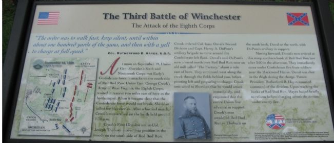
"The order was to walk fast, keep silent, until within about one hundred yards of the guns, and then with a yell to charge at full speed."
Col. Rutherford B. Hayes, U.S.A.
At noon on September 19, Union General Sheridan's Sixth and Nineteenth Corps met Early's Confederate force in attacks on the south side of Red Bud Run. Union Gen. George Crook's Army of West Virginia, the Eighth Corps, waited in reserve two miles east of here as the battle raged. When it became clear that the Confederate force would not break, Sheridan called for his reserves. After a hurried march, Crook's men arrived on the battlefield around 1:30 p.m.
Crook's First Division under Col. Joseph Thoburn moved into position in the woods on the south side of Red Bud Run. Crook ordered Col. Isaac Duval's Second Division and Capt. Henry A. DuPont's artillery brigade to move around the Confederate left flank. Duval's and DuPont's men crossed north over Red Bud Run near an old mill called "The Factory," about a mile east of here. They continued west along the creek through the fields behind you, before pivoting left and preparing to charge. Crook sent word to Sheridan that he would attack immediately, and requested that the entire Union line advance in support. Crook's men straddled Red Bud Run - Thoburn on the south bank, Duval on the north, with DuPont's artillery in support.
Moving forward, Duval's men arrived at this steep northern bank of Red Bud Run just after 3:00 in the afternoon. They immediately came under Confederate fire from soldiers near the Hackwood House. Duval was shot in the thigh during the charge. Future President Rutherford B. Hayes assumed command of the division. Upon reaching the banks of Red Bud Run, Hayes halted briefly to reform before charging across the stream under enemy fire.
Topics and series. This historical marker is listed in this topic list: War, US Civil. In addition, it is included in the Former U.S. Presidents: #19 Rutherford B. Hayes series list. A significant day of the year for for this entry is September 19.
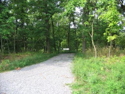
Location. Marker has been reported permanently removed. It was located near 39° 12.198′ N, 78° 7.595′ W. Marker was near Winchester, Virginia, in Frederick County. Marker could be reached from Redbud Road, on the right when traveling east. Located at the Crook's Attack Wayside, on the Confederate Flank Trail, inside the CWPT Third Winchester battlefield site. The closest trailhead to this marker is along Redbud Road. Touch for map. Marker was in this post office area: Winchester VA 22603, United States of America.
We have been informed that this sign or monument is no longer there and will not be replaced. This page is an archival view of what was.

2. Help Preserve 3rd Winchester
Details of CWPT efforts to save this battlefield.
Click for more information.
Click for more information.
Other nearby markers. At least 8 other markers are within walking distance of this location. Stuck In The Mud (a few steps from this marker); Ohio (within shouting distance of this marker); In Memory of Gilcin F. Meadors III (about 300 feet away, measured in a direct line); Sheridan Renews The Attack (about 300 feet away); Fury On The Fence Line (about 400 feet away); Duval's Attack (about 400 feet away); Hackwood And Patton (about 600 feet away); A Murderous Fire (approx. ¼ mile away). Touch for a list and map of all markers in Winchester.
More about this marker. On the left is a map illustrating the tactical situation between 2:30 p.m. and 3:15 p.m. on September 19, 1864. In the lower center is a portrait of General George Crook.
Also see . . . The Third Battle of Winchester. National Parks Service summary of the battle. This portion of the battle is covered under phase eight of the summary. (Submitted on October 22, 2007, by Craig Swain of Leesburg, Virginia.)

Photographed By Craig Swain, August 26, 2007
4. Redbud Run
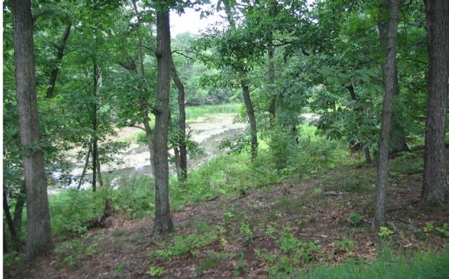
At around 3 in the afternoon, Duval's Division arrived here. With Duval wounded, future president Hayes took command of the division and advanced down the embankment and across the creek. The drop here is around 30 to 40 feet to the creek bottom. Another marker a few hundred yards down the trail is at a better vantage point to visualize the undertaking this would have been on just a normal day. The Federals led by Hayes, and the added difficulty of Confederate fire further prohibiting their movement.
Credits. This page was last revised on October 20, 2023. It was originally submitted on October 22, 2007. This page has been viewed 3,891 times since then and 22 times this year. Last updated on May 26, 2023. Photos: 1. submitted on October 22, 2007, by Craig Swain of Leesburg, Virginia. 2. submitted on March 13, 2009, by Craig Swain of Leesburg, Virginia. 3, 4. submitted on October 22, 2007, by Craig Swain of Leesburg, Virginia. • Devry Becker Jones was the editor who published this page.

