Midlothian in Chesterfield County, Virginia — The American South (Mid-Atlantic)
Mid-Lothian Mines and Rail Roads
Local Coal Mining in the 18th and 19th Centuries
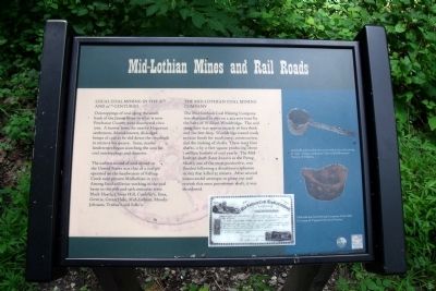
Outcroppings of coal along the south bank of the James River in what is now Powhatan County were discovered circa 1700. A hunter from the nearby Huguenot settlement, Manakintown, dislodged lumps of coal as he slid down the riverbank to retrieve his quarry. Soon, nearby landowners began searching the area for coal outcroppings and deposits.
The earliest record of coal mined in the United States was that of a coal pit operated on the headwaters of Falling Creek near present Midlothian in 1737. Among local collieries working in the coal basin in the 18th and 19th centuries were Black Heath, Clover Hill, Cunliffe’s, Etna, Gowrie, Green Hole, Mid-Lothian, Moody-Johnson, Trabue’s and Salle's.
The Mid-Lothian Coal Mining Company
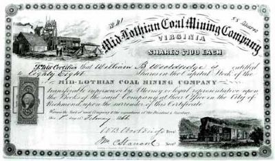
The Mid-Lothian Coal Mining Company was chartered in 1835 on a 404 acre tract by the heirs of William Wooldridge. The coal seam here was approximately 36 feet thick and 700 feet deep. Wooldridge issued stock to raise funds for machinery, construction and the sinking of shafts. There were four shafts, 11 by 11 feet square producing about 1 million bushels of coal yearly. The Mid-Lothian shaft (later known as the Pump Shaft), one of the most productive, was flooded following a disastrous explosion in 1855 that killed 55 miners. After several unsuccessful attempts to pump out and rework this once preeminent shaft, it was abandoned.
Erected 2009 by Chesterfield Heritage Alliance, Chesterfield County Parks & Recreation.
Topics. This historical marker is listed in these topic lists: Colonial Era • Industry & Commerce • Railroads & Streetcars • Settlements & Settlers. A significant historical year for this entry is 1700.
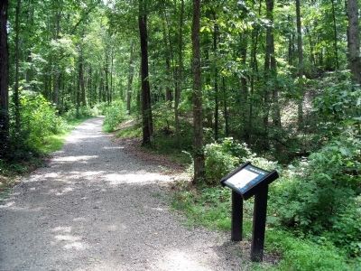
Location. 37° 29.5′ N, 77° 38.617′ W. Marker is in Midlothian, Virginia, in Chesterfield County. Marker can be reached from North Woolridge Road, 0.3 miles south of Walton Park Road. This marker is located along the multi-use trail in the Mid-Lothian Mines Park. Touch for map. Marker is at or near this postal address: 13301 North Woolridge Road, Midlothian VA 23114, United States of America. Touch for directions.
Other nearby markers. At least 8 other markers are within walking distance of this marker. A different marker also named Mid-Lothian Mines and Rail Roads (about 500 feet away, measured in a direct line); a different marker also named Mid-Lothian Mines and Rail Roads (about 500 feet away); a different marker also named Mid-Lothian Mines and Rail Roads (approx. ¼ mile away); a different marker also named Mid-Lothian Mines and Rail Roads (approx. ¼ mile away); Headstock (approx. ¼ mile away); The Bermuda Hundred Campaign (approx. 0.3 miles away); From Mines to Market (approx. 0.3 miles away); Midlothian Coal Mines (approx. 0.8 miles away). Touch for a list and map of all markers in Midlothian.
More about this marker. On the bottom is an image of "Mid-Lothian Coal Mining Company Stock 1866. Courtesy of Virginia Historical Society."
On the right are photos with the caption, "Iron ladle and crucible that were used in the coal mining process. Images courtesy of Chesterfield Historical Society of Virginia."
Also see . . . Mid-Lothian Mines Park. Park website homepage (Submitted on October 10, 2022, by Larry Gertner of New York, New York.)
Credits. This page was last revised on October 10, 2022. It was originally submitted on June 6, 2010, by Bernard Fisher of Richmond, Virginia. This page has been viewed 1,246 times since then and 19 times this year. Photos: 1, 2, 3. submitted on June 6, 2010, by Bernard Fisher of Richmond, Virginia.


