Near Winchester in Frederick County, Virginia — The American South (Mid-Atlantic)
The Third Battle of Winchester
Union Victories in the Valley
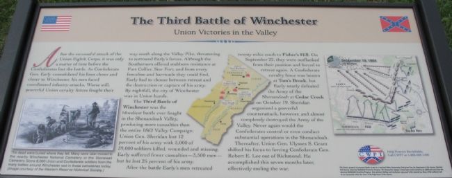
The Third Battle of Winchester was the bloodiest battle ever fought in the Shenandoah Valley, producing more casualties than the entire 1862 Valley Campaign. Union Gen. Sheridan lost 12 percent of his army with 5,000 of 39,000 soldiers killed, wounded and missing. Early suffered fewer casualties - 3,500 men - but he lost 25 percent of his army.
After the battle Early's men retreated twenty miles south to Fisher's Hill. On September 22, they were outflanked from their position and forced to retreat again. A Confederate cavalry force was beaten at Tom's Brook, but Early nearly defeated the Army of the Shenandoah at Cedar Creek on October 19. Sheridan organized a powerful counterattack, however, and almost completely destroyed the Army of the Valley. Never again would the Confederates control or even conduct substantial operations in the Shenandoah. Thereafter, Union Gen. Ulysses S. Grant shifted his focus to forcing Confederate Gen. Robert E. Lee out of Richmond. He accomplished this seven months later, effectively ending the war.
Erected by Civil War Preservation Trust.
Topics. This historical marker is listed in this topic list: War, US Civil. A significant historical date for this entry is September 22, 1862.
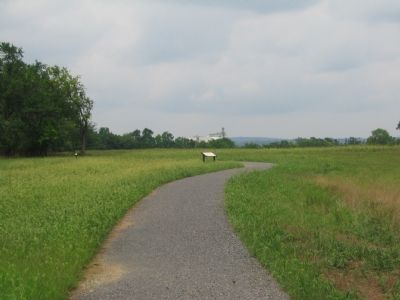
Location. Marker has been reported permanently removed. It was located near 39° 11.942′ N, 78° 7.611′ W. Marker was near Winchester, Virginia, in Frederick County. Marker could be reached from Redbud Road (County Route 661), on the right when traveling east. Located at the Union Victories Wayside, along the Battle Trail, inside the CWPT Third Winchester Battlefield site. The closest access site is a trail head on the west side of the Frederick County School complex parking lot. Touch for map. Marker was in this post office area: Winchester VA 22603, United States of America.
We have been informed that this sign or monument is no longer there and will not be replaced. This page is an archival view of what was.
Other nearby markers.

2. Help Preserve 3rd Winchester
Details of CWPT efforts to save this battlefield.
Click for more information.
Click for more information.
More about this marker. On the lower left of the marker is a drawing showing "The dead were buried where they fell. Many were later moved to the nearby Winchester National Cemetery or the Stonewall Cemetery. Some 8,000 Union and Confederate soldiers from the many battles around Winchester rest in these cemeteries today."
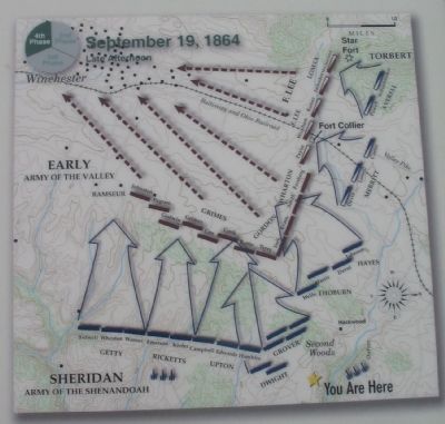
A map, in the center of the marker, of the Lower Shenandoah Valley indicates the battles mentioned in the text. On the right a map details the final states of the Third Battle of Winchester.
Also see . . .
1. Summary of the Battle of Third Winchester. The action described on the marker is covered under phases 9 and 10 of this National Parks Service summary. (Submitted on October 27, 2007, by Craig Swain of Leesburg, Virginia.)
2. CWPT Walking Tour of The Third Battle of Winchester. This marker is one along the walking trail around a portion of the Third Winchester Battlefield, preserved by the Civil War Preservation Trust. (Submitted on October 27, 2007, by Craig Swain of Leesburg, Virginia.)
Credits. This page was last revised on March 1, 2021. It was originally submitted on October 27, 2007, by Craig Swain of Leesburg, Virginia. This page has been viewed 2,165 times since then and 17 times this year. Last updated on February 28, 2021, by Bradley Owen of Morgantown, West Virginia. Photos: 1. submitted on October 27, 2007, by Craig Swain of Leesburg, Virginia. 2. submitted on March 13, 2009, by Craig Swain of Leesburg, Virginia. 3, 4. submitted on October 27, 2007, by Craig Swain of Leesburg, Virginia. • Bill Pfingsten was the editor who published this page.


