Near Skidmore in Bee County, Texas — The American South (West South Central)
Papalote Creek
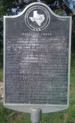
A few yards south passes Papalote Creek, crossed by the fierce Karankawa Indians who found kite-shaped pebbles and named it Papalote, which means,"kite-shaped" or "wing-shaped". Along its banks came the leaders of the Power and Hewetson colonists, holding Mexican land grants in the 1830's. On its Rata tributary there is evidence the Mexican Army camped on its way to suppress the Texas Revolution.
By 1857 the town of Papalote had emerged. It was the center of entertainment for the county, boasting of a circular dance hall built by cowboys trading steer yearlings at $3 a head for lumber. There were rooster fights, ring tournaments and horse races. In 1886, when the railroad came, the town was booming.
After the turn of the century, however, Papalote began to die away. A land company sold lots to settlers from as far away as Hawaii. Expecting to grow citrus fruits, they were disillusioned when the first killing frost doomed the project. Threats of Pancho Villa's raids continued as late as 1916, when women and children hid in a brick schoolhouse.
In 1948, Main Street was bypassed by U.S. Highway 181. Today there is no post office--only a rural route for the few remaining households.
Erected 1965 by State Historical Survey Committee. (Marker Number 3934.)
Topics. This historical marker is listed in this topic list: Settlements & Settlers. A significant historical year for this entry is 1857.
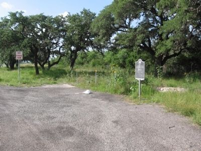
Location. 28° 9.841′ N, 97° 35.601′ W. Marker is near Skidmore, Texas, in Bee County. Marker is on U.S. 181, on the right when traveling south. Touch for map. Marker is in this post office area: Skidmore TX 78389, United States of America. Touch for directions.
Other nearby markers. At least 8 other markers are within 11 miles of this marker, measured as the crow flies. St. Paul (approx. 5.1 miles away); Aransas Creek Settlers (approx. 8.2 miles away); Welder Ranch (approx. 9.7 miles away); Plymouth Oil Company and Plymouth Oilers (approx. 10 miles away); San Patricio County World War I Monument (approx. 10 miles away); Courthouses of San Patricio County (approx. 10 miles away); First United Methodist Church of Sinton (approx. 10.1 miles away); Odem Building (approx. 10.2 miles away).
Credits. This page was last revised on July 15, 2022. It was originally submitted on June 27, 2010, by Steve Gustafson of Lufkin, Texas. This page has been viewed 1,712 times since then and 31 times this year. Last updated on July 11, 2022, by Joe Lotz of Denton, Texas. Photos: 1, 2. submitted on June 27, 2010, by Steve Gustafson of Lufkin, Texas. • J. Makali Bruton was the editor who published this page.

