Near Winchester in Frederick County, Virginia — The American South (Mid-Atlantic)
How To See the Battlefield

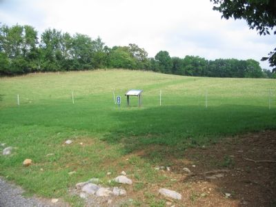
Photographed By Craig Swain, August 26, 2007
1. How To See the Battlefield Marker
A Virtual Tour of the Battle of Kearnstown by HMDb markers:
Click for more information.
Click for more information.
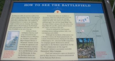
On March 23, 1862, the opening conflict of the famous Valley Campaign began on the adjoining Glass and Pritchard farms. You are visiting the Glass Farm called Rose Hill. The neighboring Pritchard Farm is 1½ miles to the southeast (right) of where you are standing. The conflict began early in the morning on the Pritchard Farm and concluded on the Glass Farm with the loss of sunlight at the end of the day.
Acting on faulty intelligence that his small army outnumbered the Northern forces at Winchester, Southern commander Major General Thomas J. "Stonewall" Jackson moved to strike his opponents and prevent Northern reinforcements from leaving the Valley to aid McClellan's army on the Peninsula. In fact, the Northern forces outnumbered his two-to-one.
To learn more about the 1st Battle of Kernstown, follow the walking trail to your left. Interpretive signs such as this one will help explain the battle. The trail is 0.7 miles there and back again. You will view Sandy Ridge (#3), the point of Tyler's advance (#4), the ruins of the Stone Wall (#5 and #6), and the field of retreat (#7) before returning to this spot.
Please be prepared for trail hazards, including uneven walking surfaces, hills, rock outcroppings and wildlife.
Although the 1st Battle of Kernstown was a Northern victory, the South gained much. As a result, President Lincoln, fearing for the safety of Washington, D.C., diverted 35,000 troops from the campaign against Richmond to defend approaches to the Northern capital from the Valley. This redeployment set the stage for "Stonewall" Jackson's enormously successful Shenandoah Valley Campaign.
Trail and interpretive signs are funded in part by Save America's Treasures administered by the National Parks Service
Topics and series. This historical marker is listed in this topic list: War, US Civil. In addition, it is included in the Former U.S. Presidents: #16 Abraham Lincoln series list. A significant historical month for this entry is March 1862.
Location. 39° 9.104′ N, 78° 13.18′ W. Marker is near Winchester, Virginia, in Frederick County. Marker can be reached from Jones Road (County Route 621), on the right when traveling north. Located at stop two of the walking tour of Rose Hill. See the link to the Museum of the Shenandoah for details about visiting Rose Hill. Touch for map. Marker is at or near this postal address: 1985 Jones Road, Winchester VA 22602, United States of America. Touch for directions.
Other nearby markers. At least 8 other markers are within walking distance of this marker. War In The Backyard (within shouting distance of this marker); Rose Hill (about 500 feet away, measured in a direct line); Fight for the High Ground (about 500 feet away); The First Battle Of Kernstown (about 600 feet away); Northern Victory, Southern Defeat (approx. 0.2 miles away); The Defense of the Stone Wall (approx. 0.2 miles away); The Order for Retreat (approx. ¼ mile away); The Advance of Tyler’s Brigade (approx. 0.3 miles away). Touch for a list and map of all markers in Winchester.
More about this marker. On the lower left is a map of the lower Shenandoah Valley annotating the nearby battlefields. "To learn more about the Civil War battles in the Shenandoah Valley, visit other sites in the Shenandoah at War Heritage Areas."
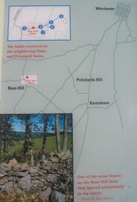
On the right is a map of the Kernstown-Winchester area with detail of the Rose Hill trail, "The battle occurred on the neighboring Glass and Pritchard farms." Below the map is a photograph of "one of the stone fences on the Rose Hill farm that figured prominently in the battle."
Regarding How To See the Battlefield. This is one of seven battlefield interpretive markers at Rose Hill. See the related markers section below for a listing of the walking tour, or the Kernstown Battles Virtual Tour by Markers in the links section for a driving tour.
Related markers. Click here for a list of markers that are related to this marker. To better understand the relationship, study each marker in the order shown.
Also see . . .
1. Rose Hill Park. Museum of the Shenandoah website entry (Submitted on November 12, 2007, by Craig Swain of Leesburg, Virginia.)
2. Battle of First Kernstown Summary. The action around Rose Hill is discussed in phase three of this National Parks Service battle summary. (Submitted on November 12, 2007, by Craig Swain of Leesburg, Virginia.)
Credits. This page was last revised on July 5, 2022. It was originally submitted on November 12, 2007. This page has been viewed 1,775 times since then and 18 times this year. Last updated on August 14, 2020, by Bradley Owen of Morgantown, West Virginia. Photos: 1, 2, 3. submitted on November 12, 2007, by Craig Swain of Leesburg, Virginia. • J. Makali Bruton was the editor who published this page.

