Near Winchester in Frederick County, Virginia — The American South (Mid-Atlantic)
Northern Victory, Southern Defeat

Photographed By Craig Swain, October 20, 2007
1. Northern Victory, Southern Defeat Marker
A Virtual Tour of the Battle of Kearnstown by related HMDb markers:
Click for more information.
Click for more information.
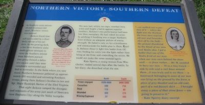
As Southern units retreated and resistance fell apart, Northern victory was assured.
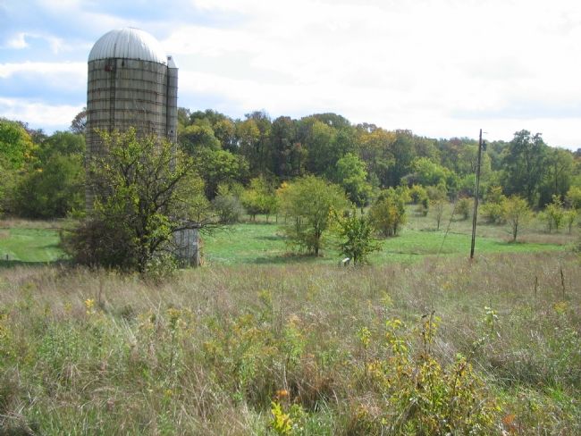
Jackson found himself surrounded by a disorderly retreat of his soldiers. In the growing dark, a few fresh Southern units made gallant attempts to cover the Southern retreat from Northern pursuit. One group formed a defensive square until they were completely surrounded and had to surrender. In the fields where you now stand, Northern horsemen gathered up approximately 250 wounded and retreating Southern troops, among them Jackson's brother-in-law and Sgt. Major Randolph Barton of the 33rd Virginia.
That night Jackson camped the disorganized remnants of his army just south of Newtown (now Stephens City) along the Valley turnpike. His men had, within two days, marched forty miles and fought a battle against superior numbers. Jackson's own performance had been less than exemplary. He had risked his army by pitching it headlong into a larger Northern force without an adequate picture of enemy strength. He failed to rely on his subordinates and communicate his battle plan to them. Finally, Jackson chose to fight this battle from the rear, feeding his units into the fight rather than being at the front and controlling the action. He would not make the same mistake again.
Kate Sperry, a young woman from Winchester, visited several days after the battle. In her diary she described what she saw.
"…we walked over a portion of it - where the fight was the thickest… the trees were scarred all over and branches shot off by the balls - the ground discolored by the blood of our men and Yanks also. I got a bullet that one of the Yanks fired at our men when our men were behind the stone wall - or fence rather … Mr. M. assisted to bury our men - 79 in a tiny trench - side by side and a rail fence around them … it was truly sad to see them - a haversack belonging to some of our men was lying on the ground by the fence, a piece of grey blanket and an old coat, part of a red flannel shirt … . I brought away a piece of that stone fence - am going to preserve it."
-Kate Sperry diary excerpt
Topics. This historical marker is listed in this topic list: War, US Civil.
Location. 39° 9.146′ N, 78° 12.999′ W. Marker is near Winchester, Virginia, in Frederick County. Marker can be reached from Jones Road (County Route 621), on the right when traveling north. Located at stop seven of the walking tour of Rose Hill. See the link to the Museum of the Shenandoah for details about visiting Rose Hill. Touch for map. Marker is at or near this postal address: 1985 Jones Road, Winchester VA 22602, United States of America. Touch for directions.
Other nearby markers. At least 8 other markers are within walking distance of this marker. The Defense of the Stone Wall (about 300 feet away, measured in a direct line); Fight for the High Ground (about 400 feet away); The Order for Retreat (about 600 feet away); War In The Backyard (approx. 0.2 miles away); How To See the Battlefield (approx. 0.2 miles away); Rose Hill (approx. 0.2 miles away); The First Battle Of Kernstown (approx. 0.2 miles away); The Advance of Tyler’s Brigade (approx. 0.2 miles away). Touch for a list and map of all markers in Winchester.
More about this marker. On the upper left of the marker is a portrait of "Sergeant Major Randolph Barton of the 33rd Virginia Infantry," who "was one of more than 250 Southern soldiers captured as a result of the 1st Battle of Kernstown. He, like many of Jackson's men, was originally from the area." In the side bar quote to the right is a portrait of Kate Sperry. A breakdown of the numbers of men engaged and casualties for both sides is displayed in the lower center of the marker.
Regarding Northern Victory, Southern Defeat. This is one of seven battlefield interpretive markers at Rose Hill. See the related markers section below for a listing of the walking tour, or the Kernstown Battles Virtual Tour by Markers in the links section for a driving
tour.
Related markers. Click here for a list of markers that are related to this marker. To better understand the relationship, study each marker in the order shown.
Also see . . .
1. Rose Hill Park. Museum of the Shenandoah website entry (Submitted on November 12, 2007, by Craig Swain of Leesburg, Virginia.)
2. Battle of First Kernstown Summary. The action around Rose Hill is discussed in phase three of this National Parks Service battle summary. (Submitted on November 12, 2007, by Craig Swain of Leesburg, Virginia.)

Photographed By Craig Swain, October 20, 2007
4. Federal Pursuit
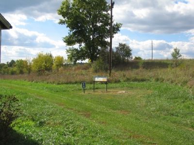
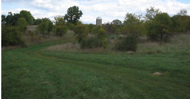
In this draw the Federal cavalry and infantry pressed the Confederates, capturing several including many of the wounded. The grain silo was built well after the war, but serves as a good place-mark to aid orientation around the battlefield site today. Note the marker standing nearby.
Credits. This page was last revised on September 30, 2022. It was originally submitted on November 12, 2007, by Craig Swain of Leesburg, Virginia. This page has been viewed 1,638 times since then and 23 times this year. Photos: 1, 2, 3, 4. submitted on November 12, 2007, by Craig Swain of Leesburg, Virginia.

