Near Spotsylvania Courthouse in Spotsylvania County, Virginia — The American South (Mid-Atlantic)
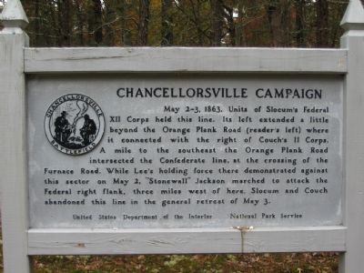
Chancellorsville Campaign
Erected by United States Department of the Interior - National Park Service.
Topics. This historical marker is listed in this topic list: War, US Civil. A significant historical year for this entry is 1863.
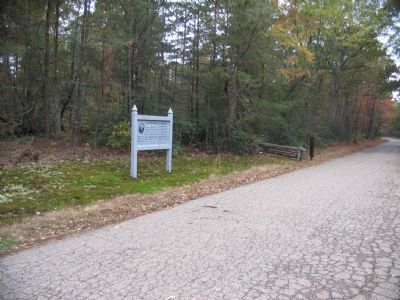
Location. 38° 18.366′ N, 77° 38.079′ W. Marker is near Spotsylvania Courthouse, Virginia, in Spotsylvania County. Marker is at the intersection of Slocum Drive and Old Plank Road, on the left when traveling east on Slocum Drive. Touch for map. Marker is at or near this postal address: 8840 Co Rd 610, Spotsylvania VA 22553, United States of America. Touch for directions.
Other nearby markers. At least 8 other markers are within walking distance of this marker. Chancellorsville Home of Mrs. Sanford Chancellor (approx. 0.2 miles away); Civilians in the Crossfire (approx. 0.2 miles away); The Chancellor Slaves (approx. 0.2 miles away); a different marker also named Chancellorsville Campaign (approx. 0.2 miles away); a different marker also named Chancellorsville Campaign (approx. 0.2 miles away); Climactic Struggle (approx. 0.2 miles away); Lee's Greatest Triumph (approx. 0.2 miles away); Chancellorsville (approx. ¼ mile away).
Regarding Chancellorsville Campaign. This is one of several markers for the Battle of Chancellorsville at Hazel Grove and Fairview, the central part of the battle. See the Hazel Grove - Fairview Virtual Tour by Markers in the links section for a listing of related markers on the tour.
Also see . . .
1. Battle of Chancellorsville. National Park Service site. (Submitted on November 18, 2007, by Craig Swain of Leesburg, Virginia.)
2. Hazel Grove - Fairview Virtual Tour by Markers. The Hazel Grove and Fairview portions of the battlefield (stops nine and ten on the driving tour of the battlefield). Markers along this tour include those on Stuart and Slocum Drives. (Submitted on November 18, 2007, by Craig Swain of Leesburg, Virginia.)
Credits. This page was last revised on July 9, 2021. It was originally submitted on November 18, 2007, by Craig Swain of Leesburg, Virginia. This page has been viewed 1,271 times since then and 37 times this year. Photos: 1, 2. submitted on November 18, 2007, by Craig Swain of Leesburg, Virginia.

