East Village in Manhattan in New York County, New York — The American Northeast (Mid-Atlantic)
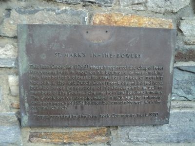
St. Mark’s in-the-Bowery
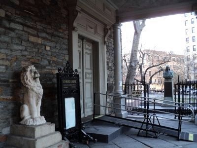
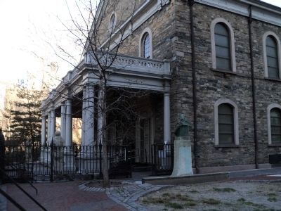
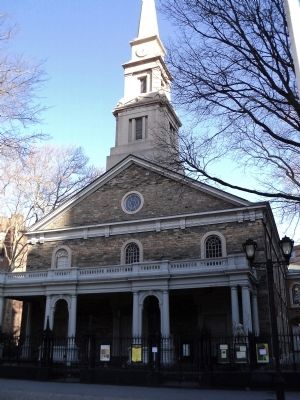
This late Georgian (1799) church replaced the chapel Peter Stuyvesant built in 1660 on his Bouwerie or Farm - making this Manhattan’s oldest site used for a place of worship. Not only is the last Dutch Governor-General buried here, but also seven generations of his descendants as well as members of the Goelet, Schermerhorn and Lorillard families. The Greek Revival steeple, added in 1828, and the Italianate cast-iron porch of 1854 harmonize remarkably well with the original church.
Erected 1970 by New York Community Trust.
Topics. This historical marker is listed in these topic lists: Churches & Religion • Colonial Era. A significant historical year for this entry is 1660.
Location. 40° 43.806′ N, 73° 59.22′ W. Marker is in Manhattan, New York, in New York County. It is in East Village. Marker is at the intersection of E 10th Street and 2nd Avenue, on the left when traveling east on E 10th Street. Touch for map. Marker is at or near this postal address: 131 E 10th Street, New York NY 10003, United States of America. Touch for directions.
Other nearby markers. At least 8 other markers are within walking distance of this marker. Petrus Stuyvesant (a few steps from this marker); In Memoriam (a few steps from this marker); St. Mark’s Historic District and District Extension (a few steps from this marker); Ukrainian Americans World War II Memorial (a few steps from this marker); a different marker also named Petrus Stuyvesant (a few steps from this marker); Daniel D. Tompkins (within shouting distance of this marker); Hebrew Technical Institute (about 300 feet away, measured in a direct line); Stuyvesant – Fish House (about 400 feet away). Touch for a list and map of all markers in Manhattan.
Regarding St. Mark’s in-the-Bowery. The building is listed in the “American Institute of Architecture (AIA) Guide to New York City, Fifth Edition”.
Also see . . .
1. History of St. Mark’s in-the-Bowery. (Submitted on March 26, 2011, by Bill Coughlin of Woodland Park, New Jersey.)
2. St. Mark's Church-in-the-Bowery. "Daytonian in Manhattan" entry. (Submitted on April 12, 2020, by Larry Gertner of New York, New York.)
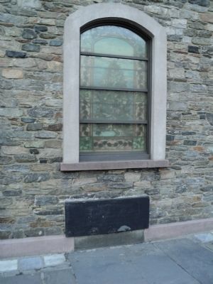
Photographed By Bill Coughlin, March 26, 2011
5. Grave of Petrus Stuyvesant
Seen here in the churchyard of St. Mark's is the grave of the the last Dutch Governor-General.
In this Vault lies buried
Petrus Stuyvesant
late Captain General and Governor in Chief of Amsterdam
in New Netherland now called New York
and the Dutch West-India Islands, dies Feby. A.D. 1672
aged 80 years.
In this Vault lies buried
Petrus Stuyvesant
late Captain General and Governor in Chief of Amsterdam
in New Netherland now called New York
and the Dutch West-India Islands, dies Feby. A.D. 1672
aged 80 years.
Credits. This page was last revised on January 31, 2023. It was originally submitted on March 26, 2011, by Bill Coughlin of Woodland Park, New Jersey. This page has been viewed 725 times since then and 44 times this year. Last updated on April 12, 2020, by Larry Gertner of New York, New York. Photos: 1, 2, 3, 4, 5. submitted on March 26, 2011, by Bill Coughlin of Woodland Park, New Jersey. • Bill Pfingsten was the editor who published this page.
